Maps of Hammersmith and Fulham
Surrey II - OS Six-Inch Map
1 : 10560 Topographic maps Ordnance Survey Ordnance Survey
Map shewing the situation of all premises licensed for the sale of intoxicating liquors in the County of London
London County Council
A PLAN of the ROADS Under the DIRECTION and CARE of this TRUST and divers Roads Adjacent.
1 : 16351 The title of this road map of Kensington and Chelsea appears in a panel above the plan, with the compass star at top right and scale bar at bottom left. The roads within the Kensington and Hyde Park Trust are indicated by a shadowed line; the king's private roads by a double line; the common roads by a double dotted line; and the footpaths by a single dotted line. Turnpikes and junctions are numbered for reference with distances given in a table down the left side of the plate. Roberts, R.
An exact survey of the city's of London Westminster , XI
1 Blatt : 53 x 71 cm John Rocque
London SW.
1 : 15840 Stanford, Edward
Surrey II.SE - OS Six-Inch Map
1 : 10560 Topographic maps Ordnance Survey Ordnance Survey
Charles Booth's descriptive map of London poverty 1889
Charles Booth
Surrey II.SW - OS Six-Inch Map
1 : 10560 Topographic maps Ordnance Survey Ordnance Survey
Surrey II.SW - OS Six-Inch Map
1 : 10560 Topographic maps Ordnance Survey Ordnance Survey
Surrey II.SW - OS Six-Inch Map
1 : 10560 Topographic maps Ordnance Survey Ordnance Survey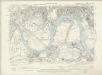
Surrey II.SW - OS Six-Inch Map
1 : 10560 Topographic maps Ordnance Survey Ordnance Survey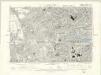
London VI.SE - OS Six-Inch Map
1 : 10560 Topographic maps Ordnance Survey Ordnance Survey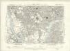
London X.NE - OS Six-Inch Map
1 : 10560 Topographic maps Ordnance Survey Ordnance Survey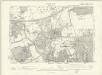
London VI.SW - OS Six-Inch Map
1 : 10560 Topographic maps Ordnance Survey Ordnance Survey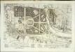
A plan of the palace gardens and town of Kensington
1 Plan : Kupferdruck ; 28 x 48 cm Rocque; Deharme John Rocque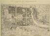
A Plan of the Palace Gardens and TOWN of KENSINGTON
1 : 4800 The title of this plan of Kensington Palace and gardens appears in English and French, with scale bars and a key to architectural and natural features, in a panel below the plan. Kensington Gardens were originally attached to Nottingham House, which was bought in 1689 by William III and turned into Kensington Palace. Queen Mary took a great interest in the gardens and had them landscaped by royal gardeners in formal Dutch patterns. Uprooted by order of Queen Anne at the beginning of the 18th century, the Dutch gardens were replaced in 1726 by this Wise and Bridgeman design, including the round pond, the Broad Walk and the Temple Lodge. Rocque, John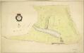
HYDE PARK
1 : 3960 The title and compass star of this plan appear at middle left, with them scale bar at bottom right. At over 340 acres the largest of all the royal parks, Hyde Park was originally a hunting ground for deer, boars and wild bull. Bequeathed to the monks of Westminster after the conquest of Geoffrey de Mandeville in the 1140s, the park was appropriated by Henry VIII at the dissolution of the monasteries in 1536. The park was opened to the public at the beginning of the 17th century, and remained a deer hunting ground until 1768. Bennett, S.
PLAN OF HYDE PARK as it was in 1725
1 : 792 This retrospective plan of Hyde Park was produced from an earlier plan held in the Vestry Room in St George's Church, Hanover Square. Its title features at top right, with the scale bar at top left. At over 340 acres of land the largest of all the royal parks, Hyde Park was originally a hunting ground for deer, boars and wild bull. Bequeathed to the monks of Westminster after the conquest of Geoffrey de Mandeville in the 1140s, the park was appropriated by Henry VIII at the dissolution of the monasteries in 1536. The park was opened to the public at the beginning of the 17th century, and remained a deer hunting ground until 1768. Neele
London X.NW - OS Six-Inch Map
1 : 10560 Topographic maps Ordnance Survey Ordnance Survey
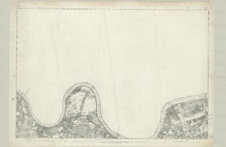
London (1915- Numbered sheets) IV.10 (includes: Acton; Hammersmith) - 25 Inch Map
1 : 2500 Topographic maps Ordnance Survey Ordnance Survey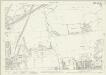
London (1915- Numbered sheets) IV.10 (includes: Acton; Hammersmith) - 25 Inch Map
1 : 2500 Topographic maps Ordnance Survey Ordnance Survey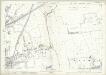
London (Edition of 1894-96) LVIII (includes: Acton; Hammersmith) - 25 Inch Map
1 : 2500 Topographic maps Ordnance Survey Ordnance Survey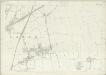
London (First Editions c1850s) XXXI (includes: Acton; Hammersmith) - 25 Inch Map
1 : 2500 Topographic maps Ordnance Survey Ordnance Survey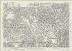
London (1915- Numbered sheets) IV.14 (includes: Acton; Chiswick St Nicholas; Hammersmith) - 25 Inch Map
1 : 2500 Topographic maps Ordnance Survey Ordnance Survey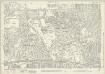
London (1915- Numbered sheets) IV.14 (includes: Acton; Chiswick St Nicholas; Hammersmith) - 25 Inch Map
1 : 2500 Topographic maps Ordnance Survey Ordnance Survey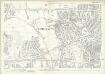
London (Edition of 1894-96) LXXII (includes: Acton; Chiswick St Nicholas; Hammersmith) - 25 Inch Map
1 : 2500 Topographic maps Ordnance Survey Ordnance Survey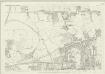
London (First Editions c1850s) XL (includes: Acton; Chiswick St Nicholas; Hammersmith) - 25 Inch Map
1 : 2500 Topographic maps Ordnance Survey Ordnance Survey
Plan of the parish of PADDINGTON in the County of Middlesex 6
The development of Paddington began at the end of the Napoleonic wars, when the Bishop of London granted permission for building on his estate north of Hyde Park. Under Gutch's supervision, works continued into the 1850s, extending to Bayswater and the Edgware and Harrow Roads. The title of this plan appears at top left, with compass rose at top right and scale bar at bottom left. Also at bottom left is a key to the land acquired by the Grand Junction Canal Company from the Bishop of London. This the area in red on the plan, which also shows the final proposals for the new street plan at Bayswater. Gutch, George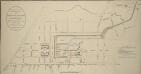
IMPROVED PLAN of the Termination of the GRAND JUNCTION CANAL at PADDINGTON With the Intended New Streets on the Estates of the Bishop of London
1 : 4800 The old course of the canal is indicated in blue.The improvements to the canal included: three new wharfs with enclosed reservoirs, at "A"; a service reservoir, at "B"; the enlargement of the canal by Arrow Road to allow barges to dock, at "C"; and a new basin for leisure boats, at "D". Also noted are three-and-a-half acres of land claimed by a Mr White, indicated by the letter "E".
London (1915- Numbered sheets) VIII.2 (includes: Barnes; Chiswick St Nicholas; Hammersmith) - 25 Inch Map
1 : 2500 Topographic maps Ordnance Survey Ordnance Survey
London (1915- Numbered sheets) VIII.2 (includes: Barnes; Chiswick St Nicholas; Hammersmith) - 25 Inch Map
1 : 2500 Topographic maps Ordnance Survey Ordnance Survey