Maps of Hammersmith and Fulham

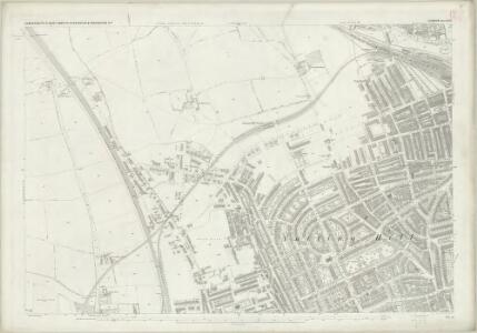
London (1915- Numbered sheets) IV.11 (includes: Hammersmith; Kensington) - 25 Inch Map
1 : 2500 Topographic maps Ordnance Survey Ordnance Survey
London (Edition of 1894-96) LIX (includes: Hammersmith; Kensington) - 25 Inch Map
1 : 2500 Topographic maps Ordnance Survey Ordnance Survey
London (First Editions c1850s) XXXII (includes: Hammersmith; Kensington) - 25 Inch Map
1 : 2500 Topographic maps Ordnance Survey Ordnance Survey
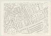
London VI.67 - OS London Town Plan
1 : 1056 Topographic maps Ordnance Survey Ordnance Survey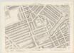
London VI.57 - OS London Town Plan
1 : 1056 Topographic maps Ordnance Survey Ordnance Survey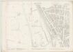
London VI.66 - OS London Town Plan
1 : 1056 Topographic maps Ordnance Survey Ordnance Survey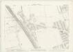
London VI.56 - OS London Town Plan
1 : 1056 Topographic maps Ordnance Survey Ordnance Survey
Insurance Plan of London West North-West District Vol. B: sheet 26
1 : 480 This detailed 1902 plan of London is one of a series of eighteen sheets in an atlas originally produced to aid insurance companies in assessing fire risks. The building footprints, their use (commercial, residential, educational, etc.), the number of floors and the height of the building, as well as construction materials (and thus risk of burning) and special fire hazards (chemicals, kilns, ovens) were documented in order to estimate premiums. Names of individual businesses, property lines, and addresses were also often recorded. Together these maps provide a rich historical shapshot of the commercial activity and urban landscape of towns and cities at the time. The British Library holds a comprehensive collection of fire insurance plans produced by the London-based firm Charles E. Goad Ltd. dating back to 1885. These plans were made for most important towns and cities of the British Isles at the scales of 1:480 (1 inch to 40 feet), as well as many foreign towns at 1:600 (1 inch to 50 feet). Chas E Goad Limited Chas E Goad Limited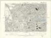
London VI.SE - OS Six-Inch Map
1 : 10560 Topographic maps Ordnance Survey Ordnance Survey
Japan-British Exhibition 1910 ... at the "Great White City," Shepherd’s Bush, London

The Imre Kiralfy new International Exhibition Grounds, London
London VI.77 - OS London Town Plan
1 : 1056 Topographic maps Ordnance Survey Ordnance Survey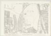
London VI.76 - OS London Town Plan
1 : 1056 Topographic maps Ordnance Survey Ordnance Survey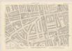
London VI.68 - OS London Town Plan
1 : 1056 Topographic maps Ordnance Survey Ordnance Survey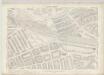
London VI.58 - OS London Town Plan
1 : 1056 Topographic maps Ordnance Survey Ordnance Survey
Insurance Plan of London West North-West District Vol. B: sheet 27-1
1 : 480 This detailed 1902 plan of London is one of a series of eighteen sheets in an atlas originally produced to aid insurance companies in assessing fire risks. The building footprints, their use (commercial, residential, educational, etc.), the number of floors and the height of the building, as well as construction materials (and thus risk of burning) and special fire hazards (chemicals, kilns, ovens) were documented in order to estimate premiums. Names of individual businesses, property lines, and addresses were also often recorded. Together these maps provide a rich historical shapshot of the commercial activity and urban landscape of towns and cities at the time. The British Library holds a comprehensive collection of fire insurance plans produced by the London-based firm Charles E. Goad Ltd. dating back to 1885. These plans were made for most important towns and cities of the British Isles at the scales of 1:480 (1 inch to 40 feet), as well as many foreign towns at 1:600 (1 inch to 50 feet). Chas E Goad Limited Chas E Goad Limited
London VI.78 - OS London Town Plan
1 : 1056 Topographic maps Ordnance Survey Ordnance Survey
Insurance Plan of London West North-West District Vol. B: Key Plan
1 : 3600 This "key plan" indicates coverage of the Goad 1902 series of fire insurance maps of London that were originally produced to aid insurance companies in assessing fire risks. The building footprints, their use (commercial, residential, educational, etc.), the number of floors and the height of the building, as well as construction materials (and thus risk of burning) and special fire hazards (chemicals, kilns, ovens) were documented in order to estimate premiums. Names of individual businesses, property lines, and addresses were also often recorded. Together these maps provide a rich historical shapshot of the commercial activity and urban landscape of towns and cities at the time. The British Library holds a comprehensive collection of fire insurance plans produced by the London-based firm Charles E. Goad Ltd. dating back to 1885. These plans were made for most important towns and cities of the British Isles at the scales of 1:480 (1 inch to 40 feet), as well as many foreign towns at 1:600 (1 inch to 50 feet). Chas E Goad Limited Chas E Goad Limited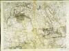
An exact survey of the city's of London Westminster , XI
1 Blatt : 53 x 71 cm John Rocque
A PLAN of the ROADS Under the DIRECTION and CARE of this TRUST and divers Roads Adjacent.
1 : 16351 The title of this road map of Kensington and Chelsea appears in a panel above the plan, with the compass star at top right and scale bar at bottom left. The roads within the Kensington and Hyde Park Trust are indicated by a shadowed line; the king's private roads by a double line; the common roads by a double dotted line; and the footpaths by a single dotted line. Turnpikes and junctions are numbered for reference with distances given in a table down the left side of the plate. Roberts, R.
London NW.
1 : 15840 Stanford, Edward
Plan of the parish of PADDINGTON in the County of Middlesex 7
The development of Paddington began at the end of the Napoleonic wars, when the Bishop of London granted permission for building on his estate north of Hyde Park. Under Gutch's supervision, works continued into the 1850s, extending to Bayswater and the Edgware and Harrow Roads. The title of this plan appears at top left, with compass rose at top right and scale bar at bottom left. It shows the final street plan, with the Bishop of London's estate outlined in green, the Great Western Railway terminus in red, and the Paddington estate in yellow. Gutch, George
Plan of the parish of PADDINGTON in the County of Middlesex 6
The development of Paddington began at the end of the Napoleonic wars, when the Bishop of London granted permission for building on his estate north of Hyde Park. Under Gutch's supervision, works continued into the 1850s, extending to Bayswater and the Edgware and Harrow Roads. The title of this plan appears at top left, with compass rose at top right and scale bar at bottom left. Also at bottom left is a key to the land acquired by the Grand Junction Canal Company from the Bishop of London. This the area in red on the plan, which also shows the final proposals for the new street plan at Bayswater. Gutch, George
Plan of the Parish of PADDINGTON in the County of Middlesex 4
1 : 9600 The title, imprint and compass rose of this plan appear at top right with scale bars at the foot of the plate. It is accompanied by handwritten note with key to land acquired by the Grand Junction Canal Company from the Bishop of London(depicted in red) with the proposed new roads into the Bishop's estate.These roads are represented by a brown double-dotted line and were added by the surveyor Ralph Samuel Cockrell. With Cockrell's additions, this plan was presented to the Commissioners of Sewers for consultation on the best way to lay out a sewage and draining system in the area. Gutch, George
PLAL OF THE PARISH OF PADDINGTON IN THE COUNTY OF MIDDLESEX
1 : 3168 Plan of the Parish of Paddington with title, imprint and compass rose at top right and scale bar at bottom right. The plan features the Grand Junction and Regents Canals and the Great Western Railway Terminal, with all properties and plots of land numbered for reference. Lucas, George Oakley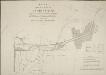
PLAN of the LANDS at PADDINGTON Proposed to be Leased and Exchanged by the Bishop of London and his Lessees AND THE Grand JUNCTION CANAL Company.
1 : 3168 Paddington was a predominantly rural area until the end of the 18th century.The Bishop of London granted the Grand Junction Canal Company permission to extend the canal from Brentford to Paddington.The Paddington Estate Act also allowed developers to start building on the estate.The title of this plan appears at top left. A reference table at bottom right gives a key to hatching and the dimensions of lots that formed part of the lease and exchange between the bishop and the canal company. Cary, J.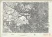
London Sheet J - OS Six-Inch Map
1 : 10560 Topographic maps Ordnance Survey Ordnance Survey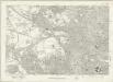
London Sheet J - OS Six-Inch Map
1 : 10560 Topographic maps Ordnance Survey Ordnance Survey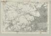
Middlesex XVI - OS Six-Inch Map
1 : 10560 Topographic maps Ordnance Survey Ordnance Survey