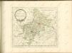
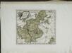
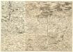
Old maps of Landkreis Neustadt an der Aisch-Bad Windsheim
Discover the past of Landkreis Neustadt an der Aisch-Bad Windsheim on historical maps
Browse the old maps


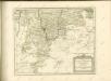
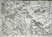
Maps of Landkreis Neustadt an der Aisch-Bad Windsheim
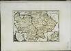
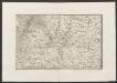
Maps of Landkreis Neustadt an der Aisch-Bad Windsheim