Maps of Landkreis Neustadt an der Aisch-Bad Windsheim

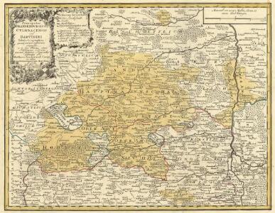
Principatus Brandenbvrgico Cvlmbacensis vel Barvthini
1 : 120000 Mollova mapová sbírka Cnopf, Matthäus Ferdinand Homann, Johann Baptista - dědici
Geographica Provinciarum Sveviae Descriptio =
Mollova mapová sbírka Hurter, Johann Christoph Bodenehr, Johann Georg
Geographica Provinciarum Sveviae Descriptio =
Mollova mapová sbírka Hurter, Johann Christoph Bodenehr, Gabriel
Windsheim
1 : 50000 Mollova mapová sbírka Homann, Johann Baptista - dědici
Nürnberg, mit dero Gegend.
1 : 100000 Mollova mapová sbírka Bodenehr, Gabriel Bodenehr, Gabriel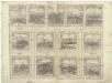
Decem et tria loca confoederatorvm Helvetiae
Schwyz (Švýcarsko) Braun, Georg Hogenberg, Franz
Meßtischblatt 130 : Miltenberg (Freudenberg), 1935
1 : 250000 Miltenberg (Freudenberg). - Aufn. 1935, Ausg. 1935. - 1:25000. - München, 1935. - 1 Kt.
Nürnberg

[Nürnberg]
Paul, August August Paul
Prospect und Grundris der des Heil: Röm. Reichs-Stadt Nürnberg : samt ihren Linien und Gegend auf eine Meil-wegs herumb
Homann, Johann Baptist, 1663-1724 Ioh. Bap. Homann
Grundris der Stadt Nürnberg
Mollova mapová sbírka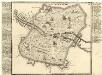
Nürnberg.
Mollova mapová sbírka Bodenehr, Gabriel Bodenehr, Gabriel
Nürmberg :
Mollova mapová sbírka Bodenehr, Gabriel Bodenehr, Gabriel
Geometrischer Grundris der des Heiligen Romischen Reiches Freyen Stadt Nürnberg
Seutter, Matthaeus, 1678-1756 Matth. Seutter, Kayserl. Geogr.
Tabulae Geographicae Principatus Brandenburg: Culmb: sive Baruthini Pars Inferior cum adjacentibus Regionibus exhibita et Sculpta
1 : 150000 Mollova mapová sbírka Seutter, Matthäus Seutter, Matthäus
Tabulae geographicae principatus Brandenburg. Culmb. sive Baruthini
1 : 179600 Bavorsko severní (Německo) Lotter, Tobias Conrad Tob. Conrad Lotter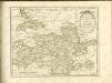

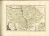
Mappa Geographica exhibens Principatvm Brandenbvrgico Onolsbacensem, una cum finitimis Regionibus Terrisque
1 : 260000 Mollova mapová sbírka Cnopf, Matthäus Ferdinand Hauer, Daniel Adam Homann, Johann Baptista - dědici
Deutsche Strassenprofilkarte für Rad - und Autofahrer 58 Nürnberg

153. Bamberg, uit: Topographische Uebersichtskarte des Deutschen Reiches / herausgegeben v. d. Kartogr. Abt. d. Königl. Preuß. Landesaufnahme
1 : 200000 titelvariant: Topogr. Übersichtskarte des Deutschen Reiches; Annotatie: Titel boven bladen ook: Topogr. Übersichtskarte des Deutschen Reiches; Annotatie geografische gegevens: Op elk blad twee maatstokken: 10 Kilometer = 5,5 cm; 1 geogr. Meile = 3,6 cm; Legenda onder op elk blad Königlich Preußische Landesaufnahme. Kartographische Abtheilung [S.l : Königlich Preußische Landesaufnahme, Kartographische Abtheilung]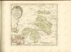

Territorivm Norimbergense
1 : 120000 Mollova mapová sbírka Blaeu, Willem Janszoon Blaeu, Willem Jansz.
Nürnbergischer Bezirck
1 : 110000 Mollova mapová sbírka Scheurer, Christoph
Nürnbergischer Bezirck
1 : 110000 Mollova mapová sbírka Scheurer, Christoph
Territorivm Norimbergense
1 : 120000 Mollova mapová sbírka Schenk, Pieter Schenk, Peter I
Territorium Norimbergense. [Karte] Nurnberg [1 Nebenkarte], in: Theatrum orbis terrarum, sive, Atlas novus, Bd. 1, S. 263.
1 Karte aus Atlas Blaeu, Joan Blaeu, Willem Janszoon
Territorium Norimbergense. [Karte], in: Le théâtre du monde, ou, Nouvel atlas contenant les chartes et descriptions de tous les païs de la terre, Bd. 1, S. 257.
1 Karte aus Atlas Blaeu, Willem Janszoon und Blaeu, Joan Blaeu, Willem Janszoon
Territorium Norimbergense. [Karte] Nurenberg [Nebenkarte], in: Novus atlas absolutissimus, Bd. 2, S. 235.
1 Karte aus Atlas Janssonius Offizin