Maps of Northern European Plain

Russiae, Moscoviae Et Tartariae Descriptio. [Karte], in: Theatrum orbis terrarum, S. 387.
1 Karte aus Atlas Ortelius, Abraham Vrients, Jan Baptista
Russiae, Moscoviae Et Tartariae Descriptio. [Karte], in: Theatrum orbis terrarum, S. 107.
1 Karte aus Atlas Ortelius, Abraham
Russiae, Moscoviae Et Tartariae Descriptio. [Karte], in: Theatrum orbis terrarum, S. 292.
1 Karte aus Atlas Ortelius, Abraham

Schema bolševických front

Europaeisches Russland
Grosser Hand-Atlas über alle Theile der Erde in 170 Karten Meyer, J. Verlag des Bibliographischen Instituts
Europaeisches Russland mit Kasan, Astrachan und Georgien
Schul-Atlas über alle Theile der Erde nach dem neuesten Zustande, und über das Weltgebäude Stieler, Adolf Justus Perthes
Russland
Volksschul-Atlas über alle Teile der Erde Lange, Henry Druck und Verlag von Georg Westermann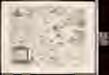
Rvssiae, Moscoviae et Tartariae descriptio / auctore Antonio Ienkensono Anglo, edita Londini anno 15
1 : 12000000 1 Karte : Kupferdruck ; 36 x 45 cm Jenkinson, Anthony [Verlag nicht ermittelbar]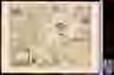
Rvssiae, Moscoviae et Tartariae descriptio / auctore Antonio Ienkensono Anglo, edita Londini anno 15
1 : 12000000 1 Karte : Kupferdruck ; 36 x 45 cm Jenkinson, Anthony [Verlag nicht ermittelbar]
Russland seit Peters des Grossen Zeit
1 : 12000000 Russland
Russia
1 : 40000000 1 Karte : Kupferdruck ; 7 x 11 cm Galle, Philippe [Christophe Plantin]
Tabula Russiae [...] [Karte] Moscua [Planvedute, [Nebenkarte], in: Novus Atlas, das ist, Weltbeschreibung, Bd. 1, S. 55.
1 Karte aus Atlas Blaeu, Joan Blaeu, Willem Janszoon
Europaeisches Russland
Plastischer Schul-Atlas über alle Theile der Erde : in 24 Karten Woldermann, G Verlag von P. Eckerlein
Europäisches Russland
Russland / Europäischer Teil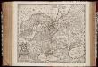
Novissima Russiæ tabula / authore Isaaco Massa
1 : 8500000 Annotatie: Rechtsboven genummerd: VI; Met opdracht van Hondius aan Isaac Bernart; Origineel is Blad 135 in atlas factice; Annotatie geografische gegevens: Met 2 schaalstokken Isaac Abrahamszoon Massa 1586-1643; Henricus Hondius 1573-1650 [Amsterdam, Londen : apud Janssonio-Waesbergios, et Mosem Pitt]
Russland
Neuer Handatlas über alle Theile der Erde Kiepert, Heinrich Verlag von Dietrich Reimer
Etnografska karta na slavjanstvoto v Evropa
1 : 5000000 Evropa východní Florinskij, Timofej Dmitrijevič Slavjanska besěda
13-14. Soviet Union in Europe. The World Atlas.
1 : 7500000 USSR (Union of Soviet Socialist Republics).
Theatrum historicum ad annum Christi quadrigentesimũ : in quo tũ Imperii Romani tũ Barbarorum circumincolentium status ob oculos ponitur pars orientalis
1 : 8500000 L'Isle, Guillaume de, 1675-1726 Apud I. Covens & C. Mortier
Europaeisches Russland
E. von Sydow's Schul-Atlas in sechs und dreissig Karten Sydow, Emil von bei Justus Perthes
Osteuropa, Kleinasien. Arabien
1 : 5000000 Asie severní Kremling, Ernst JRO
Evrope
1 Karte : Kupferdruck ; 18 x 23 cm Sanson; Winter s.n.
Theatrum historicum ad annum Christi quadringentesimu[m] / autore Guillelmo Del'isle e Regiâ scient
1 : 8500000 1 Karte : Kupferdruck ; 47 x 59 cm L'Isle, Guillaume de apud I. Cóvens [et] C. Mortier
Rußland
1 : 18000000 Russland / Europäischer Teil
Erste Revolution des Kaspischen Meeres, oder Karte, worauf dessen Ausdehnung um die Zeit der ursprünglichen Bevölkerung Asiens angezeigt wird
1 Karte : Kupferdruck ; 20 x 28 cm Philipp Heinrich Perrenon
[Europ. Russland]
[Allgemeiner Atlas über alle Theile der Erde in 29 Blättern] Ziegler, Jakob Melchior Top. Anstalt v. J. Wurster u. Comp.
Russia cum confiniis. [Karte] Russiae Pars Amphlificata [Nebenkarte], in: Gerardi Mercatoris Atlas, sive, Cosmographicae meditationes de fabrica mundi et fabricati figura, S. 158.
1 Karte aus Atlas Mercator, Gerhard Montanus, Petrus
Praktische Geschäfts und Reisekarte sämmtlicher Staaten von Europa enthaltend die vorzüglichsten Strassen-Verbindungen mit Angage der Distanzen und der bestehenden Eisenbahnen: Nebst einem Theile von Africa u. Asien, und zwar die Länder: Marocco, Algerien u. Tunis, ganz Kleinasien, und ein Theil von Persien
Schulz, R. A.
![Russiae, Moscoviae Et Tartariae Descriptio. [Karte], in: Theatrum orbis terrarum, S. 387.](https://images-2.georeferencer.com/images/iiif/786030611115/full/,300/0/native.jpg)

