Maps of Europe


L'Europe 800, 1500.
1 : 16500000 Lapie, M. (Pierre), 1779-1850
L'Europe avant l'invasion des Barbares.
1 : 17000000 Lapie, M. (Pierre), 1779-1850
L'Europe.
1 : 12800000 Andriveau-Goujon, J.
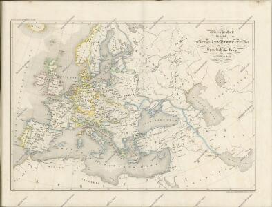
Europa zur Uebersicht der Flussgebiete und Höhenzüge
Stieler's Hand-Atlas Stieler, Adolf bei Justus Perthes
Charte von Europa
1 Karte : Kupferdruck ; 46 x 56 cm im Verlage des Industrie-Comptoirs
General Karte von Europa
1 Karte : Kupferdruck ; 50 x 58 cm von der K. K. privileg: Schneider und Weigelschen Kunst= und Buchhandlung
L'Europe
1 Karte : Kupferdruck ; 46 x 51 cm Nolin; Longchamps; Basset; Basset chez Basset rue Jacques au coin de celle des Mathurins
Charte von Europa
1 Karte : Kupferdruck ; 38 x 47 cm Güssefeld zu finden bey C. Weigel u. Schneider
Charte von Europa
1 Karte : Kupferdruck ; 38 x 48 cm Güssefeld zu finden bey C. Weigel u. Schneider
Charte von Europa
1 Karte : Kupferdruck ; 38 x 47 cm Güssefeld zu finden bey C. Weigel u. Schneider
Europe Antiqua.
1 : 47000000 Fenner, Rest.
Composite: Europe.
1 : 4800000 Kitchin, Thomas
Karte von Europa.
1 : 13500000 Berghaus, Heinrich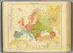
15-16. Europa etnografica.
1 : 12000000 Touring club italiano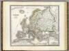
Europa.
1 : 10000000 Weiland, C. F. (Carl Ferdinand), d. 1847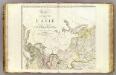
L'Asie 1.
1 : 9500000 Brue, Adrien Hubert, 1786-1832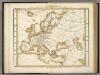
Karte Von Europa.
1 : 14500000 Berghaus, Heinrich
Neueste Karte von Europa
Grosser Hand-Atlas über alle Theile der Erde in 170 Karten Meyer, J. Verlag des Bibliographischen Instituts
Europa
Handatlas über alle Theile der Erde und über das Weltgebäude Stieler, Adolf Justus Perthes
Verbreitung Der Wichtigsten Kultur, - Baum - Und Strauchgewachse In Europa.
1 : 15000000 Berghaus, Heinrich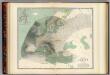
Hyetographic map Europe.
1 : 10600000 Johnston, Alexander Keith, 1804-1871
Karte von Europa
1 Karte : Kupferdruck ; 25 x 29 cm Sotzmann; Schmidt s.n.
General Karte von Europa, worinnen die Gestalt dieses Erdtheiles zu ersehen ist, wie selbe nach seinem Höhensisteme und Wasserzuge angeordnet ist
1 : 9500000 entworfen von Freyherrn v. Sorriot [...] gestochen v. J. List Wien, [s.n.]
Charte von Europa
1 Karte : Kupferdruck ; 38 x 47 cm Güssefeld zu finden bey C. Weigel u. Schneider
Europa
Adolf Stieler's Handatlas über alle Theile der Erde und über das Weltgebäude Stieler, Adolf Justus Perthes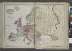
Europe
from New topographical atlas and gazetteer of New York, comprising a topographical view of the several counties of the state, ... including ... map of the United States and territories ... Compiled from the latest astronomical observations, official surveys and records of the United States and territories ...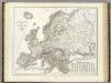
Orograph. Europa.
1 : 8900000 Weiland, C. F. (Carl Ferdinand), d. 1847
Europe.
1 : 24000000 Darton, William