Maps of South Holland

Paskaerte Begrypende in zich de Kusten van Hollandt en Zeelandt als meede de Rievier de Maas tot de Stadt Dordrecht [...] [Karte], in: De Nieuwe Groote Vermeerderde Zee-Atlas ofte Water-Werelt, S. 33.
1 Karte aus Atlas Doncker, Hendrick
Descriptio Frisiae haereditariae inter Scaldim et Kinnemum sub Carolinis
1 : 600000 auctore Mensone Alting G. de Broen fecit. [Amstelaedami] : [apud Henricum Wetstenium]
Het Graafschap Hollandt.
1 : 4500000 Te Amsterdam : bij B. Mourik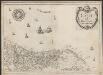
Carte de Hollande
1 : 500000 [Christophe Tassin] [Paris] : [Christophe Tassin]
Comitatus Hollandiae novissima descriptio [...] [Karte] d' Eÿlanden Texel, Vlielandt en der Schelling. [Nebenkarte], in: Gerardi Mercatoris et I. Hondii Newer Atlas, oder, Grosses Weltbuch, Bd. 1, S. 442.
1 Karte aus Atlas Mercator, Gerhard und Hondius, Jodocus Jansson, Jan
Comitatus Hollandiæ novissima descriptio
1 : 360000 designatore Balthazaro Florentio a Berckenrode Salomon Rogiers sculpsit. Amstelodami : sumptibus Henrici Hondii ...
Hollandia Comitatus. [Karte] Insulae Texel, Vlielandt et der Schelling. [Nebenkarte], in: Theatrum orbis terrarum, sive, Atlas novus, Bd. 1, S. 421.
1 Karte aus Atlas Blaeu, Joan Blaeu, Willem Janszoon
Hollandia Comitatus. [Karte] Insulae Texel Vlielandt et der Schelling. [Nebenkarte], in: Novus Atlas, das ist, Weltbeschreibung, Bd. 1, S. 388.
1 Karte aus Atlas Blaeu, Joan Blaeu, Willem Janszoon
Hollandia Comitatus
1 : 520000 [Caspar Merian] [Frankfurt am Main] : Caspar Merian]
Hollandia Comitatus. [Karte] Insulae Texel Vlielandt et der Schelling. [Nebenkarte], in: Le théâtre du monde, ou, Nouvel atlas contenant les chartes et descriptions de tous les païs de la terre, Bd. 1, S. 417.
1 Karte aus Atlas Blaeu, Willem Janszoon und Blaeu, Joan Blaeu, Willem Janszoon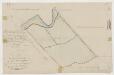
Polder Langeland en Kortland, gemeente Krimpen a/d IJssel.

HOLLANDIA | COMITATVS
Apud Guiljelmum Blaeu
Comitatus Hollandiae Tabula Pluribus Locis [...] [Karte], in: Novus atlas absolutissimus, Bd. 3, S. 162.
1 Karte aus Atlas Janssonius Offizin
Comitatus Hollandiae pluribus locis recens emendata / a Frederico de Wit
1 : 300000 Annotatie: Deze derde staat van de koperplaat is te herkennen aan het cijfer "I" rechtsboven (net als de tweede staat) en aan het feit dat de plattegrond van Amsterdam is ingevuld (bij de eerste en tweede staat van de koperplaat is dit niet het geval); Annotatie geografische gegevens: West boven Wit, Frederik de Amsterdam : Frederick de Wit
Chart of part of coast of England, Holland & Flanders &c.
1 : 1330000 Moll, Herman, d. 1732
Comitatus Hollandiae Nova Descriptio. Ex Optimis & novißimis Delineationibus designata [Karte], in: Novus atlas absolutissimus, Bd. 3, S. 159.
1 Karte aus Atlas Janssonius Offizin
Nuova carta della contèa di Olanda
1 : 700000 [Giambatista Albrizzi] [Venezia] : [Giambatista Albrizzi]
Nuova carta della contea di Olanda
1 : 700000 Frano. Sesone sculp. [Napoli] : [Francesco Ricciardo]
Pars II Fresiae haereditariae a Mosa in Kinnemum, quae hodie Hollandia, sub Henricis et Suevis
1 : 480000 auctore Menso Alting G. de Broen fecit. [Amstelaedami] : [apud Henricum Wetstenium]
Belgio confederato altrimenti detto l'Olanda, delineato
1 : 1200000 delineato, e descritto dal P. Coronelli. [Napoli] : [Vincenzo Coronelli]
Comitatus Hollandiæ novissima descriptio
1 : 360000 designatore Balthazaro Florentio a Berckenrode Salomon Rogiers sculpsit. Amstelodami : sumptibus Joannis Janssonii
Hollandia Comitatus
1 : 360000 [Cornelis Danckerts jr.] Amstelodami : apud Cornelio Dankero
La Hollande suivant les nouvelles observations de messrs. de l'Academie Royale des Sciences, etc. augmentées de nouveau
1 : 900000 [Pieter van der Aa] A Leide : chez Pierre van der Aa
Charte von Holland
1 : 300000 nach astronomischen Beobachtungen, den Messungen des Schnellius &.c.c. und den vorzüglichsten Specialcharten neu entworfen von F.L. Güssefeld. Nürnberg : bey den Hom[ännischen Erben]
Comitatus Hollandiæ tabula denuo in lucem
1 : 300000 edita à Carolo Allard Amstelodami. 't Amsterdam : gedruckt by, Carel Allard. caart en constverkooper op den Dam inde Caartwinkel
Holland
1 : 800000 [Franz Johann Joseph von Reilly] [Wien] : [Franz Johann Joseph von Reilly]
Le Comté de Hollande
1 : 240000 dressé sur les memoires les plus nouveaux par le Sr. Sanson, geographe ordinaire du roy presenté à ... le Dauphin ... par ... Alexis Hubert Jaillot. A Amsterdam : chez I. Cóvens et C. Mortier
Comitatus Hollandiae tabula pluribus locis
1 : 308000 Nizozemsko Visscher, Nicolaes Jansz. Schenk, Pieter apud Petrum Schenk Junior
Comitatus Hollandiae tabula pluribus locis
1 : 308000 Nizozemsko Wit, Frederick de by Frederick de Wit
![Paskaerte Begrypende in zich de Kusten van Hollandt en Zeelandt als meede de Rievier de Maas tot de Stadt Dordrecht [...] [Karte], in: De Nieuwe Groote Vermeerderde Zee-Atlas ofte Water-Werelt, S. 33.](https://images-2.georeferencer.com/images/iiif/274473135659/full/,300/0/native.jpg)

