Maps of Niederösterreich
Austria archiducatus. [Karte], in: Gerardi Mercatoris Atlas, sive, Cosmographicae meditationes de fabrica mundi et fabricati figura, S. 403.
1 Karte aus Atlas Mercator, Gerhard Montanus, Petrus
Austria Archiducatus [Karte], in: Theatrum orbis terrarum, sive, Atlas novus, Bd. 1, S. 127.
1 Karte aus Atlas Blaeu, Joan Blaeu, Willem Janszoon
Austria Archiducatus [Karte], in: Novus atlas absolutissimus, Bd. 2, S. 276.
1 Karte aus Atlas Janssonius Offizin
Austria Archiducatus [Karte], in: Gerardi Mercatoris et I. Hondii Newer Atlas, oder, Grosses Weltbuch, Bd. 1, S. 334.
1 Karte aus Atlas Mercator, Gerhard und Hondius, Jodocus Jansson, Jan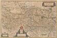
Austria Archiducatus [Karte], in: Novus Atlas, das ist, Weltbeschreibung, Bd. 1, S. 216.
1 Karte aus Atlas Blaeu, Joan Blaeu, Willem Janszoon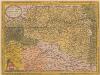
Austriae Ducatus Chorographia [Karte], in: Theatrum orbis terrarum, S. 67.
1 Karte aus Atlas Ortelius, Abraham
Austria Archiducatus [Karte], in: Le théâtre du monde, ou, Nouvel atlas contenant les chartes et descriptions de tous les païs de la terre, Bd. 1, S. 245.
1 Karte aus Atlas Blaeu, Willem Janszoon und Blaeu, Joan Blaeu, Willem Janszoon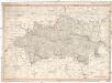
Erz Herzogthum Oesterreich ob und unter der Enns
1 : 506000 Rakousko Mollo, Tranquillo T. Mollo
Erzherzogthum Oesterreich
1 : 1030000 Rakousko Theinert, A. Flemming, C. C. Flemming
Strassen- und Eisenbahnkarte des oesterreichischen Kaiserthumes
1 : 864000 Blatt 6 Schaller, G. K.K. Militärisch-Geografisches Institut, Karten-Evidenthaltungs-Abteilung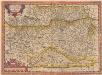
Austriae Descirp. [Karte], in: Theatrum orbis terrarum, S. 165.
1 Karte aus Atlas Ortelius, Abraham
AVSTRIA | ARCHIDVCATVS
auctore Wolfgango Lazio. [Amsterdam : Joan Blaeu]
Partie Du Cercle D'Austriche Sçavoir L'Archiduché D'Austriche Divisé en Haute et Basse [Karte], in: Atlas nouveau, contenant toutes les parties du monde [...], Bd. 1, S. 259.
1 Karte aus Atlas Sanson, Nicolas Jaillot, Alexis Hubert und Mortier, Pieter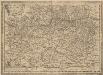
Austriae Descirp. [Karte], in: Theatrum orbis terrarum, S. 257.
1 Karte aus Atlas Ortelius, Abraham Vrients, Jan Baptista
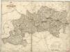
Das Erzherzogthum Oesterreich ob- und unter der Enns
1 : 643000 Rakousko Weiland, Karl Ferdinand im Verlage des Geographischen Instituts
Das Erzherzogthum Oesterreich ob- und unter der Enns
1 : 643000 Rakousko Weiland, Karl Ferdinand im Verlage des Geographischen Instituts
Erzherzogthum Österreich

Carte de l'archiduché d'Autriche avec Salzbourg
1 : 890000 Rakousko Raffelsperger, Franz Bermann, Jeremias au Dépôt des cartes typografiées
Carta dell' arciducato d'Austria con Salisburgo
1 : 890000 Rakousko Raffelsperger, Franz Magazzino delle carte tipografiate
Karte des Erzherzogthumes Österreich mit Salzburg
1 : 890000 Rakousko Raffelsperger, Franz im Typographischen Landkarten Verlage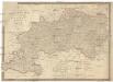
[K]arte des [Erzh]erzogthums [Oes]terreich [ob] und unter der Enns mit Salzburg
1 : 767000 Dolní Rakousko (Rakousko) Fried, Franz Artaria und Comp.
Erzherzogthum Österreich

Erzherzogthum Österreich
Rakousko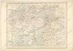
Strassen und Eisenbahnkarte des oesterreichischen Kaiserthumes


Die Krönlander Oesterreich unter und ob der Enns und Salzburg
Dolní Rakousko (Rakousko) Marco Berra
Austriae ducatus chorographia
1 : 590000 Rakousko Lazius, Wolfgang Ortelius, Abraham A. Ortelius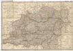
General-Post und Strassen-Karte des Erzherzogthums Oesterreich
1 : 540000 Rakousko Fried, Franz Artaria & Comp.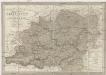
General-Post und Strassen-Karte des Erzherzogthums Oesterreich nebst einem grossen Theile von Steyermark
1 : 540000 Rakousko Fried, Franz Artaria & Comp.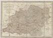
General- Post und Strassen-Karte des Erzherzogthums Oesterreich
1 : 540000 Rakousko Fried, Franz bei Artaria & Comp.
General-Post und Strassen-Karte des Erzherzogthums Oesterreich
1 : 540000 Rakousko Fried, Franz Biller, Bernh. bei Artaria
![Austria archiducatus. [Karte], in: Gerardi Mercatoris Atlas, sive, Cosmographicae meditationes de fabrica mundi et fabricati figura, S. 403.](https://images-2.georeferencer.com/images/iiif/387512041687/full/,300/0/native.jpg)

