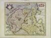
Maps of Ostfriesland

Emden & Olden Borch Comit. [Karte], in: Gerardi Mercatoris Atlas, sive, Cosmographicae meditationes de fabrica mundi et fabricati figura, S. 337.
1 Karte aus Atlas Mercator, Gerhard Montanus, Petrus
Tabula Frisiae orientalis
1 : 210000 Aurich (Německo) Coldewey, Ehrenreich Gerhard Allard, Abraham ex officina Ioh. Christoph. Homanni
Tabula Frisiae orientalis
1 : 210000 Aurich (Německo) Coldewey, Ehrenreich Gerhard Allard, Abraham ex officina Ioh. Christoph. Homanni
Königreich Hannover u. Herzogthum Oldenburg
1 : 380000 Aurich (Německo) Renner, Art. Frommann, Max.
Ducatus Bremae & Ferdae maximaeque partis fluminis Visurgis
1 : 326500 Brémy (Německo : spolková země) Wit, Frederick de R. & J. Ottens
DUCATUS BREMAE & FERDAE Maximaeque partis FLUMINIS VISURGIS
1 : 340000 Brémy (Německo : spolková země) Wit, Frederick de Frederic de Wit
Ducatus Bremae & Ferdae maximaeque partis fluminis Visurgis
1 : 326500 Brémy (Německo : spolková země) Wit, Frederick de I. Covens et C. Mortier
Emden & Oldenborch comit
1 Karte : Kupferdruck ; 32 x 41 cm Mercator; Hondius Henricus Hondius
Emden & Oldenborch comit
1 Karte : Kupferdruck ; 32 x 40 cm Mercator s.n.
Westfalia cum diœcesi Bremensi
1 Karte : Kupferdruck ; 34 x 44 cm Mercator; Hondius sumptibus Henrici Hondij
Westfalia cum diœcesi Bremensi
1 Karte : Kupferdruck ; 34 x 44 cm Mercator; Hondius sumptibus Henrici Hondij
Westfalia cum diœcesi Bremensi
1 Karte : Kupferdruck ; 34 x 44 cm Mercator; Hondius sumptibus Henrici Hondij
Westfalia cum diœcesi Bremensi
1 Karte : Kupferdruck ; 34 x 44 cm Mercator s.n.
Oost-Frise, ou Le Comté D'Embden subdivisé en ses principales Iurisditions. [Karte], in: Atlas nouveau, contenant toutes les parties du monde [...], Bd. 2, S. 93.
1 Karte aus Atlas Sanson, Nicolas Jaillot, Alexis Hubert und Mortier, Pieter
Frisia Orientalis [Karte] Rideriae Portionis [...] [Nebenkarte], in: Theatrum orbis terrarum, S. 201.
1 Karte aus Atlas Ortelius, Abraham Vrients, Jan Baptista
Oldenburg Comit. [Karte], in: Theatrum orbis terrarum, S. 213.
1 Karte aus Atlas Ortelius, Abraham Vrients, Jan Baptista
Grossherzogthum Oldenburg und Gebiet der freien Stadt Bremen
Grosser Hand-Atlas über alle Theile der Erde in 170 Karten Meyer, J. Verlag des Bibliographischen Instituts
Comitatus Oldenburgici ac Delmenhorstani Sceptro Danico parentis Mappa specialissima Chorographica, novaq; recentissima
1 : 240000 Mollova mapová sbírka Rizzi Zannoni, Giovanni Antonio Seutter, Albrecht Carl
La Principauté d'Ost-Frise ou le Comté d'Embden : avec ses principales jurisdictions
1 : 210000 carte dessinée de nouveau par Tob. Conrad Lotter gravé par Georg Frederic Lotter Augsburg : Tob. Conrad Lotter
Tabula Frisiæ orientalis
1 Karte : Kupferdruck ; 47 x 56 cm Homann; Sanson; Coldewey; Allard; Emmius ex officina Ioh. Christoph: Homanni M. D
Tabula Frisiæ orientalis
1 Karte : Kupferdruck ; 47 x 56 cm Homann; Sanson; Coldewey; Allard; Emmius ex officina Ioh. Christoph: Homanni M. D
Tabula Frisiæ orientalis
1 Karte : Kupferdruck ; 47 x 56 cm Homann; Sanson; Coldewey; Allard; Emmius ex officina Ioh. Christoph: Homanni M. D
Typus Frisiae Orientalis. [Karte], in: Gerardi Mercatoris et I. Hondii Newer Atlas, oder, Grosses Weltbuch, Bd. 1, S. 149.
1 Karte aus Atlas Mercator, Gerhard und Hondius, Jodocus Jansson, Jan
Oldenbvrg Comitatvs.
1 : 190000 Mollova mapová sbírka Aveele, Johannes van den
Oldenbvrg Comitatvs
1 : 190000 Mollova mapová sbírka Aveele, Johannes van den
Typus Frisiae Orientalis. [Karte] Rideriae Portionis [...] [Nebenkarte], in: Novus Atlas, das ist, Weltbeschreibung, Bd. 1, S. 126.
1 Karte aus Atlas Blaeu, Joan Blaeu, Willem Janszoon
Oldenburg Comitatus [Karte], in: Novus atlas absolutissimus, Bd. 2, S. 109.
1 Karte aus Atlas Janssonius Offizin
Typus Frisiae Orientalis. [Karte] Rideriae Portionis [...] [Nebenkarte], in: Novus atlas absolutissimus, Bd. 2, S. 112.
1 Karte aus Atlas Janssonius Offizin
![Emden & Olden Borch Comit. [Karte], in: Gerardi Mercatoris Atlas, sive, Cosmographicae meditationes de fabrica mundi et fabricati figura, S. 337.](https://images-2.georeferencer.com/images/iiif/233091557816/full/,300/0/native.jpg)

