Maps of Bezirk Muri

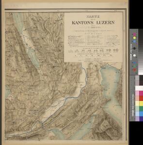
Karte des Kantons Luzern
1 : 50000 1 Karte in 6 Blättern von J.S. Gerster J.J. Hofer, Zürich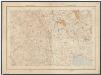
Kanton Zürich: Staats-, Gemeinde- und Genossenschaftswaldungen: Blatt 13: Gegend bei Kappel am Albis, Maschwanden, Mettmenstetten und Aeugst am Albis; Situationsplan
1 : 25000 Auf Ausgangskarten angebrachte farbige Eintragungen und Einzeichnungen. Ohne Erstellungsdatumsangabe. Ausgangskarten: Blätter 173 (Merenschwand), 176 (Mettmenstetten), 187 (Hochdorf) und 190 (Cham) des Topographischen Atlasses der Schweiz (Siegfried-Karte). Hartmann, Karl, Forstadjunkt im Zürcher Oberforstamt, von Aarau, in Unterstrass
Topographische Karte des Kantons Luzern
1 : 25000 Blatt 3 H. Müllhaupt u. Sohn H. Müllhaupt u. Sohn
Hans Konrad Gyger's Züricher-Cantons-Carte 1667
1 : 32000 1 Karte in 56 Teilen Hans Konrad Gyger
Topographische Karte des Kantons Luzern
1 : 25000 Blatt 4 H. Müllhaupt u. Sohn H. Müllhaupt u. Sohn
Knonau
1 : 25000 1 Karte [Lithographie: Josef Graf]
Nova descriptio ditionis Tigurinæ, regionumque finitimarum, 4
1 Blatt : 49 x 36 cm Johann Jost Hiltensperger
Nova descriptio ditionis Tigurinæ, regionumque finitimarum, 4
1 Blatt : 50 x 37 cm s.n.
Hans Konrad Gyger's Züricher-Cantons-Carte 1667
1 : 32000 1 Karte in 56 Teilen Hans Konrad Gyger
Hans Konrad Gyger's Züricher-Cantons-Carte 1667
1 : 32000 1 Karte in 56 Teilen Hans Konrad Gyger
Kanton Zürich: Waldungen, Rebberge und Rodungen um die Mitte des 17. Jahrhunderts: Blatt XXIX: Knonau
1 : 25000 Ohne Erstellungsdatumsangabe. Ausgangskarte: Blatt XXIX (Knonau) der Topographischen Karte des Kantons Zürich (Wild-Karte). Tirkanits, Miklos, andere Schreibweise: Nikolaus, (geb. 1923), Ingenieur und Assistent für Kartografie an der Eidgenössischen Technischen Hochschule Zürich, von Ungarn Ausgangskarte Leitung: Wild, Johannes (1814-1894), Ingenieur sowie Strassen- und Wasserbauinspektor des Kantons Zürich, von Richterswil Ausgangskarte Zeichnung: Enderli, Heinrich (1830-1902), Zeichner, von Wipkingen Ausgangskarte Stich: Brack, Johann Jakob (1824-1867), Lithograf, von Neunforn TG
Grenze zwischen den Kantonen Zürich und Zug bei Knonau; Übersichtskarte
1 : 25000 Mit handschriftlichen Einzeichnungen. Ausgangskarte: Blatt XXIX (Knonau) der Topographischen Karte des Kantons Zürich (Wild-Karte). Meyer-Näf, Hs. Ausgangskarte Leitung: Wild, Johannes (1814-1894), Ingenieur sowie Strassen- und Wasserbauinspektor des Kantons Zürich, von Richterswil Ausgangskarte Zeichnung: Enderli, Heinrich (1830-1902), Zeichner, von Wipkingen Ausgangskarte Stich: Graf, Josef (1811-1871), Lithograf, von Rottweil (Deutschland)
Hans Konrad Gyger's Züricher-Cantons-Carte
1 : 32000 Blatt 48 Gyger, Hans Conrad ; Zeller-Werdmüller, Heinrich Hofer & Burger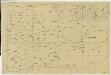
Vorlagen für die Topographische Karte des Kantons Zürich (Wild-Karte): Schrift-Pausen: Blatt XXIX: Knonau
1 : 25000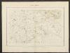
Knonau
1 : 25000 Karte des Kantons Zürich im Masstab von 1:25 000, Blatt 29 Wild, Johannes Topographisches Bureau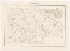
Topographische Karte des Kantons Zürich (Wild-Karte): Blatt XXIX: Knonau
1 : 25000 Leitung: Wild, Johannes (1814-1894), Ingenieur sowie Strassen- und Wasserbauinspektor des Kantons Zürich, von Richterswil Zeichnung: Enderli, Heinrich (1830-1902), Zeichner, von Wipkingen Stich: Graf, Josef (1811-1871), Lithograf, von Rottweil (Deutschland)
Grosse Landtafel des Zürcher Gebiets: Blatt 48: Eschenbach und Umgebung
Möglicherweise: Wagner, Johann (1675-1714)
Grosse Landtafel des Zürcher Gebiets: Blatt 47: Merenschwand und Umgebung
Möglicherweise: Wagner, Johann (1675-1714)
Mühlau AG: Projektierte Brücke über die Reuss; Übersichtsplan
1 : 25000 Ausgangskarten (zusammengesetzt): Ausschnitte der Blätter 173 (Merenschwand) und 176 (Mettmenstetten) des Topographischen Atlasses der Schweiz (Siegfried-Karte). Ausgangskarten Leitung: Siegfried, Hermann (1819-1879), Topograf und Kartograf, von Zofingen AG; Eidgenössisches Topographisches Bureau, in Bern
Übersichtskarte zu den Truppenbewegungen am 23ten November 1847
1 : 25000 1 Karte Topogr. Anstalt v. J. Wurster u. Comp. [Friedrich Schulthess], [Zürich]
Plan der Gegend zwischen der Reuss und Mettmenstetten
1 : 25000 1 Karte autographirt nach den Zürch. topogr. Vermessungen
Hans Konrad Gyger's Züricher-Cantons-Carte
1 : 32000 Blatt 47 Gyger, Hans Conrad ; Zeller-Werdmüller, Heinrich Hofer & Burger
<<Die>> Umgebungen von Luzern mit den vom Sonderbund errichteten Verschanzungen
1 : 25000 1 Karte Topograph. Anstalt v. J. Wurster u. Comp. [Friedrich Schulthess], [Zürich]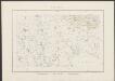
Knonau
1 : 25000 Graf, Josef [Topographisches Bureau]
Topographischer Atlas der Schweiz (Siegfried-Karte): Den Kanton Zürich betreffende Blätter: Blatt 190: Cham
1 : 25000 Erstausgabe 1887. Leitung: Siegfried, Hermann (1819-1879), Topograf und Kartograf, von Zofingen AG; Eidgenössisches Topographisches Bureau, in Bern Aufnahme: Hörnlimann, Jakob (1846-1933), Ingenieur; Pestalozzi, Karl, andere Schreibweise: Carl, (1825-1891), Ingenieur, von Zürich; Stucky, H. Revision: Benz, J. Stich: Müllhaupt, F.
Topographischer Atlas der Schweiz (Siegfried-Karte): Den Kanton Zürich betreffende Blätter: Blatt 190: Cham
1 : 25000 Erstausgabe 1878; Nachführungen 1898, 1908, 1910, 1919. Leitung: Siegfried, Hermann (1819-1879), Topograf und Kartograf, von Zofingen AG; Eidgenössisches Topographisches Bureau, in Bern Aufnahme: Hörnlimann, Jakob (1846-1933), Ingenieur; Pestalozzi, Karl, andere Schreibweise: Carl, (1825-1891), Ingenieur, von Zürich; Stucky, H. Revision: Benz, J. Stich: Müllhaupt, F. Druck: Eidgenössische Landestopographie
Hans Konrad Gyger's Züricher-Cantons-Carte 1667
1 : 32000 1 Karte in 56 Teilen Hans Konrad Gyger
Topographischer Atlas der Schweiz (Siegfried-Karte): Den Kanton Zürich betreffende Blätter: Blatt 176: Mettmenstetten
1 : 25000 Erstausgabe 1884, Nachführungen 1898, 1907, 1915. Leitung: Siegfried, Hermann (1819-1879), Topograf und Kartograf, von Zofingen AG; Eidgenössisches Topographisches Bureau, in Bern Aufnahme: Pestalozzi, Karl, andere Schreibweise: Carl, (1825-1891), Ingenieur, von Zürich; Stucky, H.; Wetli, Kaspar, andere Schreibweise: Wethli, (1822-1889), Ingenieur, von Männedorf Revision: Benz, J. Stich: Müllhaupt, Heinrich (1820-1894), Kupferstecher und Kartograf, von Hofstetten; Müllhaupt, Fritz (1846-1917), von Hofstetten
Topographischer Atlas der Schweiz (Siegfried-Karte): Den Kanton Zürich betreffende Blätter: Blatt 176: Mettmenstetten
1 : 25000 Erstausgabe 1884. Leitung: Siegfried, Hermann (1819-1879), Topograf und Kartograf, von Zofingen AG; Eidgenössisches Topographisches Bureau, in Bern Aufnahme: Pestalozzi, Karl, andere Schreibweise: Carl, (1825-1891), Ingenieur, von Zürich; Stucky, H.; Wetli, Kaspar, andere Schreibweise: Wethli, (1822-1889), Ingenieur, von Männedorf Revision: Benz, J. Stich: Müllhaupt, Heinrich (1820-1894), Kupferstecher und Kartograf, von Hofstetten; Müllhaupt, Fritz (1846-1917), von Hofstetten