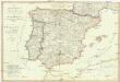
Maps of Spain

Portugal et Hispania : ex archetypo Roderici Mendez Silvae et variis relationibus et chartis manu scriptis et impressis huius Regni rectificatis per Observationes Sociorum Academiae Scieiniarum quae est Parisiis
1 : 3200000 per G. de L'Isle Aug. Vind : in officina Tobiae Conr. Lotter
Hispania : ex archetypo Roderici Mendez Silvae et variis relationibus et chartis manu scriptis et impressis hujus regni rectificatis per Observationes Sociorum Academiae Scientiarum quae est Parisiis
1 : 3200000 per G. De L'Isle Matth. Seutter sculp. Aug. Vind : in officina Tobiae Conr. Lotter

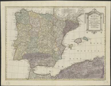
REGNORUM HISPANIAE et PORTUGALLIAE Tabula generalis
1 : 2700000 Aragonie (Španělsko) Homann, Johann Baptist Delisle, Guillaume a Ioh. Bapt. Homanno
REGNORUM HISPANIAE et PORTUGALLIAE Tabula generalis
1 : 2700000 Aragonie (Španělsko) Homann, Johann Baptist Delisle, Guillaume a Ioh. Bapt. Homanno
Die iberische Halbinsel 1257 bis 1479.
1 : 3800000 Spruner von Merz, Karl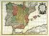
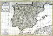
Hispania
1 Karte : Kupferdruck ; 43 x 60 cm Lotter; L'Isle; Seutter; Silva in officina Tobiæ Conr: Lotter calcogr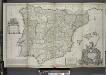
A new & exact map of Spain and Portugal, divided into its kingdoms and principalities &c. ...
from The world described, or, A new and correct sett of maps : shewing the kingdoms and states in all the known parts of the earth, with the principal cities, and most considerable towns in the world ... / ... by Herman Moll, geographer ...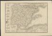
Carte d'Espagne et de Portugal divisée suivant la décision des cortès et soumise aux dernières observations
1 : 2250000 par J. B. Poirson Paris : chez A. Bes et F. Dubreul
Die iberische Halbinsel bis in die Mitte des XIIIten Jahrhundert's.
1 : 3800000 Spruner von Merz, Karl
Emirat von Cordoba bis zum Untergange der Ommijaden; christlichen Reiche im Norden der iberischen Halbinsel 711 bis 1028.
1 : 3700000 Spruner von Merz, Karl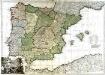
El reyno de España
1 Karte auf 2 Blatt : Kupferdruck ; 71 x 102 cm Longchamps en casa del autor en la calle San-Tiago a la insignia de la plaza de las victorias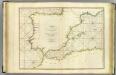
Coasts Spain, Portugal, Barbary.
1 : 3200000 Faden, William, 1750?-1836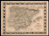
Carte administrative, physique et routiere de l'Espagne et du Portugal indiquant les canaux, les rivieres naviables, les routes de poste et les nouvelles divisions des provinces, &c.
1 Mapa, col. Orla amb 32 vistes de ciutats i monuments. - Limits acolorits Dufour, A.-H. Dufour, Bulla et Jouy

España: comunicaciones terrestres
Datat al 1950 aproximadament. 0 Seix y Barral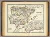
Hispania.
1 : 3800000 Menke, Th.
Carte de l'Espagne
1 Karte : Kupferdruck ; 46 x 59 cm L'Isle; Buache; Silva; Dezauche; Vallet chez Dezauche rue des Noyers
Die iberische Halbinsel seit dem Anfange des XVIten. Jahrhundert's (1479).
1 : 3800000 Spruner von Merz, Karl
El reyno de España
1 Karte : Kupferdruck ; 48 x 64 cm Longchamps en casa del autor en la calle San-Tiago a la insignia de la plaza de las victorias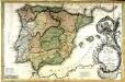
Nouvele carte phisique politique et astronomique des royaumes d'Espagne et de Portugal
1 Karte : Kupferdruck ; 53 x 80 cm Denis; Mondhare chez L. Denis et L. Mondhard ruë S Jacque à l'hotel Saumur
Espana y Portugal
1 : 1640000 Portugalsko López, Tomas Mauricio Tomas Mauricio Lopez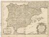
L'Espagne
1 : 2600000 Aragonie (Španělsko) Sanson, Guillaume Cordier, Louis chez H. Jaillot
Die iberische Halbinsel nach ihrer kirchlichen Eintheilung.
1 : 3800000 Spruner von Merz, Karl
Carte des royaumes d'Espagne et de Portugal
1 Karte : Kupferdruck ; 51 x 76 cm Hérisson; Basset; Perrier; Basset chez Basset rue St. Jacques au coin de celle des Mathurins no. 64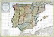
Carte des royaumes d'Espagne et de Portugal
1 Karte : Kupferdruck ; 50 x 76 cm Hérisson; Basset; Perrier; Basset chez Basset rue Jacques au coin de celle des Mathurins no. 670
Carta itineraria de España
1 : 1500000 Depósito Central de Planos de la Dirección General de Obras Públicas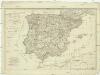
Die Königreiche Spanien und Portugal nach den neuesten Beobachtungen verfasst
1 : 2220000 Portugalsko Tranquillo Mollo