Maps of Spain


Die iberische Halbinsel bis in die Mitte des XIIIten Jahrhundert's.
1 : 3800000 Spruner von Merz, Karl
Hispania
1 Karte : Kupferdruck ; 48 x 55 cm L'Isle; Seutter; Silva Matthäus Seutter
Tabula Moderna Hispanie [Karte], in: [Clavdii Ptholomei Cosmographi ...], S. 251.
1 Karte aus Atlas Nicolaus Germanus [und Ptolemaeus, Claudius]
Hispania III. Nova Tabula [Karte], in: Claud. Ptolemaeus. Geographia lat. cum mappis [...], S. 338.
1 Karte aus Atlas Münster, Sebastian [und Ptolemaeus, Claudius]
Carte administrative, physique et routiere de l'Espagne et du Portugal indiquant les canaux, les rivieres naviables, les routes de poste et les nouvelles divisions des provinces, &c.
1 Mapa, col. Orla amb 32 vistes de ciutats i monuments. - Limits acolorits Dufour, A.-H. Dufour, Bulla et Jouy

Hispania III. Nova Tabula [Karte], in: Geographia universalis vetus et nova complectens Claudii Ptolemaei Alexandrini enarrationis libros VIII, S. 308.
1 Karte aus Atlas Münster, Sebastian [und Ptolemaeus, Claudius]
Emirat von Cordoba bis zum Untergange der Ommijaden; christlichen Reiche im Norden der iberischen Halbinsel 711 bis 1028.
1 : 3700000 Spruner von Merz, Karl
REGNORUM HISPANIAE et PORTUGALLIAE Tabula generalis
1 : 2700000 Aragonie (Španělsko) Homann, Johann Baptist Delisle, Guillaume a Ioh. Bapt. Homanno
REGNORUM HISPANIAE et PORTUGALLIAE Tabula generalis
1 : 2700000 Aragonie (Španělsko) Homann, Johann Baptist Delisle, Guillaume a Ioh. Bapt. Homanno
Die iberische Halbinsel seit dem Anfange des XVIten. Jahrhundert's (1479).
1 : 3800000 Spruner von Merz, Karl
L'Espagne divisée en tous ses Royaumes Et Principautés [...] [Karte], in: Atlas nouveau, contenant toutes les parties du monde [...], Bd. 2, S. 107.
1 Karte aus Atlas Sanson, Nicolas Jaillot, Alexis Hubert und Mortier, Pieter
[Spanien und Portugal, Iberische Halbinsel]
Geographischer Atlas über alle Theile der Erde Ziegler, Jakob Melchior Verlag von Dietrich Reimer
Die iberische Halbinsel 1257 bis 1479.
1 : 3800000 Spruner von Merz, Karl
L'Espagne
1 Karte : Kupferdruck ; 47 x 59 cm L'Isle; Luchtenburg; Silva chez I. Covens et C. Mortier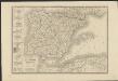
Carte d'Espagne et de Portugal divisée suivant la décision des cortès et soumise aux dernières observations
1 : 2250000 par J. B. Poirson Paris : chez A. Bes et F. Dubreul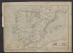
Mapa de la guia oficial de ferro-carriles de España, Francia y Portugal
1 : 4000000 Ferreiro, Martin 1830-1896
Mapa general de España Antiqua, dividido en tres partes, Bética, Lusitánia y Tarraconénse, con la subdivision de cada una
1 : 3700000 por [...] Juan Lopez, pensionista de S.M [...] Madrid : [Thomas Lopez]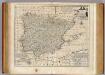
Spain and Portugal.
1 : 3500000 Bowen, Emanuel
Hispaniae Veteris Descriptio. [Karte], in: Theatrum orbis terrarum, S. 459.
1 Karte aus Atlas Ortelius, Abraham Vrients, Jan Baptista
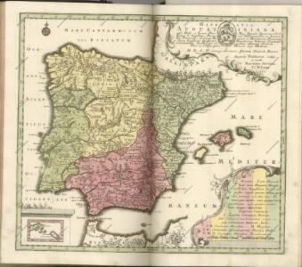
Hispanie ex archetypo Roderici Mendez Sylvae et variis relationibus manu scriptis et impresis hujus regni, emendatis per observationes Sociorum academiae scientiarum quae est Parisiis
1 : 2590000 Portugalsko Delisle, Guillaume Mendes Silva, Rodrigo cura et sumptibus Matth. Seutteri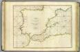
Coasts Spain, Portugal, Barbary.
1 : 3200000 Faden, William, 1750?-1836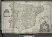
A new & exact map of Spain and Portugal, divided into its kingdoms and principalities &c. ...
from The world described, or, A new and correct sett of maps : shewing the kingdoms and states in all the known parts of the earth, with the principal cities, and most considerable towns in the world ... / ... by Herman Moll, geographer ...
Carte générale de l'Espagne et du Portugal / par A.H. Brué
1 Mapa. Atlas universel; 22 Brué. Adrien-Hubert chez l'auteur et chez Simonneau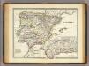
Hispania.
1 : 3800000 Menke, Th.
Carte de l'Espagne
1 Karte : Kupferdruck ; 46 x 59 cm L'Isle; Buache; Silva; Dezauche; Vallet chez Dezauche rue des Noyers
Hispaniae Veteris Descriptio. [Karte] [Blastophoenices, Region Cádiz] [Nebenkarte], in: Theatrum orbis terrarum, S. 368.
1 Karte aus Atlas Ortelius, Abraham
Portugal et Hispania : ex archetypo Roderici Mendez Silvae et variis relationibus et chartis manu scriptis et impressis huius Regni rectificatis per Observationes Sociorum Academiae Scieiniarum quae est Parisiis
1 : 3200000 per G. de L'Isle Aug. Vind : in officina Tobiae Conr. Lotter