Maps of Essex County

Passaic
1 : 125000
Passaic
1 : 125000
Passaic
1 : 125000
Passaic
1 : 125000
Map of Coney Island and Sheepshead Bay
From Brooklyn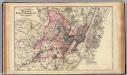
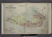
Hudson, Union, Essex Cos., N.J.
1 : 126720 Beers, F. W. (Frederick W.)
Watson's new map of the city of Brooklyn including Brooklyn
From Brooklyn
6 Central red sandstone.
1 : 63360 Vermeule, C. C. (Cornelius Clarkson), 1858-1950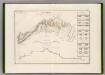
Canal Morris.
1 : 250000 Poussin, Guillaume Tell, 1794-1876
New York, Brooklyn.
1 : 42500 Beers, F. W. (Frederick W.)
Plainfield
1 : 62500
Plainfield
1 : 62500
Plainfield
1 : 62500
Plainfield
1 : 62500
Plainfield
1 : 62500
Plainfield
1 : 62500
Plainfield
1 : 62500
Plainfield
1 : 62500
Plainfield
1 : 62500
Plainfield
1 : 62500
Plainfield
1 : 62500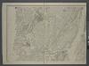
Map of New-York Bay and Harbor and the environs / founded upon a trigonometrical survey under the direction of F. R. Hassler, superintendent of the Survey of the Coast of the United States ; triangulation by James Ferguson and Edmund Blunt, assistants ;
from New York harbor
Hammond's complete map of Staten Island, N.Y., Borough of Richmond, New York City.
From Staten Island
Staten Island (cont.)
From The Borough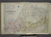
Outline & Index Map of The Borough of Richmond (Staten Island); Explanation; Note.
from Atlas of the city of New York, borough of Richmond, Staten Island. From actual surveys and original plans, by George W. and Walter S. Bromley.
Staten Island, N.Y., ed. of Feb. 1900, repr. 1932
from New York, 15 minute series (topographic) / mapped, edited, and published by the Geological Survey.
Map of the Hudson ... from New York Harbor the Fort Washington.
from Map of the Hudson between Sandy Hook & Sandy Hill : with the post road between New York and Albany / Bridges delt. ; Rollinson sct.
Paterson, N.J. - N.Y., ed. of Feb. 1903, repr. 1924
from New Jersey, 15 minute series (topographic) / mapped, edited, and published by the Geological Survey.
General map of the city of New York, consisting of boroughs of Manhattan, Brooklyn, Bronx, Queens and Richmond : consolidated into one municipality by act of the legislature of the state of New York (Chapter 378 of the laws of 1897) : showing in addition
from Whole