Maps of Essex County
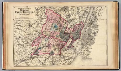
Hudson, Union, Essex Cos., N.J.
1 : 126720 Beers, F. W. (Frederick W.)
Map of Coney Island and Sheepshead Bay
From Brooklyn
Passaic
1 : 125000
Passaic
1 : 125000
Passaic
1 : 125000
Passaic
1 : 125000
New York, Brooklyn.
1 : 42500 Beers, F. W. (Frederick W.)
Map of the Hudson ... from New York Harbor the Fort Washington.
from Map of the Hudson between Sandy Hook & Sandy Hill : with the post road between New York and Albany / Bridges delt. ; Rollinson sct.
Map of New-York Bay and Harbor and the environs / founded upon a trigonometrical survey under the direction of F. R. Hassler, superintendent of the Survey of the Coast of the United States ; triangulation by James Ferguson and Edmund Blunt, assistants ;
from New York harbor
Facsimile of the unpublished British head quarters coloured manuscript map of New York & environs / reproduced from the original drawing in the War Office, London.
from Whole
Canal Morris.
1 : 250000 Poussin, Guillaume Tell, 1794-1876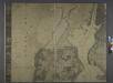
General map of the city of New York, consisting of boroughs of Manhattan, Brooklyn, Bronx, Queens and Richmond : consolidated into one municipality by act of the legislature of the state of New York (Chapter 378 of the laws of 1897) : showing in addition
from Whole
Newark, Elizabeth, the Oranges.
1 : 31680 Vermeule, C. C. (Cornelius Clarkson), 1858-1950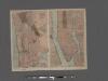
TheHome Life Publishing Co.' s map of the City of New York.
From Manhattan
Map of property situated in the 12th ward of the city of New York belonging to the estate of John Taylor : to be sold at auction by Jas. Bleecker & Sons at the Merchts. Exchange at 12 o'clock on Tuesday the 1st April 1834.
from Manhattan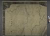
General map of the city of New York, consisting of boroughs of Manhattan, Brooklyn, Bronx, Queens and Richmond : consolidated into one municipality by act of the legislature of the state of New York (Chapter 378 of the laws of 1897) : showing in addition
from Whole
City of New Manhattan : proposed May 1911, revised May 1930 / T. Kennard Thomson, consulting engineer, New York City.
from Manhattan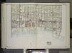
Brooklyn, Vol. 2, Double Page Plate No. 27; Part of Wards 30 & 31, Section 19; [Map bounded by 86th St., 23rd Ave., 24th Ave.; Including Gravesend Bay, 17th Ave.] / by and under the direction of Hugo Ullitz.
From Volume 2.
Newark-Paterson.
1 : 31680 Vermeule, C. C. (Cornelius Clarkson), 1858-1950
Roselle
1 : 24000
Elizabeth
1 : 24000
Elizabeth
1 : 24000
Elizabeth
1 : 24000
Elizabeth
1 : 24000
Jersey City
1 : 24000
Jersey City
1 : 24000
Roselle
1 : 24000
Roselle
1 : 24000
Roselle
1 : 24000
Elizabeth
1 : 24000
Elizabeth
1 : 24000
Jersey City
1 : 24000
Jersey City
1 : 24000
Roselle
1 : 24000
Elizabeth
1 : 24000
Elizabeth
1 : 24000