Maps of Bergen County

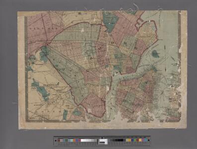
Watson's new map of the city of Brooklyn including Brooklyn
From Brooklyn
New Jersey, Double Page Sheet No. 7 [Map of Northeastern Red Sandstone]
From Atlas of New Jersey.
7 NE red sandstone.
1 : 63360 Vermeule, C. C. (Cornelius Clarkson), 1858-1950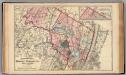
Bergen, Passaic Cos., N.J.
1 : 126720 Beers, F. W. (Frederick W.)
Passaic
1 : 125000
Passaic
1 : 125000
Passaic
1 : 125000
Passaic
1 : 125000
Paterson, N.J. - N.Y., ed. of Feb. 1903, repr. 1924
from New Jersey, 15 minute series (topographic) / mapped, edited, and published by the Geological Survey.
Canal Morris.
1 : 250000 Poussin, Guillaume Tell, 1794-1876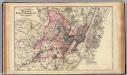
Hudson, Union, Essex Cos., N.J.
1 : 126720 Beers, F. W. (Frederick W.)
Paterson
1 : 62500
Paterson
1 : 62500
Paterson
1 : 62500
Paterson
1 : 62500
Paterson
1 : 62500
Paterson
1 : 62500
Paterson
1 : 62500
Paterson
1 : 62500
Paterson
1 : 62500
Paterson
1 : 62500
Paterson
1 : 62500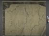
General map of the city of New York, consisting of boroughs of Manhattan, Brooklyn, Bronx, Queens and Richmond : consolidated into one municipality by act of the legislature of the state of New York (Chapter 378 of the laws of 1897) : showing in addition
from Whole
Facsimile of the unpublished British head quarters coloured manuscript map of New York & environs / reproduced from the original drawing in the War Office, London.
from Whole
Newark-Paterson.
1 : 31680 Vermeule, C. C. (Cornelius Clarkson), 1858-1950
Newark, Elizabeth, the Oranges.
1 : 31680 Vermeule, C. C. (Cornelius Clarkson), 1858-1950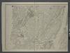
Map of New-York Bay and Harbor and the environs / founded upon a trigonometrical survey under the direction of F. R. Hassler, superintendent of the Survey of the Coast of the United States ; triangulation by James Ferguson and Edmund Blunt, assistants ;
from New York harbor
Caldwell
1 : 24000
Orange
1 : 24000
Weehawken
1 : 24000
Weehawken
1 : 24000
Weehawken
1 : 24000
Weehawken
1 : 24000
Orange
1 : 24000
Orange
1 : 24000
Orange
1 : 24000
Orange
1 : 24000
Caldwell
1 : 24000
Caldwell
1 : 24000
Caldwell
1 : 24000
Caldwell
1 : 24000
Caldwell
1 : 24000
Caldwell
1 : 24000
Caldwell
1 : 24000
Orange
1 : 24000
Weehawken
1 : 25000
Weehawken
1 : 25000
Weehawken
1 : 31680
Weehawken
1 : 31680