Maps of Columbia

Columbia
1 : 24000
Columbia
1 : 24000
Columbia
1 : 24000
Columbia
1 : 62500
Columbia
1 : 62500
Palmyra
1 : 125000
Palmyra
1 : 125000
Palmyra
1 : 125000
Palmyra
1 : 125000
Palmyra
1 : 125000
Palmyra
1 : 125000
Palmyra
1 : 125000
Palmyra
1 : 125000
Palmyra
1 : 125000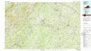
Dillwyn
1 : 100000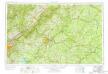
Roanoke
1 : 250000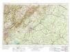
Roanoke
1 : 250000
Roanoke
1 : 250000
Roanoke
1 : 250000
Roanoke
1 : 250000
Roanoke
1 : 250000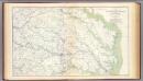
SE Virginia, Ft. Monroe.
1 : 316800 U.S. War Department, Topographical Engineers
(Seat of the Civil War - Virginia).
1 : 412000 Schonberg & Co.
Milford, Brock's Gap, Moorefield, New Creek, etc.
Hotchkiss, Jed.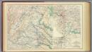
Central Virginia 1864-1865.
1 : 650000 United States. War Department
Map of the Region between Gettysburg, Pa. and Appomattox Court House, Va.
1 : 285120 Weyss, John E.
The states of Maryland and Delaware, from the latest surveys
1 : 800000 Wayland, Reid & Smith
Central Virginia showing Lieut Gen'l U.S. Grant's Campaign and Marches.
1 : 350000 United States. War Dept. Engineer Bureau
States of Maryland and Delaware.
1 : 800000 Winterbotham, W.

