Maps of Darmstadt

Bey Granichstein
Karge, Johann Friedrich; Hill, Johann Jakob
Grundriss über den Grossen Wild-Parck im Darmstler BurgerWald
Hill, Johann Jakob
Pharus-Plan Darmstadt
1 : 10000 Pharus-Verl.
Pharus-Plan Darmstadt
1 : 12500 Löwe, Cornelius Pharus-Verl.
Stadtplan von Darmstadt
1 : 10000 Otto
[Carte von Darmstadt und Umgebung]
Bechstatt, I. C.
[Situations-Charte der Umgegend von Darmstadt]
Bechstatt, C.
[Carte von Darmstadt und Umgebung]
Bechstatt, I. C.; Haas, Johann Heinrich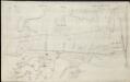
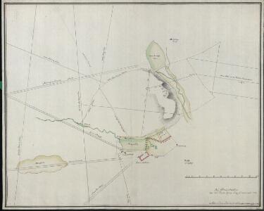
[Brouillon der Gegend am Landgraben zwischen Griesheim und Wolfskehel bis zur Sandbach]
Hill, Johann Jakob
Section Darmstadt
Eckhardt, Christian Leonhard Philipp; Haas, Johann Heinrich; Meister, G.; Stoltz
Plan des Baillages D'Umstatt et D'Otzberg
Reuling, Louis
Le Flambeau de la Guerre Allumee au Rhin
Mollova mapová sbírka Delisle, Guillaume Schenk, Peter II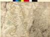
[Brouillon der Umgebung von Darmstadt]
Haas, Johann Heinrich; Lyncker, Ludwig; Meister, G.
Novam Hanc Territorii Francofurtensis Tabulam [Karte], in: Novus Atlas, das ist, Weltbeschreibung, Bd. 1, S. 150.
1 Karte aus Atlas Blaeu, Joan Blaeu, Willem Janszoon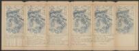
Novam Hanc Territorii Francofurtensis Tabulam [...] [Karte], in: Le théâtre du monde, ou, Nouvel atlas contenant les chartes et descriptions de tous les païs de la terre, Bd. 1, S. 181.
1 Karte aus Atlas Blaeu, Willem Janszoon und Blaeu, Joan Blaeu, Willem Janszoon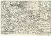
Maintz.
1 : 240000 Mollova mapová sbírka Person, Nikolaus Person, Nicolas
Situations Karte von Darmstadt und den umliegenden Gegenden zwischen Rhein, Mayn, Neckar &c.
Bechstatt, I. C.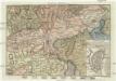
Gegend von Maynz
Mohuč (Německo) Engelmann, J. W. bey J.G. Oehler Buchdruck
[Topographische Charte der Gegend zwischen Rhein, Neckar und Mayn]
Meister, G.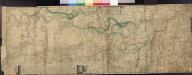
Le Cours Du Rhin Depuis Spire juisqu'à Mayence, les marches et Contremarches de l'Armée Francoise et les Camps y sont marqués Come aussi de l'Armée Alliée du coté du Main l'ann 1743 avec la Situation de l'Odewwald et du Berg Straass
Denis, Ferdinand
Special Carte Des Rheinlaufes Von Speier Bis Bingen
Dewarat, Peter; Verhelst, Aegid Schwan und Götz
Territorium Seculare Episcopatus Wormatiensis Tabula Geographica
1 : 130000 Mollova mapová sbírka Homann, Johann Baptist Homann, Johann Baptista - dědici
Erpach Comitatus
1 : 170000 Mollova mapová sbírka Keere, Pieter van den Schenk, Peter I
Erpach Comitatus
1 : 170000 Mollova mapová sbírka Keere, Pieter van den Janssonius, Johannes I
151. Darmstadt, uit: Topographische Uebersichtskarte des Deutschen Reiches / herausgegeben v. d. Kartogr. Abt. d. Königl. Preuß. Landesaufnahme
1 : 200000 titelvariant: Topogr. Übersichtskarte des Deutschen Reiches; Annotatie: Titel boven bladen ook: Topogr. Übersichtskarte des Deutschen Reiches; Annotatie geografische gegevens: Op elk blad twee maatstokken: 10 Kilometer = 5,5 cm; 1 geogr. Meile = 3,6 cm; Legenda onder op elk blad Königlich Preußische Landesaufnahme. Kartographische Abtheilung [S.l : Königlich Preußische Landesaufnahme, Kartographische Abtheilung]
Section Darmstadt, uit: Charte von dem Grossherzogtum Hessen und dem Herzogtum Nassau / trigonometrisch aufgenommen und hrsg. von C.L.P. Eckhardt
1 : 200000 titelvariant: Karte von Hessen und Nassau Eckhardt, C. L. P Darmstadt : Joh. Wilh. Heyer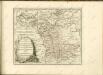


ERPACH | COMITATVS
[Amsterdam : Joan Blaeu]