Maps of Zeleneč

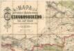
Mapa politického a školního okresu Českobrodského

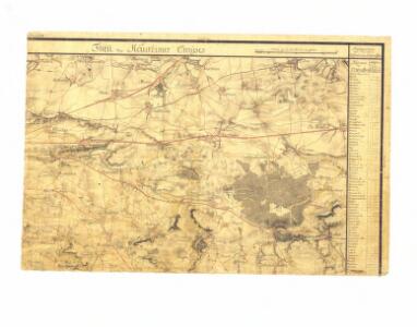
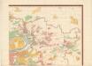
Projectierte Lager
1 : 15000 Brandýs nad Labem (Česko)
Bez titulu: Plán železniční dopravy v Praze a okolí

Gradkartenblatt
1 : 25000 Čechy (Česko) Czechák, Carl
Mapa zastupitelských a soudních okresů Kr. Vinohradského a Jílovského...

Výškopisný plán hlavního města Prahy s okolím

Výškopisný plán hlavního města Prahy s okolím
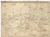
Plan der Schlacht bei Prag am 6ten Mai 1757
1 : 25000 Štěrboholy (Praha, Česko) Hoen, Maximilian von L.W. Seidel & Sohn
Orientační plán Hlavního města Prahy

Schlacht bei Prag, den 6-ten May 1757
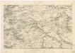
Umgebung von Prag IV.
Graenzkarte der k. k. Reservatjagdbefugnisz bei Hrdlorzes, Vissoczan, Key, Hostawitz, Chwalla, Malleschitz, Lieben und Hlaupietin &
1 : 15000 Hloubětín (Praha, Česko) Guberth, Karl
Hlavní město Praha s okolím
Situations-Plan des Reservat Jagel Terrains bey Prag gegen Chwala so weil dieses von gegenwärtigen Herrn Kommandirenden auf 6 Jahre gepachtet worden ist
1 : 15000 Trampusek, Franz Le Roy
Kollodeg (Kolodeg) - c3287-1-007 - Kaiserpflichtexemplar der Landkarten des stabilen Katasters
1 : 2880
Kollodeg (Kolodeg) - c3287-1-009 - Kaiserpflichtexemplar der Landkarten des stabilen Katasters
1 : 2880
Kollodeg (Kolodeg) - c3287-1-008 - Kaiserpflichtexemplar der Landkarten des stabilen Katasters
1 : 2880
Kollodeg (Kolodeg) - c3287-1-002 - Kaiserpflichtexemplar der Landkarten des stabilen Katasters
1 : 2880
Kollodeg (Kolodeg) - c3287-1-003 - Kaiserpflichtexemplar der Landkarten des stabilen Katasters
1 : 2880
Kollodeg (Kolodeg) - c3287-1-001 - Kaiserpflichtexemplar der Landkarten des stabilen Katasters
1 : 2880
Kollodeg (Kolodeg) - c3287-1-005 - Kaiserpflichtexemplar der Landkarten des stabilen Katasters
1 : 2880
Kollodeg (Kolodeg) - c3287-1-006 - Kaiserpflichtexemplar der Landkarten des stabilen Katasters
1 : 2880
Kollodeg (Kolodeg) - c3287-1-004 - Kaiserpflichtexemplar der Landkarten des stabilen Katasters
1 : 2880
Rev. Neuhof.
1 : 2200 Klánovice (Praha, Česko) Kohut, Josef Líčka, Josef
Situationskarte der, der Prag-Auwaller Gewerkschaft gehörigen Eisen-Bergwerke
1 : 8300 Úvaly (Praha-východ, Česko) Joh. Sandtner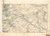
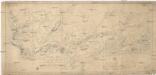
Umgebung von Prag
Orientierungsplan der Hauptstadt Prag
Jiřík, Rudolf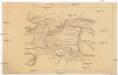
Situace nové spojovací tratě Vršovice - Libeň