Maps of Ruzyně


Ideal-Plan uiber den in VI Theilen zur Verpachtung angetragenen k.k. Jagd-Reserval-Bezirk
Braník (Praha, Česko)
Městské podniky Pražské

Specielle Telegrafen und Eisenbahn Karte von Böhmen
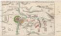
Accurate Vorstellung der zwischen den oesterreichischen und preussischen Armeen geschehenen Bataille bey Prag, den 6. May 1757
Praha (Česko)
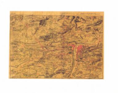
Zu Bildner des Heeres Beilage 9
1 : 63000 Praha-oblast (Česko) K.k. Schulbücher-Verschleiss-Administration
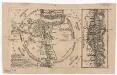
Prag's Umgebungen
Praha-oblast (Česko) Scheiner, Josef Kettner, C. J.G. Calve'sche Buchhandlung
Prag und seine Umgebungen, nach den besten Hülfsmitteln dargestellt
1 : 42000 C. Kettner sculp. Prag : J. G. Calve'sche Buchhandlung
Plan van de stadt en de beleegering van Praag, 1757 = Plan de la ville & du siege de Prague, en 1757
T. Otten sc. ['s-Gravenhage] : P. Gosse excudit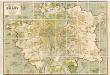
Orientační plán hlavního města Prahy
1 : 14000
Okolí města Prahy na hodinu cesty
Praha-oblast (Česko) K. Hübner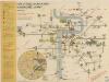
Plán sítě elektrických drah hlavního města Prahy

Blocus de Prague
1 : 106600 Praha (Česko) Therbu Coentgen, Heinrich Hugo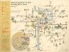
Plán sítě elektrických drah hlvního města Prahy

Orientační plán hlavního města Prahy s okolím
Jižní Město. - Opatov Orientační plán 2. souboru
1 : 2500
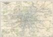
Prag und seine Umgebungen
Praha (Česko) Bittner, Joseph Kettner, C. J. G. Calvesche Buchhandlung
Hlavní město Praha
1 : 55000 Praha (Česko)
Situations - Plan der westlichen Gegend von Prag ...

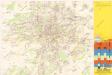
Plán velké Prahy
1 : 19000 Praha (Česko) Grgurič, Václav Sádlo, Jiří A. Storch syn
Plán Velké Prahy
1 : 19000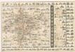
Praha : názorné plány a rejstřík

Orientační plán Prahy a obcí sousedních přehledka

Nejnovější plán Prahy : připojen abecední seznam ulic k rychlému vyhledávání, seznam škol...
1 : 17500
Die öffentlichen Verkehrsmittel der Hauptstadt Prag
Praha (Česko)
Přehledná mapa velké Prahy
Plán sítě elektrických drah, trolejbusů a autobusů hlavního města Prahy

Přehledná mapa Velké Prahy : [s průvodcem a popisem všech obcí v ní zahrnutých] : [odpolední výlety po okolí pražském]
1 : 34725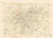
Plán sběrného okruhu a dopravních spojů pro motorová vozidla