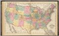
Maps of United States
Areas covered by the soil survey, completed to January 1934
1 : 7900000 Includes numbered list of reconnaissance surveys. "Atlas of American Agriculture, Soils, Plate 1." United States. Bureau of Chemistry and Soils. [Washington, D.C.?] : The Bureau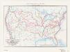
Map of the conterminous United States showing routes of the principal explorers from 1501 to 1844, whose work had an important bearing on the settlement of the country and the fixing of its successive boundaries
1 : 8500000 "Taken from Bulletin 1212, Plate 1." Original title: United States map showing routes of principal explorers and early roads and highways. Bond, Frank, 1856-1940 United States. General Land Office.; Geological Survey (U.S.); Reston, Virginia : U.S. Geological Survey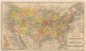
Routen der Missouri - Pacific, sowie der Wabash St. Louis und Pacific Eisenbahnen
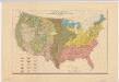
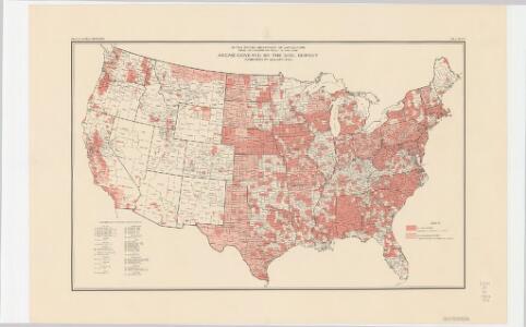
Distribution of the great soil groups (soil provinces)
1 : 8000000 Relief shown by spot heights. Appears in Washington: U.S. Dept. of Agriculture. Atlas of American agriculture, 1936. Soils, plate 2. Marbut, Curtis Fletcher, 1863-1935. Washington, D.C. : Bureau of Chemistry and Soils
Vereinigte Staaten v. Nord-America.
1 : 11500000 Flemming, Carl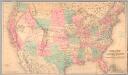
Railroad map of the United States to accompany the "Commercial travellers guide book".
From Whole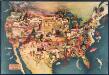
Paul Sample's America: Its Soil
This bird's-eye-view map shows scenes of land use and farming superimposed on a map of the United States. Agricultural scenes of farming, livestock, and crops are depicted. Sample, Paul Associatedd American Artists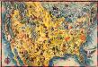
The Covarrubias America: a decorative map of the United States of America
This pictorial bird's-eye-view map shows the United States of America with parts of Canada and Mexico. Landscape, trade, industry, points of interest, people, and animals are depicted. Covarrubias, Miguel Edward Stern & Co.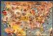
Bohrod's America, its history
This map shows scenes from America's history with names of historical events superimposed on a map of the United States. Bohrod, Aaron Associated American Artists
Vereinigte Staaten von Nord-America
1 : 13000000
United States.
1 : 10560000 Rand McNally and Company
Map of the United States and Canada.
1 : 11404800 Merriam, Moore & Co.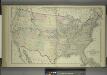
Map of the United States and Territories
from Combination atlas map of Broome County, New York; / compiled, drawn and published from personal examinations and surveys by Everts, Ensign & Everts.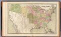
United States.
1 : 7920000 Goodrich, S.G.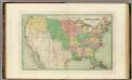
United States.
1 : 8236800 Bradford, Thomas G.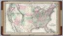
United States of America.
1 : 6336000 Colton, G.W.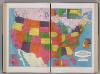
United States.
1 : 8183000 Hammond, C.S.
[Neuer Atlas der ganzen Erde nach den neuesten Bestimmungen ... : XXIV.] Charte von dem Nordamericanischen Staatenbunde
Entworfen und gezeichnet von F.W. Streit H. Leutemann sc. Leipzig : J.C. Hinrichs'sche Buchhandlung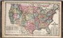
United States.
1 : 8750000 Mitchell, Samuel Augustus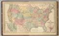
United States.
1 : 8750000 Mitchell, Samuel Augustus
Military map of the United States
1 : 5000000 Freyhold, Edward United States. War Dept.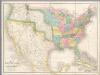
Map of the United States Of North America.
1 : 4118400 Burr, David H., 1803-1875
Hypsometric sketch US.
1 : 10400000 United States. Census Office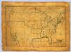
United States.
1 : 7700000 Symonds, Maria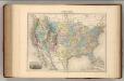
Etats-Unis.
1 : 11700000 Migeon, J.
United States Of North America.
1 : 6336000 Stanford, Edward
Hammond's comprehensive map of the United States with portions of Canada and Mexico
1 : 5000000 C.S. Hammond & Company C.S. Hammond & Company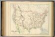
United States.
1 : 9504000 Fullarton, A. & Co.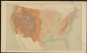
United States relief map
1 : 7000000 Geological Survey (U.S.) Geological Survey (U.S.)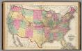
Map of the United States and territories.
1 : 7500000 Lloyd, H.H.
United States.
1 : 7500000 Gray, Ormando Willis; Walling, H. F.