Maps of United States
Map of the United States Of North America.
1 : 4118400 Burr, David H., 1803-1875
Map of the United States of North America: with parts of the adjacent countries / by David H. Burr (late topographer to the Post Office), geographer to the House of Representatives of the U.S.
from Whole David H. Burr,
American Union Railroad Map Of The United States.
1 : 4435000 Haasis & Lubrecht
United States / Geo. Boynton, sc., Boston.
from Whole
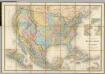
United States with the contiguous British & Spanish Possessions.
1 : 3801600 Melish, John
Composite: United States with the contiguous British & Spanish Possessions.
1 : 3801600 Melish, John
Map of the United States: with the contiguous British & Spanish possessions / compiled from the latest & best authorities by John Melish; engraved by J. Vallance & H.S. Tanner.
from Whole John Melish; J. Vallance; Henry S. Tanner,
American Continent: United States, British Possessons, West Indies, Mexico, Central America
1 : 4435200 Rosa, R.
Map of the United States of America with its territories & districts : including also a part of upper & lower Canada and Mexico.
from Whole
Map showing the location of the Indian reservations within the limits of the United States and territories / compiled from official and other authentic sources, under the direction of the Hon. John D.C. Atkins, Commissioner of Indian Affairs ; Paul Brodi
from Whole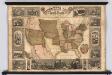
Pictorial Map Of The United States.
1 : 6336000 Atwood, J.M.; Ensign & Thayer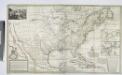
A new map of the north parts of America claimed by France under ye names of Louisiana, Mississipi, Canada and New France, with ye adjoyning territories of England and Spain ... / by H. Moll, geographer, 1720.
from Charts and maps Herman Moll,
A new map of the north parts of America claimed by France under ye names of Louisiana, Mississipi, Canada and New France, with ye adjoyning territories of England and Spain ... / by H. Moll, geographer, 1720.
from Charts and maps Herman Moll,
Etats Unis.
1 : 10000000 Vivien St Martin, L.
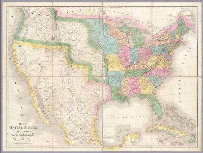
Map of the United States and Mexico: including Oregon, Texas and the Californias.
from Parts s.n.: [New York?],
Verein-Staaten Von Nord-America, Mexico, Yucatan U. A.
1 : 13400000 Stulpnagel, F.v.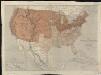
Map of the United States of North America, upper & lower Canada, New Brunswick, Nova Scotia & British Columbia, Mexico, Cuba, Jamaica, St. Domingo and the Bahama Islands
1 : 5800000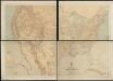
Military map of the United States
1 : 5000000 Freyhold, Edward United States. War Dept.
United States Of North America.
1 : 6336000 Stanford, Edward
[Map of Spanish Louisiana and the American colonies]
from Whole
Vereinigte Staaten von Nord-America
Hand-Atlas über alle Theile der Erde nach dem neuesten Zustande und über das Weltgebäude Stieler, Adolf bei Justus Perthes
Base-map of the United States
1 : 7000000 U.S. Coast and Geodetic Survey U.S. Coast and Geodetic Survey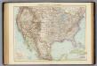
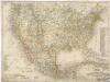
Vereinigte Staaten von Nordamerika.
1 : 10000000 Andree, Richard
United States and territories.
1 : 2534400 U.S. General Land Office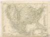
Vereinigte Staaten von Nord - America und Mexico
Vereinigte Staaten von Nord America - und Mexico
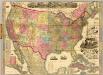
The American Republic and rail-road map of the United States.
1 : 4435200 Watson, Gaylord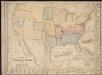
Military map of the United States & territories showing the location of the military posts, arsenals, Navy Yards, & ports of entry
Carte Generale Des Etats.
1 : 7285000 Andriveau-Goujon, E.