Maps of Essex

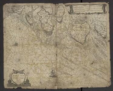
De Cust van Zeeland : Begrypende in sich de Zee gaten, als van de Wielingen. Ter Veere. Zieric zee. Brouwers-haven. Goeree en de Maes
1 : 160000 Theunisz, Jacob Amsterdam : Lootsman, Jacob Theunisz
THE WEST PART OF THE RIVER THAMES and THE EAST PART OF THE RIVER THAMES
The title of this map of the course of the River Thames (from its spring in Gloucestershire to its estuary)runs along the top, with a scale bar at bottom centre and a key to docking reaches at top right. Geographical features and built-up areas are indicated by symbols, with the water soundings expressed in feet at various points of the estuary. Harris, J.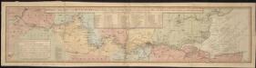
Bowles's new map of the River Thames, from it's spring in Gloucester-shire, to it's influx into the sea, with a table of all the locks, wears, and bridges thereupon, shewing the tolls payable at each and their distance by water from one another
1 : 1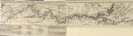
A Draught of the RIVER THAMES from its Spring in GLOUCESTERSHIRE to its Influx into the SEA
The title of this map of the River Thames' course runs along the top, with a scale bar at bottom centre. A note below the plan gives an account of the geographical features of the river, with a table indicating distances and fares of barges between points of navigation. A second note gives instructions on docking for goods coming from overseas with key to docking reaches at top right. Geographical features and built-up areas are indicated by symbols, with the soundings of the water expressed in feet at various points along the river. Bowles, Thomas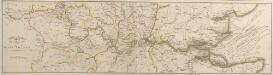
Plan of the RIVER THAMES
The title of this map of the course of the River Thames' course (running from its spring in Gloucestershire to the estuary) appears at bottom left next to the scale bar. The course of the river is highlighted in yellow, and different colours used to indicate county borders. Neele, S.
A MAP OF THE DIOCESS OF LONDON
This drawn plan was probably a draught for the map of the Diocese of London published by Jacob Robinson between 1723 and 1748. The title and an explanatory note appear in a square table at the bottom right. The boundaries of the diocese are outlined in red and all the churches within the diocese indicated by a red symbol. Harris, John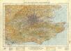
England and Wales 1:253,440
Ordnance Survey

Generalkarte von Zentraleuropa

L'abbrucciamento fatto da gli vascelli Olandesi di quelli de gli Inglesi nella réuéera di Cattam anno 1666 24 di agosto
Chatham (Anglie) Bouttats, Gerhaert
L'abbrucciamento fatto da gli vascelli Olandesi di quelli de gli Inglesi nella réuéera di Cattam anno 1666 24 di agosto
Chatham (Anglie) Bouttats, Gerhaert
Glocestria Ducatus, cum Monumethensi Comitatu. Glocester Shire & Monmouth Shire. [Karte], in: Novus atlas absolutissimus, Bd. 7, S. 217.
1 Karte aus Atlas Janssonius Offizin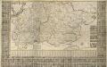
A New and Correct MAPP OF MIDDLESEX, ESSEX AND HERTFORDSHIRE With the Roads Rivers Sea-Coast ACTUALLY SURVEYED
Based on an original survey of 1721, this map of Hertfordshire, Middlesex and Essex was first issued in 1724. It was still being offered for sale by Bowles& Carver at the end of the 18th Century. Printed in six sheets, the map's title appears in ornamental cartouche at top left, with compass star at bottom right, key to symbols at bottom left and a list of towns and villages in a panel below the plan. Down both sides of the map and along the bottom are 850 coats of arms. A key in the table at bottom centre links them to the homes of their owners, who were also subscribers to the map. County borders are indicated by a discontinuous line, with liberty boundaries (public land) outlined in colour. Warburton, John, Bland, Joseph and Smyth, Pyler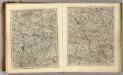
Sheets 23-24. (Cary's England, Wales, and Scotland).
1 : 360000 Cary, John, ca. 1754-1835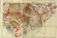
South Wales and the border in the 14th century
Rees, William Ordnance Survey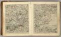
Sheets 25-26. (Cary's England, Wales, and Scotland).
1 : 360000 Cary, John, ca. 1754-1835
A New and Exact Map of the DIOCESE OF LONDON
This plan is based on John Harris's similar map of 1714.A dedication to the Lord Bishop of London and diocesan arms appear at the top, surrounded by illustrated views of prominent London churches: St Paul's Cathedral, St. Bridget's, Westminster Abbey and St. Mary-le-Bow. Robinson, Jacob
Bercheria Vernacule Bark Shire. [Karte], in: Theatrum orbis terrarum, sive, Atlas novus, Bd. 4, S. 186.
1 Karte aus Atlas Blaeu, Joan Blaeu, Willem Janszoon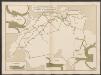
Bercheria Vernacule Barkshire. [Karte], in: Le théâtre du monde, ou, Nouvel atlas contenant les chartes et descriptions de tous les païs de la terre, Bd. 4, S. 164.
1 Karte aus Atlas Blaeu, Willem Janszoon und Blaeu, Joan Blaeu, Willem Janszoon
Bercheria Vernacule Bark Shire. [Karte], in: Theatrum orbis terrarum, sive, Atlas novus, Bd. 4, S. 186.
1 Karte aus Atlas Blaeu, Joan Blaeu, Willem Janszoon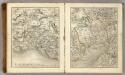
Sheets 21-22. (Cary's England, Wales, and Scotland).
1 : 360000 Cary, John, ca. 1754-1835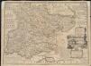
An accurate map of the county of Essex, divided into its hundreds
1 : 180000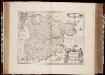
Essexiae descriptio = The description of Essex / [Joannes Janssonius]
1 : 220000 titelvariant: The description of Essex; Annotatie: Oorspr. verschenen in: Ioannis Ianssonii Novus Atlas ... - Amstelodami : apud Iohannem Ianssonium, 1646; Origineel is Blad 28 in atlas factice Janssonius, Joannes (jr.) (1588-1664) Amstelodami : sumptibus Ioannis Ianssonii
Les environs de Londres
1 Karte : Kupferdruck ; 47 x 55 cm Le Rouge par et chez le Sr. le Rouge ingenieur geographe du roi rue des Augustins vis a vis le panier Fleury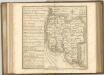
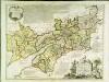
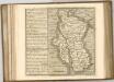
An accurate map of the counties Gloucester and Monmouth
1 Karte : Kupferdruck ; 51 x 66 cm Tinney; Bowles; Sayer; Bowles; Bowles printed for T. Bowles in St. Pauls Church Yard Rob.t Sayer and John Tinney in Fleet Street and John Bowles and son in Cornhil
Essexiae Descriptio. The Description of Essex. [Karte], in: Novus atlas absolutissimus, Bd. 7, S. 265.
1 Karte aus Atlas Janssonius Offizin
Essexiae Descriptio. The Description of Essex. [Karte], in: Gerardi Mercatoris et I. Hondii Newer Atlas, oder, Grosses Weltbuch, Bd. 1, S. 93.
1 Karte aus Atlas Mercator, Gerhard und Hondius, Jodocus Jansson, Jan