Maps of Valais/Wallis

Atlas der alten Eidgenossenschaft in 20 Karten: Oberwallis und Unterwallis
Originaltitel: Vallesia superior ac inferior, Wallis. Mit Erklärung der Zeichen und Zeichnungen des Furkagletschers, des Gemmibergs, des Pissevache-Wasserfalls und des grossen St. Bernhards. Zeichnung: Walser, Gabriel (1695-1776), reformierter Pfarrer, von Teufen AR Herausgeber: Homännische Erben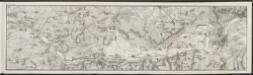
Lombardiae Alpestris pars occidentalis cum Valesia [Karte], in: Gerardi Mercatoris Atlas, sive, Cosmographicae meditationes de fabrica mundi et fabricati figura, S. 432.
1 Karte aus Atlas Mercator, Gerhard Montanus, Petrus
Lombardiae Alpestris pars occidentalis cum Valesia [Karte], in: Gerardi Mercatoris et I. Hondii Newer Atlas, oder, Grosses Weltbuch, Bd. 2, S. 225.
1 Karte aus Atlas Mercator, Gerhard und Hondius, Jodocus Jansson, Jan

<<Der>> Canton Wallis
1 : 450000 1 Karte gez. u. gest. von J. Scheurmann Orell Füssli & Comp., Zürich
Lombardiae alpestris pars occidentalis cum Valesia
1 Karte : Kupferdruck ; 34 x 43 cm Mercator; Hondius Henricus Hondius
Lombardiae alpestris pars occidentalis cum Valesia
1 Karte : Kupferdruck ; 34 x 43 cm Mercator s.n.
Landtaflen
1 Atlas [von Johannes Stumpf] Christoffel Froschower, Zürych
Geologische Kartenskizze der Alpen zwischen St. Gotthard & Montblanc
1 : 350000 Alpy (pohoří) Schmidt, Carl Ernst Finckh
Atlas der Schweiz
1 : 450000 1 Atlas (18 Bl.) gez. u. gest. v. J. Scheurmann Orell Fussli, Zurich
Atlas novus Reipublicae Helveticae
1 Atlas ([40] Bl., 97 S.) bey Orell, Gessner und Compagnie, Zürich
[Keller's Reisekarte der Schweiz]
1 : 500000 1 Karte auf 6 Bl. gezeichnet v. H. Keller ; gest. v. J.J. Scheurmann [Keller], Zürich
Parte del Piemonte...

Reisekarte der Schweiz
1 : 500000 1 Atlas (1, 6 Bl.) gezeichnet von H. Keller und gestochen von J. Scheurmann = Carte routière de la Suisse / dessinée par H. Keller et gravée par J. Scheurmann bey Fuessli und Comp., Zürich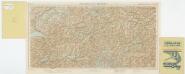
Foglio 1, uit: Carta d'Italia alla scala di 1:500.000 / Touring Club Italiano
1 : 500000 Annotatie: Voor aanwezige bladen zie overzichtsblad Touring Club Italiano Milano : Touring Club Italiano
[Wallis]
1 : 500000 1 Karte [Johannes Stumpf] [Christoffel Froschouer], [Zürych]
Nova Helvetiae tabula geographica
1 : 1000000 Südwest-Blatt Scheuchzer, Johann Jakob ; Schenck, Peter ex officina Petri Schenckii
Nova Helvetiae tabula geographica illustrissimis et potentissimis cantonibus et rebuspublicis reformatae religionis Tigurinae, Bernensi, Glaronensi, Basiliensi, Scaphusianae, Abbatis Cellanae
1 : 230000 1 Karte auf 4 Bl. dominis suis clementissimis humillime dicata a Ioh. Iacobo Scheuchzero Tigurino ; Ioh. Melch. Füsslin ornamenta pinx. ; Ioh. Henr. Huber et Eman. Schalch sculps. [Hofmeister], [Zürich]
Neue Schweizerkarte von 1847
1 : 300000 1 Karte auf 4 Bl. als Wand- und Reliefkarte topisch und politisch dargestellt von Eduard Winckelmann Tobias Dannheimer, Kempten
Postkarte der schweizerischen Eidgenossenschaft
1 : 300000 1 Karte in 4 Teilen unter Aufsicht des General Dufour nach den gegenwürtig vorhandenen Materialien des eidgenössischen Atlasses und den besten Karten gezeichnet von J.R. Stengel u. E. Mohr Wurster, Winterthur
Nouvelle carte géographique de la Suisse
1 : 600000 1 Karte auf 4 Bl. dressé par Jacq. Scheuchzer chez R. & J. Wetstein et Guil. Smith, Amsterdam
Carte du phénomène erratique et des anciens glaciers du versant nord des Alpes suisses et de la chaîns du Mont-Blanc
1 : 250000 1 Karte auf 4 Blättern par Alphonse Favre ; publ. par la Commission géologique de la Société Helvétique des Sciences Naturelles [Verlag nicht ermittelbar], [Erscheinungsort nicht ermittelbar]
[Reisekarte der Schweiz]
1 : 500000 1 Karte auf 6 Bl. gezeichnet v. H. Keller ; gest. v. J.J. Scheurmann [Füssli & Comp.], [Zürich]
<<Les>> Suisses, leurs alliés et leurs sujets
1 : 230000 1 Karte auf 4 Bl. par Iaillot chez l'auteur joignant les Grands Augustins aux deux Globes, Paris
Nova Rhaetiae atque totius Helvetiae descriptio
1 : 350000 1 Karte auf 10 Bl. per Aegidium Tschudum Glaronensem Hofer & Burger, Zürich
Hypsometrische Karte der Schweiz
1 : 380000 1 Karte auf 4 Blättern von J.M. Ziegler = Carte hypsométrique de la Suisse / par J.M. Ziegler Verlag von Joh. Wurster u. Comp., Winterthur
Carte géologique de la Suisse
1 : 380000 1 Karte auf 4 Bl. par B. Studer et A. Escher de la Linth d'après leurs propres observations et les communications de leurs amis propriété de l'Etablissement topographique de J. Wurster & Comp., Winterthur
<<Les>> Suisses, leurs alliés et leurs sujets
1 : 230000 1 Karte auf 4 Bl. par A.H. Iaillot, 1703 chez l'auteur joignant les grands Augustins aux deux globes, Paris
Karte des Kriegs-Schauplatzes der Schweiz
1 : 700000 2 Karten Verlag der Steiner'schen Buchhandlung, [Winterthur]


