Maps of Předhradí

Katastrální mapa pro obec Rychmburk
1 : 2880
Katastrální mapa obce Rychmburk (Předhradí)
1 : 2880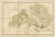
Mapa vrchnostenského dvora Rychmburk a k němu náležejícím pozemkům
1 : 3448
Mapa vrchnostenského dvora Daletice a vsi Lešany
1 : 3853
Richenburg (Richunburk) - c6167-2-004 - Kaiserpflichtexemplar der Landkarten des stabilen Katasters
1 : 2880
Richenburg (Richunburk) - c6167-2-007 - Kaiserpflichtexemplar der Landkarten des stabilen Katasters
1 : 2880
Richenburg (Richunburk) - c6167-2-002 - Kaiserpflichtexemplar der Landkarten des stabilen Katasters
1 : 2880
Richenburg (Richunburk) - c6167-2-006 - Kaiserpflichtexemplar der Landkarten des stabilen Katasters
1 : 2880
Richenburg (Richunburk) - c6167-2-005 - Kaiserpflichtexemplar der Landkarten des stabilen Katasters
1 : 2880
Richenburg (Richunburk) - c6167-2-003 - Kaiserpflichtexemplar der Landkarten des stabilen Katasters
1 : 2880
Richenburg (Richunburk) - c6167-2-001 - Kaiserpflichtexemplar der Landkarten des stabilen Katasters
1 : 2880
Mapa vsi Otradov a Miřetín
1 : 4055
Mirzetin (Miřetin) - c4714-1-002 - Kaiserpflichtexemplar der Landkarten des stabilen Katasters
1 : 2880
Mirzetin (Miřetin) - c4714-1-001 - Kaiserpflichtexemplar der Landkarten des stabilen Katasters
1 : 2880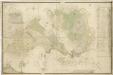
Mapa vrchnostenského dvora Rychmburk a k němu náležejícím pozemkům
1 : 3512
Indikační skica mapy stabilního katastru pro obec Otradov
1 : 2880
Gradkartenblatt
1 : 25000 Hlinsko-oblast (Chrudim, Česko) Hallada, Alois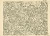
III. vojenské mapování 4056/3
1 : 25000

Mapa dominikální osady Pláňavy
1 : 2880
Vys. Mýto
1 : 75000 Vysoké Mýto (Česko : oblast) Vojenský zeměpisný ústav
Hohenmauth und Leitomischl
1 : 75000 Litomyšl (Česko : oblast) Storch K. u. k. Militärgeographisches Institut
III. vojenské mapování 4056
1 : 75000
Mapa horo- a vodopisná okresu chrudimského a nasavrckého
1 : 100000 Chrudim-oblast (Česko) Homolka, Josef Výbor ku popisu okresu chrudimského a nasavrckého
Vys[oké] Mýto a Litomyšl
1 : 75000 Litomyšl (Česko) Vojenský zeměpisný ústav
Polička a okolí
1 : 75000 Polička (Česko : oblast) Vojenský zeměpisný ústav
[Vilímkovy místopisné mapy zemí Koruny české]
1 : 100000 Litomyšl (Česko : oblast) Srp, Jan Jos. R. Vilímek
Podrobná mapa Království českého
1 : 100000 Litomyšl (Česko : oblast) Srp, Jan Jos. R. Vilímek
Podrobná mapa Markrabství moravského a Vévodství slezkého
1 : 100000 Litomyšl (Česko : oblast) Srp, Jan Jos. R. Vilímek
Politický okres Chrudim
1 : 100000 Chrudim-oblast (Česko) Josef Richard Vilímek


