Maps of Čeperka

Indikační skica mapy stabilního katastru pro obec Podulšany ad III.
1 : 2880
Indikační skica mapy stabilního katastru pro obec Čeperka IV.
1 : 2880
Koncept mapy pozemků bývalého rybníka Malá Čeperka
1 : 2880
Indikační skica mapy stabilního katastru pro obec Staré Ždánice a osadu Nové Ždánice I.-V.
1 : 2880
Mapa Opatovického revíru
1 : 9372
Czeperka - c0851-1-002 - Kaiserpflichtexemplar der Landkarten des stabilen Katasters
1 : 2880
Czeperka - c0851-1-006 - Kaiserpflichtexemplar der Landkarten des stabilen Katasters
1 : 2880
Czeperka - c0851-1-007 - Kaiserpflichtexemplar der Landkarten des stabilen Katasters
1 : 2880
Czeperka - c0851-1-005 - Kaiserpflichtexemplar der Landkarten des stabilen Katasters
1 : 2880
Czeperka - c0851-1-008 - Kaiserpflichtexemplar der Landkarten des stabilen Katasters
1 : 2880
Czeperka - c0851-1-001 - Kaiserpflichtexemplar der Landkarten des stabilen Katasters
1 : 2880
Czeperka - c0851-1-004 - Kaiserpflichtexemplar der Landkarten des stabilen Katasters
1 : 2880
Czeperka - c0851-1-003 - Kaiserpflichtexemplar der Landkarten des stabilen Katasters
1 : 2880
Indikační skica mapy stabilního katastru pro obec Čeperka I.-X.
1 : 2880
Mapa rybníka Jezero a jeho severního okolí
1 : 10000
Porostní mapa revíru Stéblové
1 : 10000
Mapa polesí Stéblová
1 : 15000
Indikační skica mapy stabilního katastru pro obec Libišany I.-V.
1 : 2880

Gradkartenblatt
1 : 25000 Hradec Králové-oblast (Česko) Hallada, Alois
Geometrische Karte von der Herrschaft Chlumetz
1 : 87000 Chlumec nad Cidlinou-oblast (Česko) Langweil, Antonín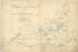
Některé vodní stavby z 15. a 16. století na Pardubicku

Domäne Daschitz
1 : 57600
Pardubice
1 : 75000 Hradec Králové (Česko : oblast) Vojenský zeměpisný ústav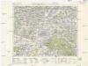
Königgrätz u. Umgebung
1 : 75000 Hradec Králové (Česko : oblast) Landesvermessungsamt Böhmen u. Mähren
Hradec Králové a okolí
1 : 75000 Hradec Králové (Česko : oblast) Vojenský zeměpisný ústav
III. vojenské mapování 3955
1 : 75000
Pardubice a okolí
1 : 75000 Pardubice (Česko : oblast) Vojenský zeměpisný ústav
Königgratz, Elbeteinitz und Pardubitz
1 : 75000 Hradec Králové (Česko : oblast) Fenzl K. u. k. militär-geographisches Institut
Königgratz, Elbeteinitz und Pardubitz
1 : 75000 Hradec Králové (Česko : oblast) Fenzl K. u. k. Militärgeographisches Institut


