Maps of Předhradí

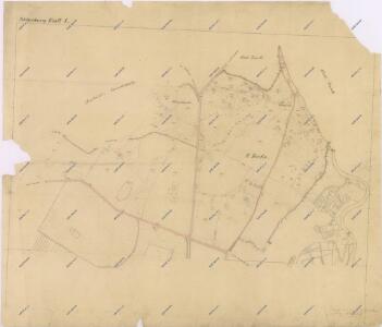
Mapa části panství Rychmburk Blatt I.
1 : 2880
Mapa vrchnostenského dvora Rychmburk a k němu náležejícím pozemkům
1 : 3512
Indikační skica mapy stabilního katastru pro obec Rychmburk a osady Lažany, Lešany a Dolívka
1 : 2880
Katastrální mapa pro obec Rychmburk
1 : 2880
Katastrální mapa pro obec Rychmburk
1 : 2880
Katastrální mapa pro obec Rychmburk
1 : 2880
Richenburg (Richunburk) - c6167-2-004 - Kaiserpflichtexemplar der Landkarten des stabilen Katasters
1 : 2880
Richenburg (Richunburk) - c6167-2-007 - Kaiserpflichtexemplar der Landkarten des stabilen Katasters
1 : 2880
Richenburg (Richunburk) - c6167-2-002 - Kaiserpflichtexemplar der Landkarten des stabilen Katasters
1 : 2880
Richenburg (Richunburk) - c6167-2-006 - Kaiserpflichtexemplar der Landkarten des stabilen Katasters
1 : 2880
Richenburg (Richunburk) - c6167-2-005 - Kaiserpflichtexemplar der Landkarten des stabilen Katasters
1 : 2880
Richenburg (Richunburk) - c6167-2-003 - Kaiserpflichtexemplar der Landkarten des stabilen Katasters
1 : 2880
Richenburg (Richunburk) - c6167-2-001 - Kaiserpflichtexemplar der Landkarten des stabilen Katasters
1 : 2880
Mapa vrchnostenského dvora Rychmburk a k němu náležejícím pozemkům
1 : 3448
Porostní mapa polesí Ochoz
1 : 10000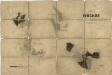
Porostní mapa polesí Ochoz
1 : 10000
Mapa města Skuteč
1 : 3625
Mapa vrchnostenského dvora Daletice a vsi Lešany
1 : 3853
Mapa rychmburské stráně
1 : 3000
Indikační skica mapy stabilního katastru pro obec Rychmburk a osady Lažany, Lešany a Dolívka
1 : 2880
Indikační skica mapy stabilního katastru pro obec Rychmburk a osady Lažany, Lešany a Dolívka
1 : 2880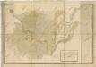
Mapa pozemků vrchnostenského dvora Daletice
1 : 3793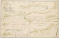
Mapa dominikálních pozemků v Hlubočicích, Dolech, Rabouni, Hněvěticích, Borku, Chlumu, Lhotě u Skutče a Štěpánově
1 : 3448
Gradkartenblatt
1 : 25000 Hlinsko-oblast (Chrudim, Česko) Hallada, Alois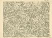
III. vojenské mapování 4056/3
1 : 25000

Mapa dominikální osady Pláňavy
1 : 2880
Vys. Mýto
1 : 75000 Vysoké Mýto (Česko : oblast) Vojenský zeměpisný ústav
Hohenmauth und Leitomischl
1 : 75000 Litomyšl (Česko : oblast) Storch K. u. k. Militärgeographisches Institut