Maps of okres České Budějovice

Hospodářská mapa polesí Zámecký 1
1 : 5760
Geometrický plán pozemků sedláků z Nové Hlíny u rybníka Rožmberk 1

Třeboň o. Jindřichův Hradec 1
1 : 2880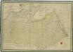
Geometrický plán měšťanských Mokrých luk mezi Zlatou a Mlýnskou stokou ohrožených vytápěním

Geometrický plán měšťanských Mokrých luk mezi Zlatou a Mlýnskou stokou ohrožených vytápěním

Mapy činžovních pozemků III. sekce třeboňského velkostatku pro obce: Branná, Břilice, Domanín, Herda, Holičky, Kojákovice, Spolí, Třeboň 1

Mapy činžovních pozemků III. sekce třeboňského velkostatku pro obce: Břilice, Domanín, Herda, Holičky, Kojákovice, Spolí, Třeboň 1
1 : 2880
Holičky o. Jindřichův Hradec 1
1 : 2880
Holičky o. Jindřichův Hradec 1
1 : 2880
Generální mapa panství Třeboň a inkorporovaných statků Bzí, Lomnice, Borovany, Třeboň, Hamr a Val 1

Altlahm - c7237-1-002 - Kaiserpflichtexemplar der Landkarten des stabilen Katasters
1 : 2880
Altlahm - c7237-1-006 - Kaiserpflichtexemplar der Landkarten des stabilen Katasters
1 : 2880
Altlahm - c7237-1-005 - Kaiserpflichtexemplar der Landkarten des stabilen Katasters
1 : 2880
Altlahm - c7237-1-003 - Kaiserpflichtexemplar der Landkarten des stabilen Katasters
1 : 2880
Altlahm - c7237-1-004 - Kaiserpflichtexemplar der Landkarten des stabilen Katasters
1 : 2880
Altlahm - c7237-1-007 - Kaiserpflichtexemplar der Landkarten des stabilen Katasters
1 : 2880
Altlahm - c7237-1-001 - Kaiserpflichtexemplar der Landkarten des stabilen Katasters
1 : 2880
Hollitzky - c1966-1-007 - Kaiserpflichtexemplar der Landkarten des stabilen Katasters
1 : 2880
Hollitzky - c1966-1-013 - Kaiserpflichtexemplar der Landkarten des stabilen Katasters
1 : 2880
Hollitzky - c1966-1-001 - Kaiserpflichtexemplar der Landkarten des stabilen Katasters
1 : 2880
Hollitzky - c1966-1-005 - Kaiserpflichtexemplar der Landkarten des stabilen Katasters
1 : 2880
Hollitzky - c1966-1-008 - Kaiserpflichtexemplar der Landkarten des stabilen Katasters
1 : 2880
Hollitzky - c1966-1-010 - Kaiserpflichtexemplar der Landkarten des stabilen Katasters
1 : 2880
Hollitzky - c1966-1-009 - Kaiserpflichtexemplar der Landkarten des stabilen Katasters
1 : 2880
Hollitzky - c1966-1-006 - Kaiserpflichtexemplar der Landkarten des stabilen Katasters
1 : 2880
Hollitzky - c1966-1-002 - Kaiserpflichtexemplar der Landkarten des stabilen Katasters
1 : 2880
Hollitzky - c1966-1-004 - Kaiserpflichtexemplar der Landkarten des stabilen Katasters
1 : 2880
Hollitzky - c1966-1-012 - Kaiserpflichtexemplar der Landkarten des stabilen Katasters
1 : 2880
Hollitzky - c1966-1-003 - Kaiserpflichtexemplar der Landkarten des stabilen Katasters
1 : 2880


