Maps of Lužnice
Lužnice o. Jindřichův Hradec 1
1 : 2880
Hospodářská mapa polesí Kolence 1
1 : 2880
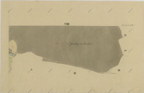
Projekt Podbřezského rybníka u Staré Hlíny 1

Hospodářská mapa polesí Kolence 1
1 : 2880
Luschnitz - c4338-1-007 - Kaiserpflichtexemplar der Landkarten des stabilen Katasters
1 : 2880
Luschnitz - c4338-1-005 - Kaiserpflichtexemplar der Landkarten des stabilen Katasters
1 : 2880
Luschnitz - c4338-1-001 - Kaiserpflichtexemplar der Landkarten des stabilen Katasters
1 : 2880
Luschnitz - c4338-1-006 - Kaiserpflichtexemplar der Landkarten des stabilen Katasters
1 : 2880
Luschnitz - c4338-1-002 - Kaiserpflichtexemplar der Landkarten des stabilen Katasters
1 : 2880
Luschnitz - c4338-1-003 - Kaiserpflichtexemplar der Landkarten des stabilen Katasters
1 : 2880
Luschnitz - c4338-1-004 - Kaiserpflichtexemplar der Landkarten des stabilen Katasters
1 : 2880
Hospodářská mapa polesí Mláka 1
1 : 2880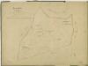
Hospodářská mapa polesí Mláka 1
1 : 2880
Porostní obrysová mapa polesí Kolence 1
1 : 10000
Generální mapa panství Třeboň a inkorporovaných statků Bzí, Lomnice, Borovany, Třeboň, Hamr a Val 1

Porostní mapa polesí Kolence 1
1 : 15000
Porostní mapa polesí Kolence 1
1 : 15000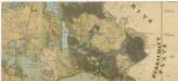
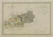
Administrativní mapa třeboňského panství se statky Bzí,Lomnice, Borovany,Hamr a Val 1
Situační plán statku Hamr-Val a přilehlých pozemků 1

III. vojenské mapování 4353/4
1 : 25000
[Gradkartenblatt]
1 : 25000 Třeboň-oblast (Česko)
Gradkartenblatt
1 : 25000 Třeboň-oblast (Česko) Gerstner, Eduard von

Mapa porostů hlavního komplexu Třeboňského polesí náležejících revírů Kolenec, Mláka, Zámecký revír, Sv. Barbora, Cep a Hrdlořez, pro exkursi České lesnické jednoty v roce 1909 1
1 : 30000
Mapa porostů hlavního komplexu Třeboňského polesí náležejících revírů Kolenec, Mláka, Zámecký revír, Sv. Barbora, Cep a Hrdlořez, pro exkursi České lesnické jednoty v roce 1909 1
1 : 30000
Podrobné mapy zemí Koruny české v měřítku 1:75.000 a mapa vzdáleností všech míst při silnici ležících - Jindř. Hradec - Třeboň - N. Bystřice. Průvodce statisticko-historický po všech místech na těchto mapách uvedených a rejstřík věcný názvů hor, potoků, řek, rybníků atd. Sešit 49. List 73,
1 : 75000
Situační plán vodní soustavy v jihozápadní části Třeboňské pánve

III. vojenské mapování 4353
1 : 75000
Wittingau und Moldauthein
1 : 75000 Týn nad Vltavou (Česko : oblast) Pflügl K. u. k. militär-geographisches Institut
Wittingau und Moldauthein
1 : 75000 Týn nad Vltavou (Česko : oblast) Pflügl K. u. k. Militärgeographisches Institut