Maps of Lužnice

Mapy činžovních pozemků II. sekce třeboňského velkostatku pro obce: Klec, Kolence, Lužnice, Mláka, Stará Hlína 1
1 : 2880
Lužnice o. Jindřichův Hradec 1
1 : 2880
Mapa pozemků dvora Lužnice 1
1 : 2880
Hospodářská mapa polesí Kolence 1
1 : 2880
Porostní obrysová mapa polesí Kolence 1
1 : 10000
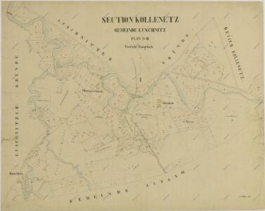
Luschnitz - c4338-1-007 - Kaiserpflichtexemplar der Landkarten des stabilen Katasters
1 : 2880
Luschnitz - c4338-1-005 - Kaiserpflichtexemplar der Landkarten des stabilen Katasters
1 : 2880
Luschnitz - c4338-1-001 - Kaiserpflichtexemplar der Landkarten des stabilen Katasters
1 : 2880
Luschnitz - c4338-1-006 - Kaiserpflichtexemplar der Landkarten des stabilen Katasters
1 : 2880
Luschnitz - c4338-1-002 - Kaiserpflichtexemplar der Landkarten des stabilen Katasters
1 : 2880
Luschnitz - c4338-1-003 - Kaiserpflichtexemplar der Landkarten des stabilen Katasters
1 : 2880
Luschnitz - c4338-1-004 - Kaiserpflichtexemplar der Landkarten des stabilen Katasters
1 : 2880
Altlahm - c7237-1-002 - Kaiserpflichtexemplar der Landkarten des stabilen Katasters
1 : 2880
Altlahm - c7237-1-006 - Kaiserpflichtexemplar der Landkarten des stabilen Katasters
1 : 2880
Altlahm - c7237-1-005 - Kaiserpflichtexemplar der Landkarten des stabilen Katasters
1 : 2880
Altlahm - c7237-1-003 - Kaiserpflichtexemplar der Landkarten des stabilen Katasters
1 : 2880
Altlahm - c7237-1-004 - Kaiserpflichtexemplar der Landkarten des stabilen Katasters
1 : 2880
Altlahm - c7237-1-007 - Kaiserpflichtexemplar der Landkarten des stabilen Katasters
1 : 2880
Altlahm - c7237-1-001 - Kaiserpflichtexemplar der Landkarten des stabilen Katasters
1 : 2880
Hospodářská mapa polesí Kolence 1
1 : 2880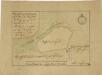
Geometrický plán pole rožmberského baštýře

Půdorysný plán a situace stavby nového jalového splavu a brlení na Rožmberském rybníku, zničených velkou povodní v r. 1804 1
Lužnice o. Jindřichův Hradec 1
1 : 2880
Generální mapa panství Třeboň a inkorporovaných statků Bzí, Lomnice, Borovany, Třeboň, Hamr a Val 1

Porostní mapa polesí Kolence 1
1 : 15000
Porostní mapa polesí Kolence 1
1 : 15000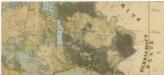
Administrativní mapa třeboňského panství se statky Bzí,Lomnice, Borovany,Hamr a Val 1

Přehledná mapa polesí Dvořiště 1