Maps of Myslín

Myslín se Stražištěm a Ohaří, okr. Písek, list 1 1

Soubor katastrálních map obcí ležících na území velkostatku orlického s přivtělenými statky, s vyznačením příslušné tratě státní dráhy (polohorysy tratí), list 15 list 15
1 : 2880
Geometrický nárys pozemků u dvora Myslína, sporných mezi panstvím Březnicí a poddanými orlickými z Myslína, list 3 1

Myslín se Stražištěm a Ohaří, okr. Písek, list 4 1

Soubor katastrálních map obcí ležících na území velkostatku orlického s přivtělenými statky, s vyznačením příslušné tratě státní dráhy (polohorysy tratí), list 17 list 17
1 : 2880
Mislin - c4916-1-005 - Kaiserpflichtexemplar der Landkarten des stabilen Katasters
1 : 2880
Mislin - c4916-1-003 - Kaiserpflichtexemplar der Landkarten des stabilen Katasters
1 : 2880
Mislin - c4916-1-004 - Kaiserpflichtexemplar der Landkarten des stabilen Katasters
1 : 2880
Mislin - c4916-1-002 - Kaiserpflichtexemplar der Landkarten des stabilen Katasters
1 : 2880
Mislin - c4916-1-001 - Kaiserpflichtexemplar der Landkarten des stabilen Katasters
1 : 2880
Mirowitz - c4705-1-001 - Kaiserpflichtexemplar der Landkarten des stabilen Katasters
1 : 2880
Mirowitz - c4705-1-004 - Kaiserpflichtexemplar der Landkarten des stabilen Katasters
1 : 2880
Mirowitz - c4705-1-002 - Kaiserpflichtexemplar der Landkarten des stabilen Katasters
1 : 2880
Mirowitz - c4705-1-003 - Kaiserpflichtexemplar der Landkarten des stabilen Katasters
1 : 2880
Plischkowitz - c5841-1-004 - Kaiserpflichtexemplar der Landkarten des stabilen Katasters
1 : 2880
Plischkowitz - c5841-1-003 - Kaiserpflichtexemplar der Landkarten des stabilen Katasters
1 : 2880
Plischkowitz - c5841-1-001 - Kaiserpflichtexemplar der Landkarten des stabilen Katasters
1 : 2880
Plischkowitz - c5841-1-002 - Kaiserpflichtexemplar der Landkarten des stabilen Katasters
1 : 2880
Podčap - c5863-1-002 - Kaiserpflichtexemplar der Landkarten des stabilen Katasters
1 : 2880
Podčap - c5863-1-001 - Kaiserpflichtexemplar der Landkarten des stabilen Katasters
1 : 2880
Podčap - c5863-1-004 - Kaiserpflichtexemplar der Landkarten des stabilen Katasters
1 : 2880
Podčap - c5863-1-003 - Kaiserpflichtexemplar der Landkarten des stabilen Katasters
1 : 2880
Bogeschitz - c0335-1-001 - Kaiserpflichtexemplar der Landkarten des stabilen Katasters
1 : 2880
Bogeschitz - c0335-1-002 - Kaiserpflichtexemplar der Landkarten des stabilen Katasters
1 : 2880
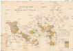
Přehledná mapa panství Orlíka a přivtělených statků Bukovan, Zalužan a Zbenic, list 11 1

Výřez z přehledné mapy velkostatku Orlíka z r. 1913 s vyznačením pozemků dvorů Horosedly, Lety, Mirovice a Nerestce 1
1 : 25000
Brzezy, Prach[iner] Kr[eis]
1 : 2880 Březnice (Příbram, Česko : oblast)
Přehledná mapa rybníků velkostatku Orlík, list 3 1
General-Mape der Herrschaft Březnic
1 : 34560 Březnice (Příbram, Česko : oblast)


