Maps of Myslín

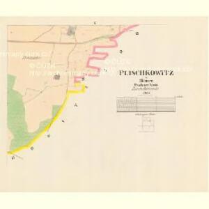
Plischkowitz - c5841-1-004 - Kaiserpflichtexemplar der Landkarten des stabilen Katasters
1 : 2880
Plischkowitz - c5841-1-003 - Kaiserpflichtexemplar der Landkarten des stabilen Katasters
1 : 2880
Plischkowitz - c5841-1-001 - Kaiserpflichtexemplar der Landkarten des stabilen Katasters
1 : 2880
Plischkowitz - c5841-1-002 - Kaiserpflichtexemplar der Landkarten des stabilen Katasters
1 : 2880
Soubor katastrálních map obcí ležících na území velkostatku orlického s přivtělenými statky, s vyznačením příslušné tratě státní dráhy (polohorysy tratí), list 17 list 17
1 : 2880
Mirowitz - c4705-1-001 - Kaiserpflichtexemplar der Landkarten des stabilen Katasters
1 : 2880
Mirowitz - c4705-1-004 - Kaiserpflichtexemplar der Landkarten des stabilen Katasters
1 : 2880
Mirowitz - c4705-1-002 - Kaiserpflichtexemplar der Landkarten des stabilen Katasters
1 : 2880
Mirowitz - c4705-1-003 - Kaiserpflichtexemplar der Landkarten des stabilen Katasters
1 : 2880
Myslín se Stražištěm a Ohaří, okr. Písek, list 1 1

Rastel - c6469-1-001 - Kaiserpflichtexemplar der Landkarten des stabilen Katasters
1 : 2880
Rastel - c6469-1-002 - Kaiserpflichtexemplar der Landkarten des stabilen Katasters
1 : 2880
Soubor katastrálních map obcí ležících na území velkostatku orlického s přivtělenými statky, s vyznačením příslušné tratě státní dráhy (polohorysy tratí), list 15 list 15
1 : 2880
Výřez z přehledné mapy velkostatku Orlíka z r. 1913 s vyznačením pozemků dvorů Horosedly, Lety, Mirovice a Nerestce 1
1 : 25000
Mislin - c4916-1-005 - Kaiserpflichtexemplar der Landkarten des stabilen Katasters
1 : 2880
Mislin - c4916-1-003 - Kaiserpflichtexemplar der Landkarten des stabilen Katasters
1 : 2880
Mislin - c4916-1-004 - Kaiserpflichtexemplar der Landkarten des stabilen Katasters
1 : 2880
Mislin - c4916-1-002 - Kaiserpflichtexemplar der Landkarten des stabilen Katasters
1 : 2880
Mislin - c4916-1-001 - Kaiserpflichtexemplar der Landkarten des stabilen Katasters
1 : 2880
Podčap - c5863-1-002 - Kaiserpflichtexemplar der Landkarten des stabilen Katasters
1 : 2880
Podčap - c5863-1-001 - Kaiserpflichtexemplar der Landkarten des stabilen Katasters
1 : 2880
Podčap - c5863-1-004 - Kaiserpflichtexemplar der Landkarten des stabilen Katasters
1 : 2880
Podčap - c5863-1-003 - Kaiserpflichtexemplar der Landkarten des stabilen Katasters
1 : 2880
Geometrický nárys pozemků u dvora Myslína, sporných mezi panstvím Březnicí a poddanými orlickými z Myslína, list 3 1

Mischowitz - c4725-1-003 - Kaiserpflichtexemplar der Landkarten des stabilen Katasters
1 : 2880
Mischowitz - c4725-1-004 - Kaiserpflichtexemplar der Landkarten des stabilen Katasters
1 : 2880
Mischowitz - c4725-1-002 - Kaiserpflichtexemplar der Landkarten des stabilen Katasters
1 : 2880
Mischowitz - c4725-1-005 - Kaiserpflichtexemplar der Landkarten des stabilen Katasters
1 : 2880
Mischowitz - c4725-1-001 - Kaiserpflichtexemplar der Landkarten des stabilen Katasters
1 : 2880