Maps of Mirovice

Přehledná mapa rybníků velkostatku Orlík, list 3 1

Brzezy, Prach[iner] Kr[eis]
1 : 2880 Březnice (Příbram, Česko : oblast)
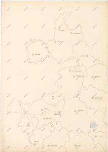
Přehledná mapa pozemkové držby velkostatku orlického v širším pojetí, podle stavu z roku 1916, list 3 1
1 : 25000
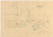
Výřez z přehledné mapy velkostatku Orlíka z r. 1913 s vyznačením pozemků dvorů Horosedly, Lety, Mirovice a Nerestce 1
1 : 25000
Mislin - c4916-1-005 - Kaiserpflichtexemplar der Landkarten des stabilen Katasters
1 : 2880
Mislin - c4916-1-003 - Kaiserpflichtexemplar der Landkarten des stabilen Katasters
1 : 2880
Mislin - c4916-1-004 - Kaiserpflichtexemplar der Landkarten des stabilen Katasters
1 : 2880
Mislin - c4916-1-002 - Kaiserpflichtexemplar der Landkarten des stabilen Katasters
1 : 2880
Mislin - c4916-1-001 - Kaiserpflichtexemplar der Landkarten des stabilen Katasters
1 : 2880
Tiecharowitz - c7873-1-003 - Kaiserpflichtexemplar der Landkarten des stabilen Katasters
1 : 2880
Tiecharowitz - c7873-1-004 - Kaiserpflichtexemplar der Landkarten des stabilen Katasters
1 : 2880
Tiecharowitz - c7873-1-006 - Kaiserpflichtexemplar der Landkarten des stabilen Katasters
1 : 2880
Tiecharowitz - c7873-1-002 - Kaiserpflichtexemplar der Landkarten des stabilen Katasters
1 : 2880
Tiecharowitz - c7873-1-005 - Kaiserpflichtexemplar der Landkarten des stabilen Katasters
1 : 2880
Tiecharowitz - c7873-1-001 - Kaiserpflichtexemplar der Landkarten des stabilen Katasters
1 : 2880
Gross Chraschtitz - c2647-1-005 - Kaiserpflichtexemplar der Landkarten des stabilen Katasters
1 : 2880
Gross Chraschtitz - c2647-1-004 - Kaiserpflichtexemplar der Landkarten des stabilen Katasters
1 : 2880
Gross Chraschtitz - c2647-1-001 - Kaiserpflichtexemplar der Landkarten des stabilen Katasters
1 : 2880
Gross Chraschtitz - c2647-1-003 - Kaiserpflichtexemplar der Landkarten des stabilen Katasters
1 : 2880
Gross Chraschtitz - c2647-1-002 - Kaiserpflichtexemplar der Landkarten des stabilen Katasters
1 : 2880
Zalužan - c9120-1-002 - Kaiserpflichtexemplar der Landkarten des stabilen Katasters
1 : 2880
Zalužan - c9120-1-003 - Kaiserpflichtexemplar der Landkarten des stabilen Katasters
1 : 2880
Zalužan - c9120-1-001 - Kaiserpflichtexemplar der Landkarten des stabilen Katasters
1 : 2880
Zalužan - c9120-1-005 - Kaiserpflichtexemplar der Landkarten des stabilen Katasters
1 : 2880
Zalužan - c9120-1-004 - Kaiserpflichtexemplar der Landkarten des stabilen Katasters
1 : 2880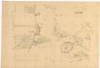
Mapa dvora Zalužany, list 2 1
1 : 1440
Mapa dvora Zalužany 1
Mapa dvora Zalužany 1
1 : 5760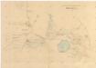
Mapa dvora Zalužany 1
1 : 5760