Maps of Obora
Katastrální mapa obce Obora
1 : 2880
Katastrální mapa obce Branka WC-XVI-19 bh
1 : 2880
Záměrná mapa parcel obce Horní Výšina
1 : 2880
Galtenhof - c0469-2-002 - Kaiserpflichtexemplar der Landkarten des stabilen Katasters
1 : 2880
Galtenhof - c0469-2-004 - Kaiserpflichtexemplar der Landkarten des stabilen Katasters
1 : 2880
Galtenhof - c0469-2-005 - Kaiserpflichtexemplar der Landkarten des stabilen Katasters
1 : 2880
Galtenhof - c0469-2-001 - Kaiserpflichtexemplar der Landkarten des stabilen Katasters
1 : 2880
Galtenhof - c0469-2-003 - Kaiserpflichtexemplar der Landkarten des stabilen Katasters
1 : 2880
Mapa vrchnostenských pozemků u obce Jalový Dvůr (Branka)
1 : 2784
Porostní mapa revíru Obora
1 : 11520
Tiergarten - c5353-1-001 - Kaiserpflichtexemplar der Landkarten des stabilen Katasters
1 : 2880
Tiergarten - c5353-1-006 - Kaiserpflichtexemplar der Landkarten des stabilen Katasters
1 : 2880
Tiergarten - c5353-1-004 - Kaiserpflichtexemplar der Landkarten des stabilen Katasters
1 : 2880
Tiergarten - c5353-1-005 - Kaiserpflichtexemplar der Landkarten des stabilen Katasters
1 : 2880
Tiergarten - c5353-1-002 - Kaiserpflichtexemplar der Landkarten des stabilen Katasters
1 : 2880
Tiergarten - c5353-1-003 - Kaiserpflichtexemplar der Landkarten des stabilen Katasters
1 : 2880
Katastrální mapa obce Pavlův Studenec WC-XVII-20 ah
1 : 2880
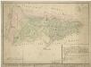
Porostní mapa revíru Jalový Dvůr (Branka)
1 : 11520
Porostní mapa revíru Jalový Dvůr (Branka)
1 : 11520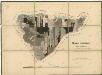
Porostní mapa revíru Jalový Dvůr (Branka)
1 : 11523
Porostní mapa revíru Jalový Dvůr (Branka)
1 : 11520
Porostní mapa revíru Jalový Dvůr (Branka) a Horní Výšina
1 : 11520
Porostní mapa revíru Obora
1 : 11671
Porostní mapa revíru Obora
1 : 11520
Porostní mapa revíru Jalový Dvůr (Branka) a Horní Výšina
1 : 11520
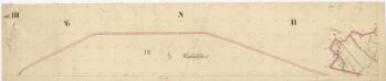
Mapa česko-bavorské hranice v prostoru sporného území mezi panstvím Tachov a bavorským městem Bärnau
1 : 12842
Přehledová mapa velkostatku Tachov
1 : 17280
Hospodářská lesní mapa panství Tachov - část Obora
Mapa česko-bavorské hranice v prostoru sporného území mezi panstvím Tachov a bavorským soudním okresem Bärnau
1 : 12842


