Maps of Zavlekov

Katastrální mapa obce Plichtice
1 : 2880
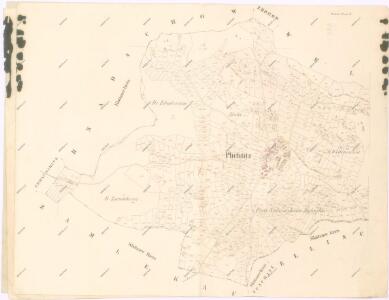
Plichtitz - c5839-1-002 - Kaiserpflichtexemplar der Landkarten des stabilen Katasters
1 : 2880
Plichtitz - c5839-1-001 - Kaiserpflichtexemplar der Landkarten des stabilen Katasters
1 : 2880
Hnadschow (Hnadczow) - c1902-1-001 - Kaiserpflichtexemplar der Landkarten des stabilen Katasters
1 : 2880
Hnadschow (Hnadczow) - c1902-1-002 - Kaiserpflichtexemplar der Landkarten des stabilen Katasters
1 : 2880
Hnadschow (Hnadczow) - c1902-1-003 - Kaiserpflichtexemplar der Landkarten des stabilen Katasters
1 : 2880
Zamlekau - c9165-1-001 - Kaiserpflichtexemplar der Landkarten des stabilen Katasters
1 : 2880
Zamlekau - c9165-1-002 - Kaiserpflichtexemplar der Landkarten des stabilen Katasters
1 : 2880
Zamlekau - c9165-1-003 - Kaiserpflichtexemplar der Landkarten des stabilen Katasters
1 : 2880
Zamlekau - c9165-1-004 - Kaiserpflichtexemplar der Landkarten des stabilen Katasters
1 : 2880
Skrantschitz - c6954-1-002 - Kaiserpflichtexemplar der Landkarten des stabilen Katasters
1 : 2880
Skrantschitz - c6954-1-001 - Kaiserpflichtexemplar der Landkarten des stabilen Katasters
1 : 2880
III. vojenské mapování 4251/3
1 : 25000
Gradkartenblatt
1 : 25000 Nalžovské Hory-oblast (Česko) Albrecht, Julius
III. vojenské mapování 4251/3
1 : 25000
Soubor přehledných map pro plánování a statistiku: 4251 – Horažďovice

Podrobné mapy zemí Koruny české v měřítku 1:75.000 a mapa vzdáleností všech míst při silnici ležících - Klatovy - Nýrsko - Sušice. Průvodce statisticko-historický po všech místech na těchto mapách uvedených a rejstřík věcný názvů hor, potoků, řek, rybníků atd. Sešit 32. List 23,
1 : 75000
Podrobné mapy zemí Koruny české v měřítku 1:75.000 a mapy vzdáleností všech míst při silnici ležících
1 : 75000 Klatovy (Česko : oblast) Bělohlav, Josef F. Topič
Nepomuk und Horaždiowitz
1 : 75000 Horažďovice (Česko : oblast) Schill K. u. k. militär-geographisches Institut
Nepomuk und Horaždiowitz
1 : 75000 Horažďovice (Česko : oblast) K. u. k. Militärgeographisches Institut
Horažďovice
1 : 75000 Horažďovice-oblast (Česko) Vojenský zeměpisný ústav
Horažďovice
1 : 75000 Horažďovice (Česko : oblast) Vojenský zeměpisný ústav
Horažďovice
1 : 75000 Horažďovice (Česko : oblast) Vojenský zeměpisný ústav
III. vojenské mapování 4251
1 : 75000
Hospodářská mapa revíru Záluží
1 : 2880
Podrobná mapa Království českého
1 : 100000 Klatovy (Česko : oblast) Srp, Jan Jaroslav Bursík
Podrobná místopisná mapa Království Českého
Příruční mapa Československé republiky

Okresní hejtmanství Klatovské
1 : 100000 Klatovy-oblast (Česko) Srp, Jan Jos. R. Vilímek