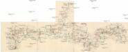
Maps of Stráž
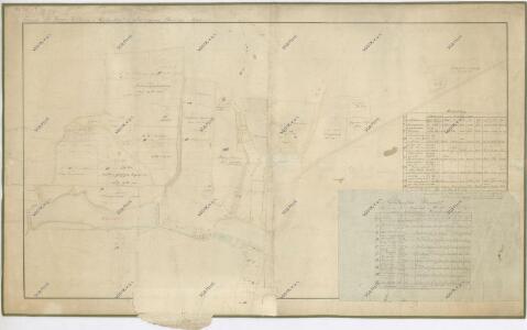
Mapa pozemků dvora Souměř
1 : 2895
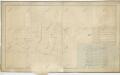
Zummern - c7150-1-001 - Kaiserpflichtexemplar der Landkarten des stabilen Katasters
1 : 2880
Zummern - c7150-1-002 - Kaiserpflichtexemplar der Landkarten des stabilen Katasters
1 : 2880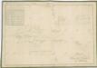
Mapa pozemků dvora Souměř
1 : 2217
Neustadtl (Nowimesto) - c7399-1-002 - Kaiserpflichtexemplar der Landkarten des stabilen Katasters
1 : 2880
Neustadtl (Nowimesto) - c7399-1-006 - Kaiserpflichtexemplar der Landkarten des stabilen Katasters
1 : 2880
Neustadtl (Nowimesto) - c7399-1-004 - Kaiserpflichtexemplar der Landkarten des stabilen Katasters
1 : 2880
Neustadtl (Nowimesto) - c7399-1-007 - Kaiserpflichtexemplar der Landkarten des stabilen Katasters
1 : 2880
Neustadtl (Nowimesto) - c7399-1-008 - Kaiserpflichtexemplar der Landkarten des stabilen Katasters
1 : 2880
Neustadtl (Nowimesto) - c7399-1-005 - Kaiserpflichtexemplar der Landkarten des stabilen Katasters
1 : 2880
Neustadtl (Nowimesto) - c7399-1-003 - Kaiserpflichtexemplar der Landkarten des stabilen Katasters
1 : 2880
Neustadtl (Nowimesto) - c7399-1-001 - Kaiserpflichtexemplar der Landkarten des stabilen Katasters
1 : 2880
Přehledná mapa vrchnostenských pozemků v katastru města Bor
1 : 8640
Přehledná porostní mapa borských lesů k lesní prohlídce konané lesnickým spolkem
1 : 10000
III. vojenské mapování 4149/2
1 : 25000
Gradkartenblatt
1 : 25000 Přimda-oblast (Česko) Bulla, Eduard
[Kartenblatt]
1 : 25000 Bor (Tachov, Česko : oblast) Reichsamt für Landesaufnahme

Uibersichtskarte der Herrschaft Tachau
Tachov-oblast (Česko) Waraus, E. André Verlag des böhm. Forstvereins
Hayder Vicariat
Bor-oblast (Tachov, Česko)
Pfraumberg
1 : 75000 Poběžovice (Domažlice, Česko : oblast) Kimlein K. u. k. militär-geographisches Institut
Pfraumberg
1 : 75000 Poběžovice (Domažlice, Česko : oblast) Kimlein K. u. k. Militärgeographisches Institut
Pfraumberg
1 : 75000 Přimda-oblast (Česko) K. u. k. Militärgeographisches Institut
Přehledová mapa velkostatku Tachov
1 : 17280
Stříbro a okolí
1 : 75000 Stříbro (Česko : oblast) Vojenský zeměpisný ústav
III. vojenské mapování 4149
1 : 75000
Politický okres Tachov
1 : 75000 Tachov (Česko : okres : 1960-) Vojenský zeměpisný ústav
Politický okres Tachov

Podrobná mapa Království českého
1 : 100000 Planá (Tachov, Česko : oblast) Srp, Jan Jaroslav Bursík