Maps of Planá

Plán pozemků dvora Catlov
1 : 14500
Katastrální mapa obce Výškov
1 : 2880
Hospodářská mapa revíru Michalovy Hory-Catlov-Otín
1 : 8640
Hospodářská mapa revíru Caltov
1 : 8640
Kiesenrieth - c3667-1-003 - Kaiserpflichtexemplar der Landkarten des stabilen Katasters
1 : 2880
Kiesenrieth - c3667-1-001 - Kaiserpflichtexemplar der Landkarten des stabilen Katasters
1 : 2880
Kiesenrieth - c3667-1-002 - Kaiserpflichtexemplar der Landkarten des stabilen Katasters
1 : 2880
Kiesenrieth - c3667-1-004 - Kaiserpflichtexemplar der Landkarten des stabilen Katasters
1 : 2880
Katastrální mapa obce Otín
1 : 2880
Hohenjamny - c8958-1-002 - Kaiserpflichtexemplar der Landkarten des stabilen Katasters
1 : 2880
Hohenjamny - c8958-1-004 - Kaiserpflichtexemplar der Landkarten des stabilen Katasters
1 : 2880
Hohenjamny - c8958-1-001 - Kaiserpflichtexemplar der Landkarten des stabilen Katasters
1 : 2880
Hohenjamny - c8958-1-003 - Kaiserpflichtexemplar der Landkarten des stabilen Katasters
1 : 2880
Hetschigau - c2243-1-004 - Kaiserpflichtexemplar der Landkarten des stabilen Katasters
1 : 2880
Hetschigau - c2243-1-001 - Kaiserpflichtexemplar der Landkarten des stabilen Katasters
1 : 2880
Hetschigau - c2243-1-005 - Kaiserpflichtexemplar der Landkarten des stabilen Katasters
1 : 2880
Hetschigau - c2243-1-003 - Kaiserpflichtexemplar der Landkarten des stabilen Katasters
1 : 2880
Hetschigau - c2243-1-002 - Kaiserpflichtexemplar der Landkarten des stabilen Katasters
1 : 2880
Ottenreuth - c5588-1-003 - Kaiserpflichtexemplar der Landkarten des stabilen Katasters
1 : 2880
Ottenreuth - c5588-1-001 - Kaiserpflichtexemplar der Landkarten des stabilen Katasters
1 : 2880
Ottenreuth - c5588-1-002 - Kaiserpflichtexemplar der Landkarten des stabilen Katasters
1 : 2880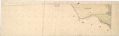
Katastrální mapa obce Kříženec
1 : 2880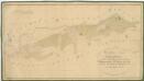
Hospodářská mapa revíru Michalovy Hory
1 : 4350
Přehledná mapa panství Planá
1 : 25000
Hospodářská mapa revíru Kočov
1 : 4350
Rundansicht von dem Basaltberge Podhorn (2634 Wien. Fuss) auf der Herrschaft Tepl bei Marienbad
Mariánské Lázně-oblast (Česko) Frey, Paul
Rundansicht von dem Basaltberge Podhorn (833 Meter) auf der Herrschaft Tepl bei Marienbad
Mariánské Lázně-oblast (Česko) F.A. Götz
Umgebungskarte der Curstadt Marienbad
1 : 60000 Mariánské Lázně-oblast (Česko) E.A. Götz
Umgebungskarte der Kurstadt Marienbad
1 : 50000 Mariánské Lázně-oblast (Česko) E.A. Götz


