Maps of Zahořany

Hospodářská mapa revíru Stanětice
1 : 6084
Hospodářská mapa revíru Stanětice
1 : 5835
Opprechtitz (Opprechticz) - c5505-1-002 - Kaiserpflichtexemplar der Landkarten des stabilen Katasters
1 : 2880
Opprechtitz (Opprechticz) - c5505-1-001 - Kaiserpflichtexemplar der Landkarten des stabilen Katasters
1 : 2880
Opprechtitz (Opprechticz) - c5505-1-003 - Kaiserpflichtexemplar der Landkarten des stabilen Katasters
1 : 2880
Zahorzan - c9051-1-003 - Kaiserpflichtexemplar der Landkarten des stabilen Katasters
1 : 2880
Zahorzan - c9051-1-004 - Kaiserpflichtexemplar der Landkarten des stabilen Katasters
1 : 2880
Zahorzan - c9051-1-001 - Kaiserpflichtexemplar der Landkarten des stabilen Katasters
1 : 2880
Zahorzan - c9051-1-002 - Kaiserpflichtexemplar der Landkarten des stabilen Katasters
1 : 2880
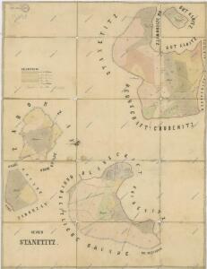
Stannetitz (Stanietice) - c7221-1-001 - Kaiserpflichtexemplar der Landkarten des stabilen Katasters
1 : 2880
Stannetitz (Stanietice) - c7221-1-002 - Kaiserpflichtexemplar der Landkarten des stabilen Katasters
1 : 2880
Stannetitz (Stanietice) - c7221-1-003 - Kaiserpflichtexemplar der Landkarten des stabilen Katasters
1 : 2880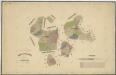
Hospodářská mapa revíru Stanětice
1 : 5747
Katastrální mapa obcí Kout a Podzámčí, Nový a Starý Dvůr
1 : 2880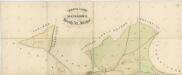
Mapa pozemků dvorů Kout, Starý dvůr a Nový Dvůr
1 : 2941
Mapa pozemků Nového a Starého Dvora
1 : 5760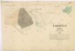
Katastrální mapa obce Zahořany
1 : 2880
Katastrální mapa obce Zahořany
1 : 2880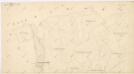
Katastrální mapa obce Zahořany
1 : 2880
Aulikau (Aulikow) - c8244-1-001 - Kaiserpflichtexemplar der Landkarten des stabilen Katasters
1 : 2880
Klattauer Kreis, Herrschaft Kauth
1 : 500 Klatovy-oblast (Česko) Stole, Anton
Grundlage des im Herrenstein befindlichen und verfallenen Ritterschloßes, nur jene noch befindliche Bestand-theile der Mauerwerken
1 : 633 Kdyně-oblast (Česko) Stalle, Anton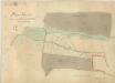
Plán pastvin u Podzámčí
1 : 2914
Katastrální mapa obce Spáňov
1 : 2880
Mapa pozemků dvorů Kout a Starý Dvůr
1 : 5760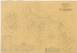
Porostní mapa revíru Podzámčí
1 : 11520
Situační plán Nového a Starého Dvora
1 : 11520
Situační plán dvorů Kout, Starý a Nový Dvůr
1 : 7480
Přehledná mapa luk panství Kout
1 : 11257