Maps of Spáňov

Mapa pozemků Nového a Starého Dvora
1 : 5760
Mapa pozemků dvorů Kout, Starý dvůr a Nový Dvůr
1 : 2941
Situační plán nových vodních nádrží v Koutě na Starém potoce
1 : 2880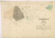
Katastrální mapa obce Zahořany
1 : 2880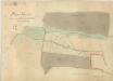
Plán pastvin u Podzámčí
1 : 2914
Katastrální mapa obce Spáňov
1 : 2880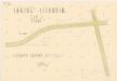
Drenáž
1 : 500
Výsek katastrální mapy obce Kout
1 : 2880
Mapa pozemků dvorů Kout a Starý Dvůr
1 : 5760
Přehledná mapa luk panství Kout
1 : 11257
Situační plán dvorů Kout, Starý a Nový Dvůr
1 : 7480
Plán panských pozemků dvora Starý Dvůr
1 : 6250
Mapa pozemků dvora Kout
1 : 2880
Katastrální mapa obcí Kout a Podzámčí, Nový a Starý Dvůr
1 : 2880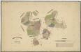
Hospodářská mapa revíru Stanětice
1 : 5747
Katastrální mapa obcí Kout a Podzámčí, Nový a Starý Dvůr
1 : 2880
Katastrální mapa obcí Kout a Podzámčí, Nový a Starý Dvůr
1 : 2880
Hospodářská mapa revíru Podzámčí
1 : 5760
Situační plán Nového a Starého Dvora
1 : 11520
Kauth (Kauto) - c3429-1-006 - Kaiserpflichtexemplar der Landkarten des stabilen Katasters
1 : 2880
Kauth (Kauto) - c3429-1-002 - Kaiserpflichtexemplar der Landkarten des stabilen Katasters
1 : 2880
Kauth (Kauto) - c3429-1-004 - Kaiserpflichtexemplar der Landkarten des stabilen Katasters
1 : 2880
Kauth (Kauto) - c3429-1-003 - Kaiserpflichtexemplar der Landkarten des stabilen Katasters
1 : 2880
Kauth (Kauto) - c3429-1-008 - Kaiserpflichtexemplar der Landkarten des stabilen Katasters
1 : 2880
Kauth (Kauto) - c3429-1-005 - Kaiserpflichtexemplar der Landkarten des stabilen Katasters
1 : 2880
Kauth (Kauto) - c3429-1-007 - Kaiserpflichtexemplar der Landkarten des stabilen Katasters
1 : 2880
Kauth (Kauto) - c3429-1-001 - Kaiserpflichtexemplar der Landkarten des stabilen Katasters
1 : 2880
Hospodářská mapa revíru Stanětice
1 : 5835
Hospodářská mapa revíru Stanětice
1 : 6084