Maps of Jerzmanki

Meßtischblatt 4856 : Lichtenberg, 1940
1 : 250000 Lichtenberg. - Aufn. 1886, hrsg. 1888, bericht. 1937. - 1:25000. - [Berlin]: Reichsamt für Landesaufnahme, 1940. - 1 Kt.
Meßtischblatt 2816 : Lichtenberg, 1937
1 : 250000 Lichtenberg. - Hrsg. 1888, bericht. 1911, einz. Nachtr. 1929, gedr. [19]37. - 1:25000. - [Berlin]: Reichsamt für Landesaufnahme, 1937. - 1 Kt.
Combat de Moys, dans la Haute Lusace, gagné par les troupes impériales, aux ordres du duc d'Aremberg et du général de Nadasti, sur un corps détaché des Prussiens, commandé par le lieutenant général de Winterfeld, le 7. septembre, 1757
1 : 19500 Görlitz (Německo)
Combat de Moys, dans la Haute Lusace, gagné par les troupes impériales, aux ordres du duc d'Aremberg et du général de Nadasti, sur un corps détaché des Prussiens, commandé par le lieutenant général de Winterfeld, le 7. septembre, 1757
1 : 19500 Görlitz (Německo)
Plan der bey Görlitz in Sachsen auf dem Holtzberg den 7. September 1757 gegen das Preussische Winterfeldische Corpo Erhaltenen Glücklichen Victorie
1 : 20000 Mollova mapová sbírka Mansfeld, Johann Ernst Trattner, Johann Thomas von
Die Statt Görlitz
Mollova mapová sbírka Merian, Matthaeus Merian, Matthäus
Tschernhausen und Preuss. Cörlitz [sic]
1 : 75000 Görlitz-oblast (Německo) K. u. k. Militärgeographisches Institut
III. vojenské mapování 3554
1 : 75000
[Kartenblatt]
1 : 25000 Dolní Oldřiš (Bulovka, Liberec, Česko) Reichsamt für Landesaufnahme
[Kartenblatt]
1 : 25000 Frýdlantský výběžek (Česko) Reichsamt für Landesaufnahme
Plan de la Position du corps de S. [...] monsigneur le Prince de Durlach
1 : 30000 Sulików (Polsko)
Tschernhausen und Preuss. Corlitz.
from Spezialkarte der osterreichisch-ungarischen Monarchie.
149 Zittau, uit: Topographische Special-Karte von Deutschland (von Central-Europa) / begründet von D.G. Reymann ; [entworfen und gezeichn. von Heinrich Berghaus... [et al.]]
1 : 200000 Annotatie: Lit.: Daniel Gottlob Reymann und die "Topographische Special-Karte von Deutschland" / von Wolfgang Scharfe, in: Kartographische Nachrichten, 39 (1989), Heft I, p. 1-10; Handgeschreven titel: Reymann's Deutschland : 24 Sectionen: Jena, Penig, Dresden, Zittau, Hirschberg, Breslau, Brieg, Andernach, Coblenz, Giessen, Fulda, Schleusingen, Plauen, Zwickau, Teplitz, Jung Bunzlau, Hohenelbe, Glatz, Neisse, Simmern, Prag, Luxemburg, Birkenfeld; Aanwezig: 23 bladen Reymann, Daniel Gottlob; Berghaus, Heinrich [Berlin : 2. Departement des Kriegsministeriums, Bureau für Plan- und Kartenzeichnung]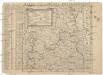
Mappa vicariatus Fridlandensis
Frýdlant-oblast (Česko) Kreibich, František Jakub Jindřich
117. Görlitz, uit: Topographische Uebersichtskarte des Deutschen Reiches / herausgegeben v. d. Kartogr. Abt. d. Königl. Preuß. Landesaufnahme
1 : 200000 titelvariant: Topogr. Übersichtskarte des Deutschen Reiches; Annotatie: Titel boven bladen ook: Topogr. Übersichtskarte des Deutschen Reiches; Annotatie geografische gegevens: Op elk blad twee maatstokken: 10 Kilometer = 5,5 cm; 1 geogr. Meile = 3,6 cm; Legenda onder op elk blad Königlich Preußische Landesaufnahme. Kartographische Abtheilung [S.l : Königlich Preußische Landesaufnahme, Kartographische Abtheilung]
Wegekarte vom Riesen- und Iser-Gebirge
1 : 150000 Jizerské hory-oblast (Česko a Polsko) Straube, Julius Geograph. Inst. u. Landkarten-Verlag v. Jul. Straube
Geographische Verzeichnung des GOERLIZER CREISES mit dem QVEISS-CREISE welches zusammen ist der Ostliche Theil von dem Marggrafthum OBER LAVSITZ
1 : 180000 Görlitz (Německo) vom Homaennischen Erben
Geographische Verzeichnung des Goerlizer Creises mit dem Qveiss-Creise
1 : 176200 Görlitz (Německo) Homaennischen Erben
Geographische Verzeichnung des Goerlizer Creises mit dem Qveiss-Creise welches zusammen ist der Ostliche Theil von dem Marggrafthum Ober Lavsiz
1 : 180000 Mollova mapová sbírka Homann, Johann Baptist Homann, Johann Baptista - dědici
Generální mapa Protektorátu Čechy a Morava
Princip. Silesiae Iavoriensis in IV. Circulos, Iaver, Hirschberg, Lemberg und Bvmtzlav divisi ac.
1 : 150000 Mollova mapová sbírka Wieland, Johann Wolfgang Homann, Johann Baptista - dědici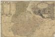
Principatvs Silesiae Iavoricensis in 4 circulos, Iaver, Hirschberg, Lemberg und Bvntzlav divisi
1 : 150000 Bolesławiec (Polsko) Wieland, Johann Wolfgang Schubarth, Matthäus Homannianos Heredes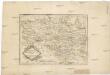
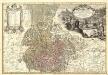
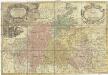
Die Markgrafschaft Oberlausitz in ihre Kreise eingetheilt.
1 : 363000 Horní Lužice (Německo) Hübner, Johann Homann, Johann Baptist
DVCATVS | SILESIÆ | IAVRANI | DELINEATIO
Auctore Friderico Kuhnovio | Bolcol. Siles. Exc. I. Blaeuw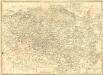
La Haute Lusace
1 : 180000 Mollova mapová sbírka Le Rouge, Georges-Louis Le Rouge, Georges-Louis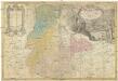
PRINCIP. SILESIAE IAVORIENSIS in IV. CIRCULOS, IAVER, HIRSCHBERG, LEMBERG und BVNTZLAV DIVISI
1 : 150000 Jelení Hora-oblast (Polsko) Wieland, Johann Wolfgang Schubarth, Matthaeus ab Hered. Homannianis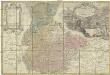
Princip. Silesiae Iavoriensis in IV. circulos, Iaver, Hirschberg, Lemberg und Bvntzlau divisi ac a I. W. Wieland
1 : 150000 Jawor (Polsko) Schubart, Mathaeum Hered. Homannianis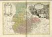
Principatvs Silesiae Schwidnicensis
1 : 128000 Svídnice-oblast (Polsko) Wieland, Johann Wolfgang Schubarth, Matthäus Hered. Homannianis
Ober Lausitz entworffen, und in Kupffer gestochen
1 : 230000 Mollova mapová sbírka Schreiber, Johann Georg Schreiber, Johann Georg
Lusatia Superior
1 : 260000 Mollova mapová sbírka Scultetus, Bartholomaeus Janssonius Van Waesberge, Johannes II
Lusatia Superior
1 : 260000 Mollova mapová sbírka Scultetus, Bartholomaeus Schenk, Peter I


