Maps of powiat zgorzelecki

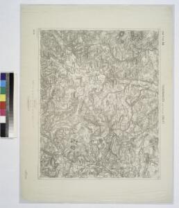
Tschernhausen und Preuss. Corlitz.
from Spezialkarte der osterreichisch-ungarischen Monarchie.
III. vojenské mapování 3554
1 : 75000
Tschernhausen und Preuss. Cörlitz [sic]
1 : 75000 Görlitz-oblast (Německo) K. u. k. Militärgeographisches Institut
Podrobná mapa Království českého
1 : 100000 Frýdlant (Česko : oblast) Srp, Jan Jos. R. Vilímek
Vilímkovy místopisné mapy zemí Koruny české
1 : 100000 Frýdlant (Česko : oblast) Srp, Jan Jos. R. Vilímek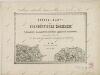
II. vojenské mapování 1
1 : 144000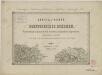
II. vojenské mapování 1
1 : 144000

[Kartenblatt]
1 : 25000 Frýdlantský výběžek (Česko) Reichsamt für Landesaufnahme
[Kartenblatt]
1 : 25000 Dolní Oldřiš (Bulovka, Liberec, Česko) Reichsamt für Landesaufnahme

III. vojenské mapování 3654/2, 3554/4
1 : 25000
III. vojenské mapování 3654/2, 3554/4
1 : 25000
III. vojenské mapování 3654/2
1 : 25000
[Kartenblatt]
1 : 25000 Hejnice-oblast (Liberec, Česko) Reichsamt für Landesaufnahme
III. vojenské mapování 3654/1
1 : 25000
III. vojenské mapování 3654/2
1 : 25000
[Gradkartenblatt]
1 : 25000 Frýdlant-oblast (Česko) Vojenský zeměpisný ústav
[Kartenblatt]
1 : 25000 Frýdlant (Česko : oblast) Reichsamt für Landesaufnahme
Meßtischblatt 4957 : Marklissa, 1940
1 : 250000 Marklissa. - Aufn. 1886, hrsg. 1888, bericht. 1937. - 1:25000. - [Berlin]: Reichsamt für Landesaufnahme, 1940. - 1 Kt.
Meßtischblatt 2881 : Marklissa, 1888
1 : 250000 Marklissa. - Aufn. 1886. - 1:25000. - [Berlin]: Königl. Preuss. Landesaufnahme, 1888. - 1 Kt.
Meßtischblatt 4956 : Seidenberg, 1939
1 : 250000 Seidenberg. - Aufgen. sächs. Teil 1902, preuß. Teil 1886, hrsg. sächs. Teil 1906, preuß. Teil 1888, bericht. 1930, einz, Nachtr. 1936, Umdruckausg.. - 1:25000. - Leipzig, 1939. - 1 Kt.
Meßtischblatt 74 (2880) : Seidenberg, 1934
1 : 250000 Seidenberg. - Umdr.-Ausg., aufgen. sächs. Teil 1902, preuß. Te. - 1:25000. - Leipzig, 1934. - 1 Kt.
Meßtischblatt 74.(2880) : Trattlau (Sächs.) - Seidenberg (Preuß.), 1922
1 : 250000 Trattlau (Sächs.) - Seidenberg (Preuß.). - Aufgen. 1902, hrsg. 1915, einz. Nachtr. 1922. - 1:25000. - Leipzig, 1922. - 1 Kt.
Meßtischblatt 74.(2880) : Trattlau (Sächs.) - Seidenberg (Preuß.), 1915
1 : 250000 Trattlau (Sächs.) - Seidenberg (Preuß.). - Aufgen. 1902. - 1:25000. - Leipzig, 1915. - 1 Kt.
Meßtischblatt 4955 : Ostritz, 1942
1 : 250000 Ostritz. - Aufn. sächs. Teil 1902, preuß. Teil 1886, hrsg. - 1:25000. - Leipzig, 1942. - 1 Kt.
Meßtischblatt 73.(2879) : Ostritz (Sächs.) - Nickrisch (Preuß.), 1919
1 : 250000 Ostritz (Sächs.) - Nickrisch (Preuß.). - Aufgen. 1902. - 1:25000. - Leipzig, 1919. - 1 Kt.
Meßtischblatt 73.(2879) : Ostritz (Sächs.) - Nickrisch (Preuß.), 1915
1 : 250000 Ostritz (Sächs.) - Nickrisch (Preuß.). - Aufgen. 1902. - 1:25000. - Leipzig, 1915. - 1 Kt.
Meßtischblatt 2817 : Lauban, 1929
1 : 250000 Lauban. - Hrsg. 1887, einz. Nachtr. 1929. - 1:25000. - [Berlin]: Reichsamt für Landesaufnahme, 1929. - 1 Kt.
Meßtischblatt 4856 : Lichtenberg, 1940
1 : 250000 Lichtenberg. - Aufn. 1886, hrsg. 1888, bericht. 1937. - 1:25000. - [Berlin]: Reichsamt für Landesaufnahme, 1940. - 1 Kt.