Maps of Elbe-Heide

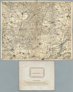
290. Neuhaldensleben.
1 : 100000 Reichsamt fur Landesaufnahme
Meßtischblatt 3636 : Rogätz, 1938
1 : 250000 Rogätz. - Hrsg. 1902, letzte Nachtr. 1932, red. Änd., Gauß-Krüger-Gitter 5.38. - 1:25000. - [Berlin]: Reichsamt für Landesaufnahme, 1938. - 1 Kt.
Meßtischblatt 1965 : Colbitz, 1937
1 : 250000 Colbitz. - Hrsg. 1902, einz. Nachtr. 1937. - 1:25000. - [Berlin]: Reichsamt für Landesaufnahme, 1937. - 1 Kt.
Meßtischblatt 1965 : Colbitz, 1935
1 : 250000 Colbitz. - Hrsg. 1902, Nachtr. 1919, gedr. [19]35. - 1:25000. - [Berlin]: Reichsamt für Landesaufnahme, 1935. - 1 Kt.
Meßtischblatt 130 : Cröchern, 1873
1 : 250000 Cröchern. - Aufn. 1858. - 1:25000. - [Berlin]: Reichsamt für Landesaufnahme, 1873. - 1 Kt.
Meßtischblatt 3535 : Dolle, 1955
1 : 250000 Dolle. - Hrsg. 1902, letzte Nachtr. 1919, bericht. 1937. - 1:25000. - [Berlin]: MdI, 1955. - 1 Kt.
Meßtischblatt 1897 : Dolle, 1937
1 : 250000 Dolle. - Hrsg. 1902, letzte Nachtr. 1919, bericht. 1937. - 1:25000. - [Berlin]: Reichsamt für Landesaufnahme, 1937. - 1 Kt.
Meßtischblatt 3536 : Tangerhütte, 1937
1 : 250000 Tangerhütte. - Hrsg. 1902, kl. Nachtr. 1924, gedr. [19]37. - 1:25000. - [Berlin]: Reichsamt für Landesaufnahme, 1937. - 1 Kt.
Meßtischblatt 1964 : Uthmöden, 1937
1 : 250000 Uthmöden. - Hrsg. 1902, letzte Nachtr. 1937. - 1:25000. - [Berlin]: Reichsamt für Landesaufnahme, 1937. - 1 Kt.
Meßtischblatt 1964 : Uthmöden, 1935
1 : 250000 Uthmöden. - Hrsg. 1902, einzelne Nachtr. 1932, XI.35. - 1:25000. - [Berlin]: Reichsamt für Landesaufnahme, 1935. - 1 Kt.
Meßtischblatt 3534 : Letzlingen, 1937
1 : 250000 Letzlingen. - Hrsg. 1902, letzte Nachtr. 1937. - 1:25000. - [Berlin]: Reichsamt für Landesaufnahme, 1937. - 1 Kt.
Meßtischblatt 1896 : Letzlingen, 1935
1 : 250000 Letzlingen. - Hrsg. 1902, einzelne Nachtr. 1932, gedr. [19]35. - 1:25000. - [Berlin]: Reichsamt für Landesaufnahme, 1935. - 1 Kt.
Meßtischblatt 2033 : Niegripp, 1932
1 : 250000 Niegripp. - Hrsg. 1902, einz. Nachtr. 1932. - 1:25000. - [Berlin]: Reichsamt für Landesaufnahme, 1932. - 1 Kt.
Meßtischblatt 2033 : Niegripp, 1873
1 : 250000 Niegripp. - Aufn. 1858. - 1:25000. - [Berlin]: Reichsamt für Landesaufnahme, 1873. - 1 Kt.
Meßtischblatt 3735 : Wolmirstedt, 1955
1 : 250000 Wolmirstedt. - Hrsg. 1902, letzte Nachtr. 1937, Ausg. 1942. - 1:25000. - [Berlin]: MdI, 1955. - 1 Kt.
Meßtischblatt 2032 : Wolmirstedt, 1935
1 : 250000 Wolmirstedt. - Hrsg. 1902, einz. Nachtr. 1932, gedr. [19]35. - 1:25000. - [Berlin]: Reichsamt für Landesaufnahme, 1935. - 1 Kt.
Meßtischblatt 144 : Wolmirstedt, 1873
1 : 250000 Wolmirstedt. - Aufn. 1858. - 1:25000. - [Berlin]: Reichsamt für Landesaufnahme, 1873. - 1 Kt.
Meßtischblatt 2031 : Neuhaldensleben, 1902
1 : 250000 Neuhaldensleben. - Aufn. 1900. - 1:25000. - [Berlin]: Reichsamt für Landesaufnahme, 1902. - 1 Kt.
Meßtischblatt 143 : Neuhaldensleben, 1873
1 : 250000 Neuhaldensleben. - Aufn. 1858. - 1:25000. - [Berlin]: Reichsamt für Landesaufnahme, 1873. - 1 Kt.
88. Magdeburg, uit: Topographische Uebersichtskarte des Deutschen Reiches / herausgegeben v. d. Kartogr. Abt. d. Königl. Preuß. Landesaufnahme
1 : 200000 titelvariant: Topogr. Übersichtskarte des Deutschen Reiches; Annotatie: Titel boven bladen ook: Topogr. Übersichtskarte des Deutschen Reiches; Annotatie geografische gegevens: Op elk blad twee maatstokken: 10 Kilometer = 5,5 cm; 1 geogr. Meile = 3,6 cm; Legenda onder op elk blad Königlich Preußische Landesaufnahme. Kartographische Abtheilung [S.l : Königlich Preußische Landesaufnahme, Kartographische Abtheilung]
Magdeburg 59, uit: Special-Karte von Mittel-Europa / nach amtlichen Quellen bearbeitet von W. Liebenow
1 : 300000 titelvariant: W. Liebenow's Mittel-Europa; Annotatie: Titel boven de bladen: W. Liebenow's Mittel-Europa Johannes Wilhelm Liebenow 1822-1897 Frankfurt a. M. : Ludwig Ravenstein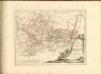

MARCHIONATUS | BRANDENBURGICI | PARS, quæ | MARCHIA VETUS, | Vulgo | ALTEMARCK, | dicitur.
[Amsterdam : Joan Blaeu]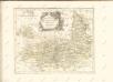

EPISCOPATVS | HALBERSTAT.
Amstlædami apud Joannem Blaeu.
Magdebvrgensis Archiepiscopatvs
1 : 350000 Mollova mapová sbírka Blaeu, Joan Blaeu, Joan I.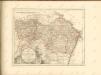

Composite: 291. Burg a. d. Ihle.
1 : 100000 Reichsamt fur Landesaufnahme
291. Burg a. d. Ihle.
1 : 100000 Reichsamt fur Landesaufnahme