Maps of Wusterhausen/Dosse

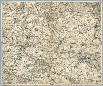
Composite: 242. Neu-Ruppin.
1 : 100000 Reichsamt fur Landesaufnahme
242. Neu-Ruppin.
1 : 100000 Reichsamt fur Landesaufnahme
Messtischblatt 1619, neue Nr. 3142 : Fehrbellin, 1936 Fehrbellin
1 : 250000 Fehrbellin. - Hrsg. 1882, einz. Nachtr. 1926, gedr. [19]36. - 1:25000. - [Berlin]: Reichsamt für Landesaufnahme, 1936. - 1 Kt.
Meßtischblatt 1619 : Fehrbellin, 1911
1 : 250000 Fehrbellin. - Aufn. 1880, hrsg. 1882, einz. Nachtr. 1911. - 1:25000. - [Berlin]: Reichsamt für Landesaufnahme, 1911. - 1 Kt.
Messtischblatt 1618 : Wildberg, 1882 Wildberg
1 : 250000 Wildberg. - Aufn. 1880. - 1:25000. - [Berlin]: Reichsamt für Landesaufnahme, 1882. - 1 Kt.
Messtischblatt 1617 : Wusterhausen an der Dosse, 1932 Wusterhausen an der Dosse
1 : 250000 Wusterhausen an der Dosse. - Hrsg. 1882, einz. Nachtr. 1932. - 1:25000. - [Berlin]: Reichsamt für Landesaufnahme, 1932. - 1 Kt.
Messtischblatt 1617 : Wusterhausen (An der Dosse), 1882 Wusterhausen (An der Dosse)
1 : 250000 Wusterhausen (An der Dosse). - Aufn. 1880. - 1:25000. - [Berlin]: Reichsamt für Landesaufnahme, 1882. - 1 Kt.
Meßtischblatt Neuruppin
1 : 250000 Neuruppin. - Hrsg. 1882, einz. Nachtr. 1932. - 1:25000. - [Berlin]: Reichsamt für Landesaufnahme, 1934. - 1 Kt.
Meßtischblatt 1548 : Neu- Ruppin, 1903
1 : 250000 Neu- Ruppin. - Aufn. 1880, hrsg. 1882, einzelne Nachtr. 1903. - 1:25000. - [Berlin]: Reichsamt für Landesaufnahme, 1903. - 1 Kt.
Meßtischblatt Tramnitz
1 : 250000 Tramnitz. - Aufn. 1880. - 1:25000. - [Berlin]: Reichsamt für Landesaufnahme, 1882. - 1 Kt.
Meßtischblatt 3040 : Kyritz, 1932
1 : 250000 Kyritz. - Hrsg. 1882. - 1:25000. - [Berlin]: Reichsamt für Landesaufnahme, 1932. - 1 Kt.
Meßtischblatt 1689 : Brunne, 1882
1 : 250000 Brunne. - Aufn. 1880. - 1:25000. - [Berlin]: Reichsamt für Landesaufnahme, 1882. - 1 Kt.
Meßtischblatt 3241 : Friesack, 1942
1 : 250000 Friesack. - Hrsg. 1882, ber. 1940, Ausg. 1942. - 1:25000. - [Berlin]: Reichsamt für Landesaufnahme, 1942. - 1 Kt.
Meßtischblatt 1688 : Friesack, 1882
1 : 250000 Friesack. - Aufn. 1880. - 1:25000. - [Berlin]: Reichsamt für Landesaufnahme, 1882. - 1 Kt.
Meßtischblatt 1687 : Rhinow, 1932
1 : 250000 Rhinow. - Hrsg. 1882. - 1:25000. - [Berlin]: Reichsamt für Landesaufnahme, 1932. - 1 Kt.
76. Charlottenburg, uit: Topographische Uebersichtskarte des Deutschen Reiches / herausgegeben v. d. Kartogr. Abt. d. Königl. Preuß. Landesaufnahme
1 : 200000 titelvariant: Topogr. Übersichtskarte des Deutschen Reiches; Annotatie: Titel boven bladen ook: Topogr. Übersichtskarte des Deutschen Reiches; Annotatie geografische gegevens: Op elk blad twee maatstokken: 10 Kilometer = 5,5 cm; 1 geogr. Meile = 3,6 cm; Legenda onder op elk blad Königlich Preußische Landesaufnahme. Kartographische Abtheilung [S.l : Königlich Preußische Landesaufnahme, Kartographische Abtheilung]

Ruppin 47, uit: Special-Karte von Mittel-Europa / nach amtlichen Quellen bearbeitet von W. Liebenow
1 : 300000 titelvariant: W. Liebenow's Mittel-Europa; Annotatie: Titel boven de bladen: W. Liebenow's Mittel-Europa Johannes Wilhelm Liebenow 1822-1897 Frankfurt a. M. : Ludwig Ravenstein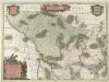
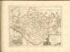
Marchionatvs Brandenburgici
1 : 330000 Mollova mapová sbírka Örnehufvud, Olof Hansson Covens, Johannes I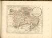

241. Havelberg.
1 : 100000 Reichsamt fur Landesaufnahme
Le cercle de Glien et de Loewenberg dans la Marche-Moyenne de Brandenbourg
1 : 296000 Braniborsko (Německo) Oesfeld, Karl Ludwig von
214. Wittstock. (Germany)
1 : 100000 Reichsamt fur Landesaufnahme
Composite: 214. Wittstock. (Germany)
1 : 100000 Reichsamt fur Landesaufnahme
Meßtischblatt 2940 : Wutike, 1919
1 : 250000 Wutike. - Hrsg. 1881, letzte Nachtr. 1919. - 1:25000. - [Berlin]: Reichsamt für Landesaufnahme, 1919. - 1 Kt.
Meßtischblatt 1474, neue Nr. 2941 : Rossow, 1945
1 : 250000 Rossow. - Hrsg. 1881, bericht. 1911, redakt. Änd. 10.37. - 1:25000. - [Berlin]: Reichsamt für Landesaufnahme, 1945. - 1 Kt.
Meßtischblatt 1475, neue Nr. 2942 : Zühlen, 1936
1 : 250000 Zühlen. - Hrsg. 1881, einz. Nachtr. 1926, gedr. [19]36. - 1:25000. - [Berlin]: Reichsamt für Landesaufnahme, 1936. - 1 Kt.
Messtischblatt 1616 : Lohm, 1932 Lohm
1 : 250000 Lohm. - Hrsg. 1882, einz. Nachtr. 1932. - 1:25000. - [Berlin]: Reichsamt für Landesaufnahme, 1932. - 1 Kt.