Maps of Mexico

Carte Generale du Mexique et des Provinces-unis de l'Amerique Centrale.
1 : 15500000 Vivien de St Martin, L.
Central America and Yucatan (Mexico).
from The cerographic atlas of the United States. By Sidney E. Morse, A.M., and Samuel Breese, A.M.
Mexico, Guatimala.
1 : 20500000 Grigg, John
Mexico, Guatimala.
1 : 9500000 Hall, S. (Sidney)
Outline & Index Map of Brooklyn, New York.
from Atlas of the entire city of Brooklyn, complete in one volume. From actual surveys and official records by G. W. Bromley & Co.
Mexico & Guatemala.
1 : 11800000 Mitchell, Samuel Augustus
Mexico & Guatemala.
1 : 12000000 Tanner, Henry S.
Mexico & Guatemala.
1 : 12000000 Tanner, Henry S.
Mexico und Centro-America
Hand-Atlas über alle Theile der Erde nach dem neuesten Zustande und über das Weltgebäude Stieler, Adolf bei Justus Perthes
Mexico, Guatamala.
1 : 37500000 Fenner, Rest.
Mexique, Republique de l'Amerique Centrale, Sud-Ouest Etats-Unis.
1 : 9200000 Levasseur, E.
Etats-Unis Mexicains, Texas, Amerique Centrale.
1 : 9300000 Picquet, C.

Mexico, Mittel-America, Texas.
1 : 12300000 Flemming, Carl
Mexique.
1 : 8900000 Lapie, M. (Pierre), 1779-1850
Mexico und Centro-America
1 : 14000000 nach den besten Hülfsmitteln in Mercators Projection entworfen und gezeichnet vom Pr. L[t]. v. Stülpnagel [...] in Mercators Projection Gotha : Perthes
Mexico, Texas und Californien
1 : 6000000 bearb. und gezeichnet von H. Kiepert Situation und Schrift gestochen von K. Mädel ; Terrain von C. Jungmann Weimar : Verlag des Geographischen Institus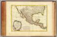
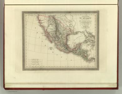
Mexique, Nlle. Mexique, Californie.
1 : 13300000 Bonne, Rigobert, 1727-1794
Spanish Dominions in North America.
1 : 19000000 Arrowsmith, Aaron; Lewis, Samuel
Spanish dominions in North America.
1 : 19000000 Arrowsmith, Aaron; Lewis, Samuel
Mexico und Centro-America
Stieler's Hand-Atlas Stieler, Adolf bei Justus Perthes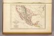
Etats-Unis du Mexique, 1835.
1 : 17000000 Malte-Brun, Conrad, 1775-1826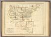
Index Map. Explanation of Signs Used In The Atlas.
1 : 17233920 Rogers, Henry Darwin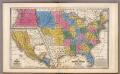
United States ... Texas ... Mexico and Guatimala.
1 : 11404800 Mitchell, Samuel Augustus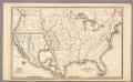
Map of the United States and Texas ... Mexico and Guatimala.
1 : 11404800 Mitchell, Samuel Augustus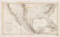
Carte du Mexique : et des pays limitrophes situés au nord et à l'est
1 : 8000000 Poirson, J. B F. Schoell
Vereinigte Staaten, Central-Amerika und Westindien
Volksschul-Atlas über alle Teile der Erde Lange, Henry Druck und Verlag von Georg Westermann
Mexico, Guatemala, W.I., North America.
Goodrich, S.G.
Washington Map of the United States.
1 : 13000000 Taintor, S. & Co.