Maps of United States
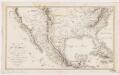
Carte du Mexique : et des pays limitrophes situés au nord et à l'est
1 : 8000000 Poirson, J. B F. Schoell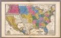
United States ... Texas ... Mexico and Guatimala.
1 : 11404800 Mitchell, Samuel Augustus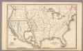
Map of the United States and Texas ... Mexico and Guatimala.
1 : 11404800 Mitchell, Samuel Augustus
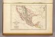
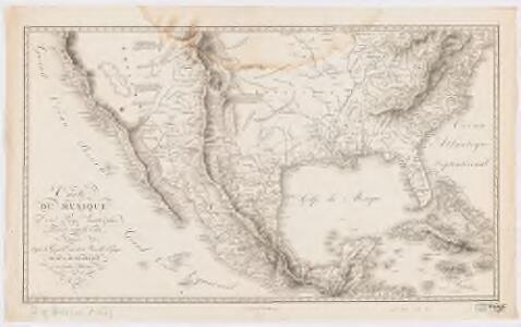
Etats-Unis du Mexique, 1835.
1 : 17000000 Malte-Brun, Conrad, 1775-1826
Washington Map of the United States.
1 : 13000000 Taintor, S. & Co.
Map Atlantic Coast Line.
1 : 12503000 Atlantic Coast Line Railroad Company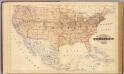
Topographical map of the United States.
1 : 9500000 Andreas, A. T. (Alfred Theodore), 1839-1900
Mexico und Centro-America
Hand-Atlas über alle Theile der Erde nach dem neuesten Zustande und über das Weltgebäude Stieler, Adolf bei Justus Perthes
Mexico und Centro-America
1 : 14000000 nach den besten Hülfsmitteln in Mercators Projection entworfen und gezeichnet vom Pr. L[t]. v. Stülpnagel [...] in Mercators Projection Gotha : Perthes
Naval And Military Map Of The United States.
1 : 3300000 Smith, Robert P.
Composite: Vereinigte Staaten von NordAmerika, nebst Mexico und Centralamerika.
1 : 7000000 Stein, Christ. Gottfr. Dan.
Washington Map of the United States.
1 : 3000000 Taintor, S. & Co.
Mexico, Mittel-America, Texas.
1 : 12300000 Flemming, Carl
Vereinigte Staaten, Central-Amerika und Westindien
Volksschul-Atlas über alle Teile der Erde Lange, Henry Druck und Verlag von Georg Westermann
Central America.
1 : 16600000 Sharpe, J.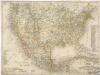
Vereinigte Staaten von Nord America - und Mexico

Map of the United States of America, the British Provinces, Mexico, the West Indies and Central America, with part of New Granada and Venezuela
1 : 6400000 Colton, George Woolworth Colton, J. H. (Joseph Hutchins)
Verein-Staaten von Nord-America, Mexico, Yucatan u.A.
Hand-Atlas über alle Theile der Erde nach dem neuesten Zustande und über das Weltgebäude Stieler, Adolf bei Justus Perthes
[Verein-Staaten von Nord-America, Mexico, Yucatan u.A.]
Handatlas über alle Theile der Erde und über das Weltgebäude Stieler, Adolf Justus Perthes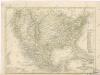
Vereinigte Staaten von Nord - America und Mexico

Map Of The United States, Canada, Mexico, Central America, West Indies, &c.
1 : 3380000 Williams, G. Washington.
Map Of The United States Of America.
1 : 16526080 Colton, J. H.
[Vereinigte Staaten v. Nord-Amerika nebst Mexico und Canada]
[Allgemeiner Atlas über alle Theile der Erde in 29 Blättern] Ziegler, Jakob Melchior Top. Anstalt v. J. Wurster u. Comp.
Washington Map of the United States.
1 : 3000000 Taintor, S. & Co.
Mexico, Guatemala, W.I., North America.
Goodrich, S.G.
Vereinigte Staaten von Nord-America und Mexico
Schul-Atlas über alle Theile der Erde nach dem neuesten Zustande, und über das Weltgebäude Stieler, Adolf Justus Perthes
Diagram of the United States of America, Mexico, the West India Islands and Isthmus of Darien : showing proposed routes of the Pacific Rail Road ...
1 : 6500000 Steiger, W. T. United States. General Land Office
North America, 1722.
1 : 25000000 Wells, Edward