Maps of New York
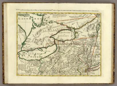
La Pensilvania, la Nuova York, il Jersey Settentriole.
1 : 2100000 Zatta, Antonio
La Pensilvania, la Nuova York, il Jersey Settentrio[na]le: con la parte occidentale del Connecticut, Massachusset-s-bay e l'Irochesia.
from Parts A. (Antonio) Zatta:[Venezia],
Plan of the State of New York.
from Atlas of Columbia County, New York. From actual surveys and official records. Compiled & published by D. G. Beers & Co.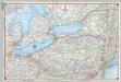
Shell Sectional Map No. 2 - North Atlantic States.
1 : 1457280 Shell Oil Company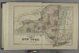
Plan of the State of New York.
from Atlas of Madison County, New York : from actual surveys / by and under the direction of D. G. Beers.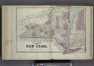
Plan of The State of New York.
from Atlas of Steuben County, New York : from actual surveys and official records / compiled & published by D.G. Beers & Co.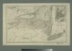
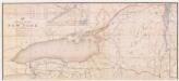
Map of the state of New York with part of Upper Canada / engraved & printed by Fenner Sears & Co.
from Whole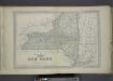
Plan of The State of New York.
from County atlas of Orange, New York / from actual surveys by and under the direction of F.W. Beers.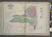
Geological Map
from New topographical atlas and gazetteer of New York, comprising a topographical view of the several counties of the state, ... including ... map of the United States and territories ... Compiled from the latest astronomical observations, official surveys and records of the United States and territories ...
Canada West (Upper).
1 : 1980000 Mitchell, Samuel Augustus
Canada West (Upper).
1 : 1980000 Mitchell, Samuel Augustus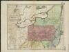
Map of the middle states of America, comprehends New-York, New-Jersey, Pennsylvania, Delaware, and the territory N.W. of Ohio
Russell, John Symonds, Henry Delahoy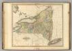
New York.
1 : 1110000 Tanner, Henry S.
[Ober-Canada]
Grosser Hand-Atlas über alle Theile der Erde in 170 Karten Meyer, J. Verlag des Bibliographischen Instituts
Schonberg's Map of Canada West.
1 : 1900000 Schonberg & Co.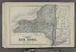
Plan of the State of New York.
from County atlas of Cayuga, New York. From recent and actual surveys and records under the superintendence of F. W. Beers.
(New York)
1 : 3500000 Ufford, Fannie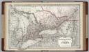
Canada. Ontario.
1 : 1500000 Colton, G.W.
New York / by H.S. Tanner ; engraved ... by H.S. Tanner.
from Whole
Map of the rail-roads of the state of New York
1 : 1000000 Vaughan, David, fl. 1849-1864 C. Van Benthuysen
Ontario.
1 : 1290000 Asher & Adams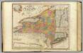
New-York State, surrounding country.
1 : 1300000 Burr, David H., 1803-1875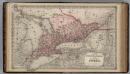
Dominion of Canada. Province of Ontario.
1 : 1550000 Colton, G.W.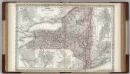
New York.
1 : 1250000 Colton, G.W.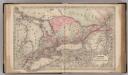
Canada West or Upper Canada.
1 : 1500000 Colton, G.W.
Map of New Jersey and Pennsylvania : exhibiting the post offices, post roads, canals, rail roads, &c. / by David H. Burr (late topographer to the Post Office), geographer to the House of Representatives of the U.S.
from Parts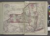
Railroads of the state.
from New topographical atlas and gazetteer of New York, comprising a topographical view of the several counties of the state, ... including ... map of the United States and territories ... Compiled from the latest astronomical observations, official surveys and records of the United States and territories ...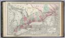
Canada West or Upper Canada.
1 : 1500000 Colton, G.W.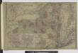
Oswego ; Buffalo ; Rochester ; Syracuse ; New York ; Albany ; Troy ; Vicinity of New York
from Atlas of Montgomery and Fulton counties, New York. From actual surveys / by and under the direction of B. Nichols ; assisted by H.B. Stranahan ... [et al.]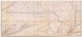
Post route map of the state of New York : and parts of Vermont, Massachusetts, Connecticut, New Jersey and Pennsylvania, showing also the adjacent portions of the dominion of Canada : Southern sheet
1 : 380160 Nicholson, Walter L U.S. Post Office Dept.