Mapa catalogado
New York / by H.S. Tanner ; engraved ... by H.S. Tanner.

Título completo:New York / by H.S. Tanner ; engraved ... by H.S. Tanner.
Tamaño físico:20 x 30 cm
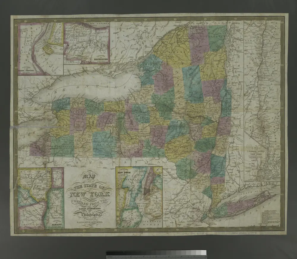
Map of the state of New York: compiled from the latest authorities.
1833
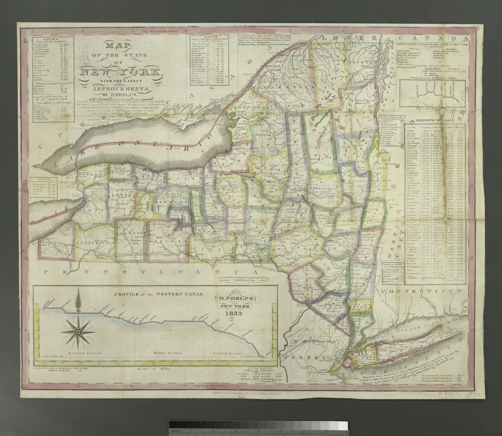
Map of the state of New York: with the latest improvements
1833
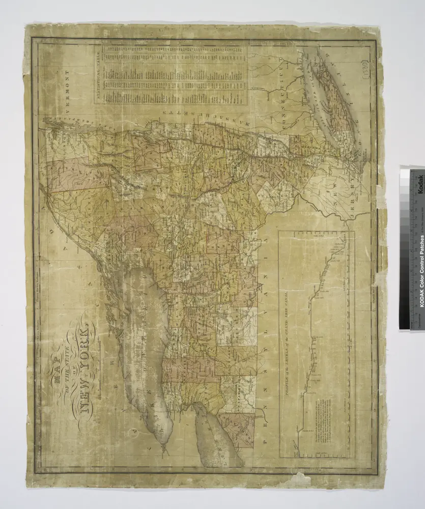
Map of the State of New York
1830
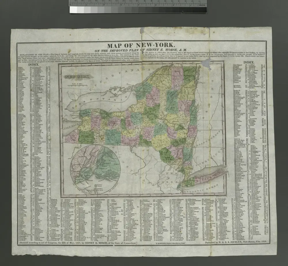
Map of New-York: on the improved plan of Sidney E. Morse; N. & S.S Jocelyn, sc.
1828
Geological map of the State of New York by legislative authority
1842
New York State Geological Survey
1:800k
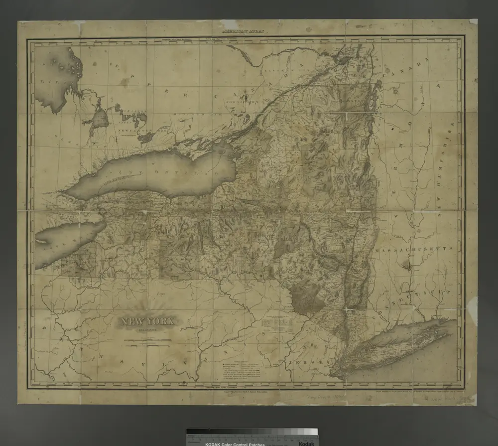
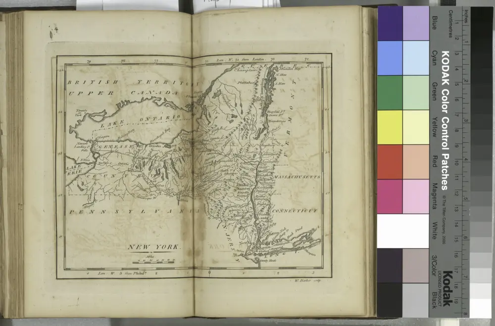
New York
1799
Sotzmann, D. F
1:1m
New York / W. Barker, sculp.; Carey's American pocket atlas; containing nineteen maps... with a brief description of each state.
1801
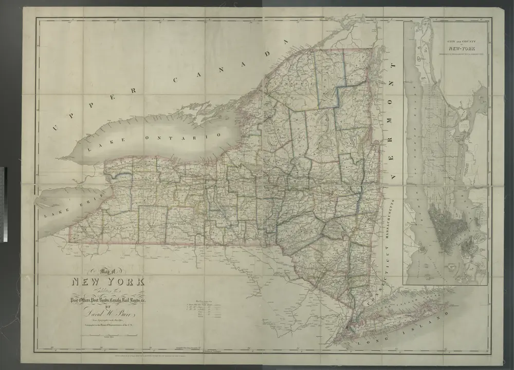
Map of New York exhibiting the post offices, post roads, canals, rail roads &c. / By David H. Burr (late topographer to the Post Office), geographer to the House of Representatives of the U.S.
1839
Map of the state of New York
1833
Maverick, Samuel, 1789-1845
1:2m
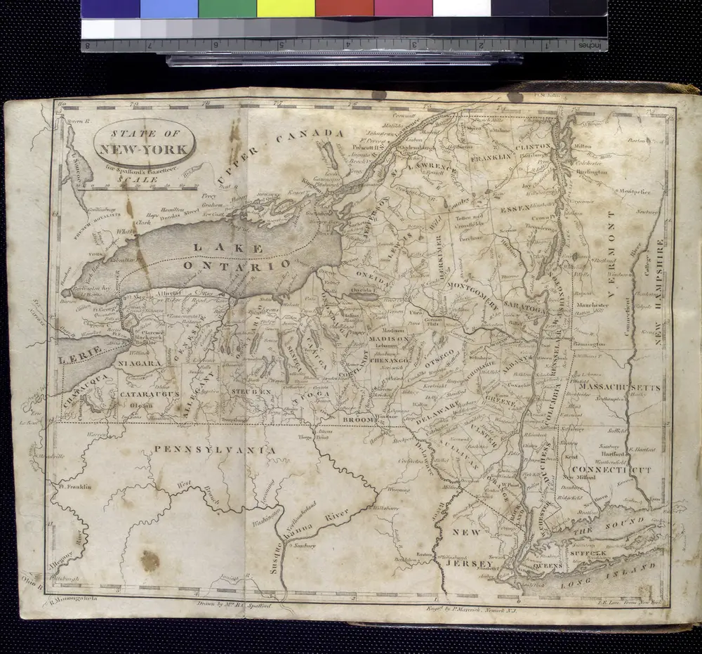
State of New-York for Spafford's gazetteer / drawn by Mrs. B.C. Stafford; engd. by P. Maverick, Newark N.J.; A gazetteer of the state of New-York; carefully written from original and authentic materials, arranged on a new plan, in three parts. By Horatio Gates Spafford.
1813