Maps of New York
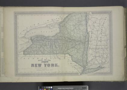
Plan of The State of New York.
from County atlas of Orange, New York / from actual surveys by and under the direction of F.W. Beers.
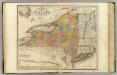
Geological Map
from New topographical atlas and gazetteer of New York, comprising a topographical view of the several counties of the state, ... including ... map of the United States and territories ... Compiled from the latest astronomical observations, official surveys and records of the United States and territories ...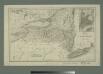
Map of the state of New York with part of Upper Canada / engraved & printed by Fenner Sears & Co.
from Whole
Map shewing the rail roads between Lake Erie, New York & Boston : intended to illustrate the importance of the N. York & Erie Rail Road / J.F. Smith, del.
from Whole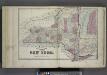
Plan of The State of New York.
from Atlas of Steuben County, New York : from actual surveys and official records / compiled & published by D.G. Beers & Co.
New York / drawn by S. Lewis ; Tanner, sc.
from Whole
Map of the middle states of North America : shewing the position of the Geneseo country comprehending the counties of Ontario & Steuben as laid off in townships of six miles squar[e] each
1 : 2250000 Maverick, Peter, 1780-1831 Printed by T. & J. Swords, no. 99 Pearl-Street.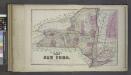
Plan of the State of New York.
from Atlas of Columbia County, New York. From actual surveys and official records. Compiled & published by D. G. Beers & Co.
A new map of part of the United States of North America, containing those of New York, Vermont, New Hampshire, Massachusets [sic], Connecticut, Rhode Island, Pennsylvania, New Jersey, Delaware, Maryland and Virginia

New York / by H.S. Tanner ; engraved ... by H.S. Tanner.
from Whole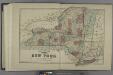
Plan of the State of New York.
from Atlas of Madison County, New York : from actual surveys / by and under the direction of D. G. Beers.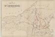
Map of the Troy & Greenfield Rail Road and its connections
Edwards, A. F B.W. Thayer & Co.'s Lith.
United States of America, northern part / drawn under the direction of Mr. Pinkerton by L. Hebert; Neele sculpt. 352 Strand.
from Whole L. Hebert Neele; Mr. Pinkerton,
Sheet 2: United States of Nth. America.
1 : 1584000 Tardieu, P.F.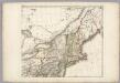
Sheet 2: United States of Nth. America.
1 : 1584000 Tardieu, P.F.
Novi Belgii Novaeque Angliae nec non partis Virginiae tabula multis in locis emendata
1 : 2000000 a Nicolao Joannis Visschero [S.l.] : [s.n.]
Map exhibiting the rail road, canal, lake and river routes from New York and Boston to the west, via Ogdensburgh, Buffalo and Sacket's Harbor, N.Y
1 : 1150000 J.H. Bufford & Co J.H. Bufford & Co. Lith.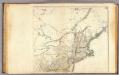
United States 4.
1 : 1750000 Arrowsmith, Aaron
Map of the interior travels through America, delineating the march of the army

Map of the state of New-York and the surrounding country / by David H. Burr; engd. by Rawdon, Clark & Co., Albany, & Rawdon, Wright & Co., New York.; An atlas of the state of New York: containing a map of the state and of the several counties / by David H. Burr.
from An atlas of the state of New York : containing a map of the state and of the several counties / by David H. Burr. Burr, David H.; Rawdon, Clark & Co.; Rawdon, Wright & Co.; Stone & Clark Republishers,
Map of the state of New-York and the surrounding country / by David H. Burr; engd. by Rawdon, Clark & Co., Albany, & Rawdon, Wright & Co., New York.; An atlas of the state of New York, designed for the use of engineers, containing a map of the state and of the several counties. / Projected and drawn ... under the superintendence and direction of Simeon de Witt.
from An atlas of the state of New York, designed for the use of engineers, containing a map of the state and of the several counties. / Projected and drawn ... under the superintendence and direction of Simeon de Witt. Burr, David H.; De Witt, Simeon; Rawdon, Clark & Co.; Rawdon, Wright & Co.; Stone & Clark Republishers,
Map of the state of New-York and the surrounding country / by David H. Burr; engd. by Rawdon, Clark & Co., Albany, & Rawdon, Wright & Co., New York.; An atlas of the state of New York: containing a map of the state and of the several counties. / Projected and drawn under the superintendence and direction of Simeon de Witt ... And also the physical geography of the State ...
from An atlas of the state of New York : containing a map of the state and of the several counties. / Projected and drawn under the superintendence and direction of Simeon de Witt ... And also the physical geography of the State ... Burr, David H.; De Witt, Simeon,
Carte des Provines Septles. des Etats-Unis.
1 : 2400000 Marshall, John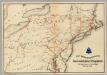
Lines and Metallic Circuit Connections.
1 : 2534400 American Telephone and Telegraph Company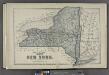
Plan of the State of New York.
from County atlas of Cayuga, New York. From recent and actual surveys and records under the superintendence of F. W. Beers.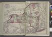
Railroads of the state.
from New topographical atlas and gazetteer of New York, comprising a topographical view of the several counties of the state, ... including ... map of the United States and territories ... Compiled from the latest astronomical observations, official surveys and records of the United States and territories ...
Northern provinces of the United States

Map of the state of New York : compiled from the latest authorities.
from Whole
Map of the state of New York : compiled from the latest authorities.
from Whole