Maps of West Indies
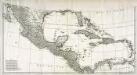
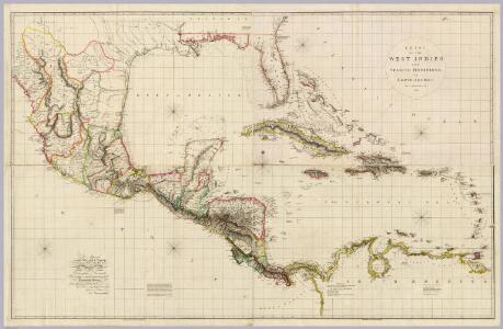
Chart Of The West Indies And Spanish Dominions In North America.
1 : 2700000 Arrowsmith, Aaron
Chart of the West Indies and Spanish Dominions in North America
1 : 2775525 Arrowsmith, Aaron, 1750-1823 Published June 1st, 1803, by A. Arrowsmith, No. 24 Rathbone Place
Mittel America.
1 : 16500000 Reichard, C. G.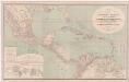
A new map of tropical-America, north of the Equator : comprising the West-Indies, Central-America, Mexico, New Cranada [sic] and Venezuela
1 : 3600000 Kiepert, Heinrich, 1818-1899 Dietrich Reimer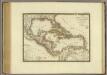
Iles-Antilles ou Indes Occidentales.
1 : 9300000 Brue, Adrien Hubert, 1786-1832
Mexique, Amerique Centrale, les Antilles.
1 : 11000000 Garnier, F. A., 1803-1863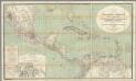
H. Kiepert's Karte des nordlichen Tropischen America.
1 : 3600000 Smith, Martin Luther, 1819-1866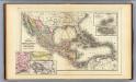
Mexico, Central America, West Indies.
1 : 12000000 Mitchell, Samuel Augustus
Cuba.
1 : 3300000 Mitchell, Samuel Augustus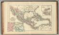
Mexico, Central America, West Indies.
1 : 12000000 Mitchell, Samuel Augustus Jr.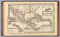
Mexico, Central America, West Indies.
1 : 12000000 Mitchell, Samuel Augustus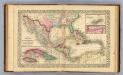
Mexico, Central America, West Indies.
1 : 12000000 Williams, W. (Wellington)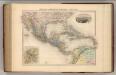
Mexique, Amerique Centrale et Antilles.
1 : 13000000 Migeon, J.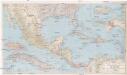
Mexico, Central America and the West Indies
1 : 5702400 Bermudy (Velká Británie : souostroví) National Geographic Society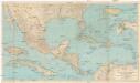
Mexico, Central America and the West Indies
1 : 5702400 Bermudy (Velká Británie : souostroví) National Geographic Society
Central America, Mexico & West Indies.
1 : 14500000 Black, Adam & Charles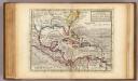
Map of the West-Indies, Mexico or New Spain.
1 : 21000000 Moll, Herman, d. 1732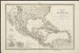
Carte du Méxique, des Antilles, d'une partie des Etats-Unis, et des pays circonvoisins
1 : 8333000 dressée d'après les nouvelles divisions, et les dernières observations par A. H. Dufour [gravée par] Guyot ; [écrite par] A. Pelicier Paris : Guyot [etc.]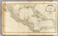
West Indies.
1 : 6400000 Robert Laurie & James Whittle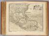
West Indies.
1 : 12500000 Bowen, Emanuel
Mexico. West Indies and Central America.
1 : 7920000 Colton, G. Woolworth
Archipelague du Mexique ou sont les Isles de Cuba, Espagnole, Jamaïque &c.
1 : 5000000 [par Pierre Mortier] A Amsterdam : nouvellement mis au jour par Covens & Mortier
Map Of Mexico, Central America, And The West Indies.
1 : 12000000 Mitchell, Samuel Augustus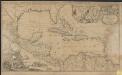
Archipelague du Mexique ou sont les Isles de Cuba, Espagnole, Jamaïque &c.
1 : 5000000 [par Pierre Mortier]
Cent. Amer., W.I. ports
1 : 10000000 Philip, George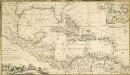
A NEW MAPP of the WEST INDIES, or the ISLANDS of AMERICA in the NORTH SEA; Together with the adjacent DOMINIONS; Explaining what belongs to SPAIN, ENGLAND, FRANCE, HOLLAND &C. As also the severall Tracts made by the Gallions and Flota from place to place,
This interesting map published in 1740 is a later edition of one published by Robert Morden, William Knight and Philip Lea. The colonising powers are indicated in words but colouring is mainly for decoration. Notes give an idea of shipping routes and practices, and in the Gulf of Mexico the number of fathoms in depth are said to be equal to the distance in leagues from the coast! The sketch at bottom left which forms part of the title cartouche shows a group of sailors presenting a pair of shoes to a native in exchange for a chest of gold coins. Morden, Robert. Cartographer.
An Accurate Map Of North America. (Southern section)
1 : 5400000 Jefferys, Thomas
Teatre de la guerre en Amerique telle que'elle est a present possedee par les Espagnols, Anglois, Francois, et Hollandois &c. : nouvellement mis au jour
1 : 5533975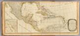
(North America south)
1 : 5400000 Kino, Eusebio Francisco