Maps of Town of Cortlandt

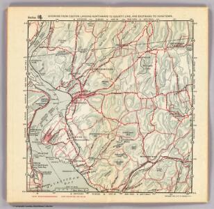
10. Croton Landing-Yorktown.
1 : 80000 Servoss, R. D.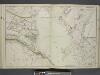
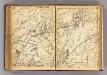
Portion of Rockland County. ; Portion of Westchester County.
from Atlas of the Hudson River Valley from New York city to Troy, including a section of about 8 miles in width. Published by Watson & co. Compiled from official records and careful surveys, under the supervision of F. W. Beers.
Westchester Co., Scarborough-Putnam Co. line.
1 : 31680 Vermeule, C. C. (Cornelius Clarkson), 1858-1950
Town of Cortlandt, Westchester County, New York. Courtlandt.
1 : 47639 Beers, Frederick W.
Cortlandt town.
1 : 31680 Bien, Joseph Rudolf
Cortlandt,Town.
1 : 48738 Beers, F. W. (Frederick W.)
Town of Cortlandt, Westchester County, New York. (inset) Courtlandtville.
1 : 47639 Beers, Frederick W.
10. Croton Landing-Yorktown.
1 : 80000 Servoss, R. D.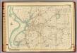
15 Atlas rural country district north of New York City.
1 : 18000 Hyde, E. Belcher
Cortland, Croton Landing.
1 : 31680 Bromley, George Washington; Bromley, Walter Scott; G.W. Bromley & Co.
Peekskill
1 : 24000
Peekskill
1 : 24000
Peekskill
1 : 24000
Peekskill
1 : 24000
Peekskill
1 : 24000
Peekskill
1 : 24000
Peekskill
1 : 24000
Town of Yorktown, Westchester County, New York. (insets) Jefferson Valley. Shrub Oak.
1 : 31680 Beers, Frederick W.
Yorktown, Town.
1 : 31680 Beers, F. W. (Frederick W.)
Yorktown town.
1 : 33600 Bien, Joseph Rudolf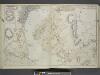
Portion of Rockland County. ; Portion of Westchester County.
from Atlas of the Hudson River Valley from New York city to Troy, including a section of about 8 miles in width. Published by Watson & co. Compiled from official records and careful surveys, under the supervision of F. W. Beers.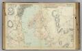
10 Rockland, Westchester counties.
1 : 14400 Watson & Co. (New York, N.Y.)
Mohegan Lake
1 : 24000
Mohegan Lake
1 : 24000
Mohegan Lake
1 : 24000
Mohegan Lake
1 : 24000
Mohegan Lake
1 : 24000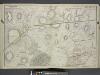
Portion of Orange & Rockland County. ; Portion of Putnam & Westchester County.
from Atlas of the Hudson River Valley from New York city to Troy, including a section of about 8 miles in width. Published by Watson & co. Compiled from official records and careful surveys, under the supervision of F. W. Beers.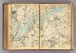
232-233 Yorktown. New Castle, Bedford.
1 : 21600 G.W. Bromley & Co.