Maps of Town of New Castle

Yorktown, Town.
1 : 31680 Beers, F. W. (Frederick W.)
Town of Yorktown, Westchester County, New York. (insets) Jefferson Valley. Shrub Oak.
1 : 31680 Beers, Frederick W.
Small folder - S2
from Atlas of New York and vicinity : from actual surveys / by and under the direction of F. W. Beers, assisted by A. B. Prindle & others
Yorktown town.
1 : 33600 Bien, Joseph Rudolf
Mohegan Lake
1 : 24000
Mohegan Lake
1 : 24000
Mohegan Lake
1 : 24000
Mohegan Lake
1 : 24000
Mohegan Lake
1 : 24000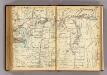
234-235 Yorktown.
1 : 21600 G.W. Bromley & Co.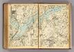
232-233 Yorktown. New Castle, Bedford.
1 : 21600 G.W. Bromley & Co.
230-231 Yorktown.
1 : 21600 G.W. Bromley & Co.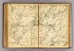
194-195 New Castle.
1 : 21600 G.W. Bromley & Co.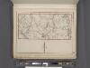
Westchester, Plate No. 27 [Map of Town of York Town] / prepared under the direction of Joseph R. Bien, from general surveys and official records.
From Atlas of Westchester County, New York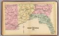
Part of West Chester Co.
1 : 14400 Bromley, George Washington; Bromley, Walter Scott; G.W. Bromley & Co.
Plate 75: Town of Somers, Westchester Co. N.Y.
from County atlas of Westchester, New York. Published by J.B. Beers & Co., assisted by S.W. Wilson and others.
10. Croton Landing-Yorktown.
1 : 80000 Servoss, R. D.
Croton Lake vicinity.
1 : 31680 Vermeule, C. C. (Cornelius Clarkson), 1858-1950
Portion of Rockland County. ; Portion of Westchester County.
from Atlas of the Hudson River Valley from New York city to Troy, including a section of about 8 miles in width. Published by Watson & co. Compiled from official records and careful surveys, under the supervision of F. W. Beers.
Ossining
1 : 24000
Ossining
1 : 24000
Ossining
1 : 24000
Ossining
1 : 24000
Ossining
1 : 24000
Ossining
1 : 24000
Ossining
1 : 31680
Ossining
1 : 25000
Ossining
1 : 31680
Ossining
1 : 31680


